


 Country:
 City:
City:


Don’t count too much on benches or picnic tables. We only found one bench near the old mill at Biesme-sous-Thuin.
Circular route around Biesme-sous-Thuin


As the title suggests, this circular walk takes you through the Thuin countryside around the village of Biesme-sous-Thuin.
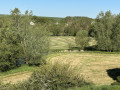
A few wooded sections interspersed with a mix of paths, tracks, small roads and a bit of the RAVeL route, set in the rather undulating countryside around the Biesmelle, make for a walk with scenery varied enough to break the monotony that usually sets in over long distances in the countryside.
The route passes by two former railway stations and an old mill, and offers a fine view of Thuin’s belfry at the first access point to the RAVeL.
Details
Creation:
Last update:
Last review:
–
–
-
 Activity: Walking
 -
 Distance: 10.29 mi
 -
 Average duration: 5h 15
 -
 Difficulty: Moderate
 -
-
 Back to start: Yes
 -
 Ascent: + 554 ft
 -
 Descent: - 574 ft
 -
-
 Highest point: 650 ft
 -
 Lowest point: 433 ft
Photos

Waypoints
- S/E : mi 0 - alt. 558 ft - Ragnies Church
- 1 : mi 0.51 - alt. 584 ft - Cemetery
- 2 : mi 1.89 - alt. 495 ft - Chapel of the Holy Face
- 3 : mi 2.26 - alt. 469 ft - La Biemelle
- 4 : mi 2.44 - alt. 449 ft - RAVeL
- 5 : mi 3.03 - alt. 446 ft - Former Haut-Marteau railway station
- 6 : mi 3.85 - alt. 548 ft - Biesme Wood
- 7 : mi 4.84 - alt. 594 ft - Reumont Wood
- 8 : mi 5.64 - alt. 610 ft - Fields
- 9 : mi 7.94 - alt. 456 ft - Old Mill
- 10 : mi 8.06 - alt. 463 ft - RAVeL
- 11 : mi 8.39 - alt. 453 ft - The old Biesme-sous-Thuin railway station
- 12 : mi 8.93 - alt. 584 ft - Fields
- S/E : mi 10.29 - alt. 558 ft - Ragnies Church
Notes
Worth a visit
Thuin, with its belfry, ramparts and terraced gardens.
The Sambre Valley, upstream towards Lobbes, Labuissière, Merbes-le-Château and Solre-sur-Sambre, and downstream towards Aulne Abbey and Landelies.
Other walks in the area
Sambre and Biesmelle valleys in Thudinie
 Visorando Member
 9.40 mi
+764 ft
-774 ft
5h 00
Moderate
9.40 mi
+764 ft
-774 ft
5h 00
Moderate
 Departure from Thuin (Hainaut)
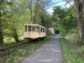
This circular route will take you on a tour of the Upper Sambre Valley, home to Lobbes and the medieval town of Thuin.
You can also admire the meanders of the Biesmelle river and take the RAVeL path, which runs alongside a tram line connecting Biesme-sous-Thuin to the Thuin tram museum.
Around Thuin
 4.06 mi
+344 ft
-351 ft
2h 10
4.06 mi
+344 ft
-351 ft
2h 10
 Easy
Departure from Thuin (Hainaut)
Easy
Departure from Thuin (Hainaut)
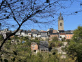
Around Thuin, a charming little fortified town, this short hike partly follows the Ravel 3 and Ravel line 109/2, passing through typical streets on the ramparts of Thuin and the magnificent Grand Bon Dieu woods.
Gozée towards Bois dè Pè and Reumont
3.15 mi
+131 ft
-131 ft
1h 35
Easy
Departure from Thuin (Hainaut)
Hike starting from Rue de Paris; also possible from the square near the church 200 m away. The route mainly follows country and forest paths away from traffic. A very peaceful route with a small wood that is interesting for its flora, especially in spring and early season.
Marbaix-la-Tour and its countryside
3.00 mi
+36 ft
-33 ft
1h 25
Easy
Departure from Ham-sur-Heure-Nalinnes (Hainaut)
Starting from the church in the village centre, the route takes you along quiet lanes and small roads in the centre before heading out into the countryside. An easy family hike with convenient parking at the start.
A short circular walk starting from Aulne Abbey
2.91 mi
+302 ft
-302 ft
1h 35
Easy
Departure from Thuin (Hainaut)
Amidst stone, woodland and tradition, this walk begins with an ascent through the forest, continues through the undergrowth before skirting a clearing, and follows a track through the fields to the abbey.
Aulne Abbey, Bois du Grand Bon Dieu and Hourpes through the forest
 11.72 mi
+1,102 ft
-1,093 ft
6h 20
11.72 mi
+1,102 ft
-1,093 ft
6h 20
 Difficult
Departure from Thuin (Hainaut)
Difficult
Departure from Thuin (Hainaut)
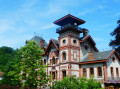
A little countryside, a little forest, a little town, a little of the Sambre with a lock and an old drawbridge, Aulne Abbey, Thuin, Hourpes with its strange castle and, to finish, lots of forest: that's what's on the programme for this walk.
In the countryside around Hantes-Wihéries
 8.70 mi
+259 ft
-279 ft
4h 15
Moderate
Departure from Erquelinnes (Hainaut)
8.70 mi
+259 ft
-279 ft
4h 15
Moderate
Departure from Erquelinnes (Hainaut)
This walk will take you on a tour of the village of Hantes-Wihéries and the surrounding countryside. The route offers beautiful panoramic views of the Hantes valley and the village. It is a mixed route combining farm tracks and small village roads.
For more walks, use our search engine .
The GPS track and description are the property of this route's author. Please do not copy them without permission.

