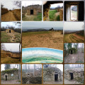
Circular route around Limonest

This walk takes you round Limonest, passing close to the Château de la Barollière. An easy walk, apart from one slightly tricky section. Trails and quiet country lanes.

Details

n°7390478
Creation:
Last update:
Last review:
  • Walking
    Activity: Walking
  • ↔
    Distance: 4.17 mi
  • ◔
    Average duration: 2h 25 
  • ▲
    Difficulty: Easy

  • ⚐
    Back to start: Yes
  • ↗
    Ascent: + 591 ft
  • ↘
    Descent: - 574 ft

  • ▲
    Highest point: 1,496 ft
  • ▼
    Lowest point: 1,014 ft

Photos

Description of the walk

Car park at the La Tuillerie industrial estate (plenty of spaces, rarely busy on Sundays).

(S/E) Take the Chemin des Tuileries, which is situated between the Saint Maclou and Lapeyre shops, heading east. Cross the D42 with care and continue along the road until you descend again to cross over the Ruisseau de Rochecardon.

(1) Shortly afterwards, take the Chemin de Beluze on the left, then turn left onto the grassy path towards Les Balmones and carry on straight ahead through the greenery.

(2) Take the path on the right to follow the stream (still heading towards Les Balmones).

(3) Due to a problem on the old path, you must now take a very steep and slippery section, even in dry weather. The path then leads onto the Chemin du Vallon. Continue along this path, turning right until you reach the Route de Saint-Didier. Turn right and take a cul-de-sac which is just ahead on the left.

(4) Turn onto the Chemin de la Châtaignière, which continues as a footpath leading uphill to the hamlet of the same name. At the junction, turn right onto the Impasse de la Châtaignière, then turn left onto the Route de la Châtaignière. Continue along this road towards the Château de la Barollière.

(5) When you reach a sharp left-hand bend, carry on straight ahead towards the château and continue along the footpath until you reach the Route du Mont Verdon (please note: there is a gate at the end of the footpath which may be closed, in which case you will have to turn back). In that case, carry on along the Route de la Châtaignière. Turn left to head back down the D73 to the village (there are some lovely views of the village and the Lyon conurbation).

(6) Cross Avenue du Général Charles de Gaulle (D42) with care and carry on straight ahead along Chemin du Mathias, which winds its way between old buildings, small blocks of flats and housing estates for over two kilometres. Head back down through a housing estate, then climb back up via the Allée du Vallon du Ruisseau until you reach the Route de la Garde. Take this road, turning right, until you come to the Chemin du Petit Paris.

(7) Continue straight on along a farm track (Sentier des Tuileries) which runs alongside a field and offers a sweeping view of Lyon. Follow the track as it descends to the right between Decathlon and Gifi until you reach the Gifi car park on the left. Walk down through the car parks to return to the starting point (S/E).

Waypoints

  1. S/E : mi 0 - alt. 1,076 ft - ZI La Tuilerie car park
  2. 1 : mi 0.62 - alt. 1,033 ft - Beluze Path
  3. 2 : mi 0.88 - alt. 1,063 ft - Path along the river
  4. 3 : mi 1.08 - alt. 1,158 ft - Steep path
  5. 4 : mi 1.26 - alt. 1,306 ft - Chemin de la Châtaignière
  6. 5 : mi 1.78 - alt. 1,401 ft - Towards Château de la Barrolière
  7. 6 : mi 2.36 - alt. 1,339 ft - Crossing the D42
  8. 7 : mi 3.73 - alt. 1,152 ft - Tuileries Trail
  9. S/E : mi 4.17 - alt. 1,076 ft - ZI La Tuilerie car park

Notes

Bring a pair of shoes with studs for a slightly slippery section.
The path offers little shade, so it’s best to set off in the morning on hot summer days; don’t forget a hat and sunglasses.

Worth a visit

Château de la Barollière.
You can join the fitness trail partway along the walk.
Close to Mont Verdun.
There are three wash houses near the walk where you can cool off.

Reviews and comments

3.3 / 5
Based on 4 reviews

Reliability of the description
3.5 / 5
Ease of following the route
3.3 / 5
Route interest
3.3 / 5
User 6436022

Overall rating : 4.3 / 5

Date of your route : Apr 06, 2026
Reliability of the description : ★★★★☆ Good
Ease of following the route : ★★★★★ Very good
Route interest : ★★★★☆ Good
Very busy route : No

A lovely local hike around Lyon. A magnificent castle well worth a visit.

Machine-translated

User 28123581

Overall rating : 4.7 / 5

Date of your route : Mar 09, 2026
Reliability of the description : ★★★★★ Very good
Ease of following the route : ★★★★★ Very good
Route interest : ★★★★☆ Good
Very busy route : No

A lovely walk around Limonest.
Easy to find.
Be aware that there is a slight incline on the way there.

Machine-translated

annie_12
annie_12

Overall rating : 3 / 5

Date of your route : May 09, 2024
Reliability of the description : ★★★☆☆ Average
Ease of following the route : ★★☆☆☆ Disappointing
Route interest : ★★★★☆ Good
Very busy route : No

It’s a lovely route near Lyon.
Our pedometers show it’s more like 8.2 km.
The tricky bit is that the paths aren’t signposted. On several occasions, it was just as well we had the app to help us find our way.
A nice afternoon all the same.

Machine-translated

vweb
vweb

Overall rating : 1.3 / 5

Date of your route : Feb 13, 2022
Reliability of the description : ★★☆☆☆ Disappointing
Ease of following the route : ★☆☆☆☆ Very disappointing
Route interest : ★☆☆☆☆ Very disappointing
Very busy route : No

Between the 90 per cent road and the landowners who are reclaiming (and therefore closing off) the footpaths, this ‘hike’ is unpleasant at best.

Machine-translated

Other walks in the area

For more walks, use our search engine .

The GPS track and description are the property of this route's author. Please do not copy them without permission.