Circular route around Yvoy-le-Marron via Mont-Collier

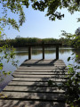
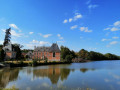
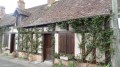
Whether on foot or by mountain bike, this route takes you through the unspoilt, little-known Sologne region, with a variety of landscapes where moors, ponds, forests and farmland alternate in peaceful harmony, as well as several castles and restored farmhouses.

Details

1078765
Creation:
Last update:
Last review:
  • Walking
    Activity: Walking
  • ↔
    Distance: 20.57 mi
  • ◔
    Average duration: 9h 35 
  • ▲
    Difficulty: Difficult

  • ⚐
    Back to start: Yes
  • ↗
    Ascent: + 164 ft
  • ↘
    Descent: - 164 ft

  • ▲
    Highest point: 443 ft
  • ▼
    Lowest point: 299 ft

Photos

Description of the walk

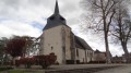
Start from the car park at the church in Yvoy-le-Marron.

(S/E) With your back to the church, turn left onto the Place du Cheval Blanc, then take the left-hand lane at the Fork in the road. Turn left onto the Grand Rue in front of the Hôtel de la Poste, then onto the Route de la Ferté-Saint-Aubin.

(1) Turn left onto the Rue du Moulin, then left again at the junction with a side street.

(2) You’ll see the Saint-Caprais Fountain, marked by a cross, on your left. Carry on and cross the Chemin du Mirauldin, then the Chemin du Val d’Arignan, and continue along the lane, ignoring the various turn-offs. Pass the Ferme des Eaux to reach the forest track.

(3) Turn left at the three-way junction, just after the Étang de la Rosa on your right, onto a path signposted “Ligny-le-Ribault 1h25”. This path is known as the “Chemin des Boursiers” where it has been made more stable.

(4) At the crossroads, follow the signs for “La Couvrée” by veering to the right and pass the Étang Neuf on your right.

(5) Pass the Domaine de la Couvrée on your left and continue along theGR®3C(GR® de Pays de Sologne), marked in white and red. The Chemin de la Couvrée, which becomes a tarmac road, crosses a moorland area

(6) At the junction with the D61, turn left. At the next crossroads, turn left towards Yvoy-le-Marron.

(7) Take the graded track on the right signposted “Villeny 2h40”, which quickly becomes a forest track before crossing moorland.

(8) When you reach a cross-cutting gravel track, turn right at a place called l’Auneau.

(9) Turn left when you reach a tarmac cross-path, and cross the Ruisseau d’Arignan. Continue along the dirt track, passing La Darmerie, then La Caroline.

(10) Opposite the Château de la Cantée, take the path on the right marked “Route du Bouchet 3h40”. Pass the Ferme de la Cantée, then the pond crossed by the Ruisseau de Saint-Caprais

(11) At the junction just after the pond, turn right, then left, passing the various private access roads.

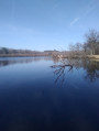
(12) When you reach a hard-surfaced track, carry on straight ahead, passing close to the Étang du Maraicheux on your left.

(13) Turn left when you reach a stabilised cross-path, pass the Ferme de la Vallée, then cross the D88.

(14) When you reach the tip of the Étang de Collier, turn onto the embankment opposite Château Mont-Collier. Leave this stabilised track when it heads towards La Grille, continuing straight on along a path that runs alongside the Étang de la Grille.

(15) As you emerge from the woods, carry on straight ahead along the grassy path, passing close to the Étang de la Beauce on your left.

(16) Turn left when you reach a cross-cutting stabilised track, cross a second track, and walk alongside a property on your right. Cross the D104 towards Le Chavant.

(17) Keep to the right at the Fork in the road, then take the path on the left in front of the Chavant farm. Once past the farm, this track becomes a grassy path and then crosses a cross-path.

(18) Carry on straight ahead, letting theGR® trail veer off to the right.

(19) At the T-junction, turn left then right. The track turns right opposite the Étang de Bouvière, then left as you approach the Étang de Ribert, and finally right to pass the Ferme de la Meule and then the Ferme de la Bordebure.

(20) The route then becomes a hard-surfaced track which turns right before joining the D207a, onto which you’ll turn left.

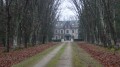
(21) At the crossroads, turn left to see Villebourgeon Castle.

(22) Once past La Garenne farm, turn left onto the stabilised track –the GR® de Pays de Sologne – which you’ll follow as far as Yvoy-le-Marron. Take in the view of La Brosse farm at the side of the path.

(23) Continue, keeping to the right at the junction, then quickly leave the track when it takes a wide right-hand bend, taking instead a forest path which you should follow – there is no possibility of confusion – until it becomes a stabilised track again, then a tarmac road as you approach the first houses of Yvoy-le-Marron, now known as ‘Chemin de la Pommelière’.

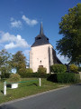
(24) Turn left onto Rue Saint-Jean, which continues as Rue des Échelles as you approach the church tower. Turn right onto Grande Rue, then left onto Rue de l’Église, to return to the starting point, the church square (S/E).


Waypoints

  1. S/E : mi 0 - alt. 417 ft - Church Square
  2. 1 : mi 0.18 - alt. 417 ft - Turn left into Rue du Moulin
  3. 2 : mi 0.73 - alt. 381 ft - Saint-Caprais fountain on the left
  4. 3 : mi 2.84 - alt. 338 ft - Turn left towards Ligny-le-Ribault – 1 hour 25 minutes
  5. 4 : mi 3.35 - alt. 325 ft - Head towards “La Couvrée” on the right
  6. 5 : mi 4.07 - alt. 335 ft - Domaine de la Couvrée on the left
  7. 6 : mi 5.94 - alt. 302 ft - Turn left at the junction with the D61
  8. 7 : mi 6.27 - alt. 302 ft - Turn right towards Villeny – 2 hours 40 minutes
  9. 8 : mi 7.23 - alt. 312 ft - Turn right at a place called l’Auneau
  10. 9 : mi 7.48 - alt. 308 ft - Turn left onto a tarmac track
  11. 10 : mi 8.67 - alt. 344 ft - Turn right when facing the Château de la Cantée
  12. 11 : mi 9.09 - alt. 328 ft - Turn right, then left
  13. 12 : mi 9.69 - alt. 361 ft - Carry on straight ahead until you reach a compacted track
  14. 13 : mi 10.2 - alt. 384 ft - Turn left when you reach a compacted track
  15. 14 : mi 11.31 - alt. 410 ft - The embankment opposite Mont-Collier Castle
  16. 15 : mi 11.96 - alt. 436 ft - Straight ahead on the grassy path
  17. 16 : mi 12.78 - alt. 440 ft - Turn left when you reach a compacted track
  18. 17 : mi 13.45 - alt. 436 ft - Turn right at the fork in the road
  19. 18 : mi 13.86 - alt. 407 ft - Carry on straight ahead, leaving the GR behind
  20. 19 : mi 14.18 - alt. 381 ft - Turn left, then right
  21. 20 : mi 15.3 - alt. 381 ft - A compacted track curving to the right
  22. 21 : mi 16.41 - alt. 364 ft - Turn left to see Villebourgeon Castle
  23. 22 : mi 16.79 - alt. 361 ft - Turn left onto the gravel track
  24. 23 : mi 18.49 - alt. 394 ft - Turn right at the junction
  25. 24 : mi 20.32 - alt. 417 ft - Turn left onto Rue Saint-Jean
  26. S/E : mi 20.57 - alt. 417 ft - Church Square

Notes

Watch out for signs indicating private property. There are many of them and their locations are often confusing.

You can stop off at Ligny-le-Ribault (restaurants, hotels).

Worth a visit

During the walk, you’ll see:

  1. the village of Yvoy-le-Marron
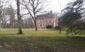
  2. the châteaux of La Cantée, Mont-Collier and Villebourgeon
  3. some very beautiful woodland scenery between Villebourgeon and Yvoy-le-Marron

Always be cautious and plan ahead when you're outdoors. Visorando and the author of this route cannot be held responsible for any accidents occurring on this route.

The GR® and PR® markings are the intellectual property of the Fédération Française de Randonnée Pédestre.

Reviews and comments

4.7 / 5
Based on 2 reviews

Reliability of the description
5 / 5
Ease of following the route
5 / 5
Route interest
4 / 5
Jean-Louis Pinault
Jean-Louis Pinault

Well done to all the brave souls! Thank you for your comments, which will help guide future hikers.
Have a lovely day
Jean-Louis

Machine-translated

Rached
Rached

Overall rating : 4.7 / 5

Date of your route : Sep 18, 2020
Reliability of the description : ★★★★★ Very good
Ease of following the route : ★★★★★ Very good
Route interest : ★★★★☆ Good
Very busy route : No

A pleasant walk along the paths of the Sologne. You’ll come across a château and a beautiful country house, as well as some lovely ponds. We saw several does and a magnificent stag.
Don’t be put off by signs saying ‘private property’ or ‘private road’…
At no point will you be trespassing or crossing private property.
We didn’t meet a single person along the 33km route.
We completed the route in 7 hours, including breaks, on a Friday.
Please note: do not undertake this walk whilst hunting is taking place.

Machine-translated

Jean-Louis Pinault
Jean-Louis Pinault
• Edited:

Thank you for your comments and photos. A warm welcome to all lovers of the Sologne!
Jean-Louis

Machine-translated

MEV3N
MEV3N

Overall rating : 4.7 / 5

Date of your route : Sep 21, 2019
Reliability of the description : ★★★★★ Very good
Ease of following the route : ★★★★★ Very good
Route interest : ★★★★☆ Good

A peaceful and very pleasant walk in the heart of Sologne.

We only came across two people over the course of our 33-kilometre walk.
You’ll come across all sorts of paths (woodland, fields, roads, villages, ponds, etc.)
Point 14 features a pond that’s ideal for pitching your tent on a patch of grass.

The downside? The first 10 kilometres offer no points of interest apart from the forest. The ponds are on private land. The remaining 23 kilometres hold some hidden gems right in the heart of Sologne.

Don’t forget your binoculars.

Machine-translated

Other walks in the area

For more walks, use our search engine .

The GPS track and description are the property of this route's author. Please do not copy them without permission.