


 Country:
 City:
City:


The route starts in the centre of Peñiscola, at Plaza de la Constitución, a large roundabout opposite the South Beach (Platja del Migjorn).
(S/E) From the roundabout, head south-west along Carrer d’Irta, running alongside the beach. The road, which further on becomes Cami de lo Pebret, runs along the coast, passing Racó Calent, Racó del Bessó, the Finca del Moro housing estate and Cala del Moro, until it reaches a junction near Platja de Santa Lucía.
(1) Turn left onto Cami del Mar, which runs alongside the sea, passes Puerto Azul and reaches Cala Ordí.
(2) Turn slightly right to take a path a little further inland before returning to the seafront.
Alternative route: it is possible to continue (2) along the unpaved coastal road, but this comes to an abrupt end; you must then carry on across the beach, amongst the rocks, which is possible but rather awkward.
Continue along the coastal road past Platja de Portonegro and Punta de Mabre until you come to some beautiful properties. Then head up to the right (north-west) via a path that leads under an archway to the junction with the Route de Font-Nova.
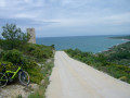
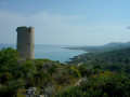
(3) Turn sharply left towards the south to take the Cami del Pebret, which winds its way through the estates and then, after a few hundred metres, begins a steep climb towards the south-west. The path levels out and runs along the hillside above the cliffs, as far as the promontory of the Tour Badúm (or Abadum, or Badún)
(4) From the tower, return to the road and descend (concrete sections) in hairpin bends towards the sea, still heading south-west. Pass Platja d’Ull de Bou, Platja del Russo and Platja del Pebret, until you reach a junction some 200 metres past Punta del Pebret.
(5) Turn right to begin the long climb leading up to the Coll d’Imberri. The gradient is initially gentle until you reach the Corral de Barrancot (Pla del Barranquet). Descend, cross the Collada del Pou del Moro and climb up the right-hand side in a series of hairpin bends, then head north-west until you cross the Barrenq de la Font de Canes; after this, a final hairpin bend and a slightly steeper climb lead to the Pou del Moro, a shaded spot equipped with a cistern
(6). Ignore the path branching off to the left towards the Font d’en Canes (spring) and continue to the right along the track, which turns north-east and levels out.
Further up, turn left to pass through the Barrenc del Pou del Moro and climb back up the hillside. Resume heading north-east on level ground and, at the end, descend towards the Barrenq de la Carrera at a place known as Mas del Senyor.
Caution: make sure you stay on the traditional route and avoid the recent developments carried out to bring the area back into use.
(7) After crossing the (dry) stream, head up the left bank due south; then, after a left-hand bend, the road turns due east onto a gently ascending stretch, which steepens slightly further on to climb up to the Coll d’Imberri.
(8) Cross the pass straight ahead and begin the fairly steep descent through a series of bends; the gradient then eases off as you reach the Font-Nova housing estate.
(9) Take the tarmac road leading down towards Peñiscola at the junction with the Cami del Pebret, which you passed on the way out.
(3) Continue alongside a housing development under construction on the left (Cap Blanc), until you reach a cluster of houses bordered by hedges of pine trees.
(10) Turn sharply left onto the path leading up to the Sant Antoni hermitage. The area is heavily affected by development work: if you find it difficult to follow the historic path, simply take the new road – Avenida Collada dels Pitxells – which leads to the same spot, the Camí de la Ermita de Sant Antoni.
(11) Take this path on the right; it descends slightly to the Baranc dels Pitxells and the Monte Pitxells housing development.
(12) Head up the small road to the left (north), which leads to a small pass and then descends towards the Peñiscola housing estates on Avinguda d’Itàlia. Go down this road to the right; it turns left and then climbs again to a junction.
(13) From this junction, head down Carrer de la Cova to the main road (Carretera de l’Estanció). Cross it to reach Plaza de la Constitución on the opposite side (S/E)



