Country:

 City:


At Ceyrat, south of the village towards Pradeaux, cross the bridge over the Artière and park in the car park just after it, on the right (glass recycling bins).
Yellow markings: line and Yellow Disc
(S/E) Head towards the Robinson marker in the car park and set off towards Côte de Berzet, which is also the direction of the Gorges de l’Artière and the Dolmen de Samson, indicated by an older sign. The path runs alongside the Artière on the right-hand side.
(1) At the crossing over the Artière, ignore the return path on the left and follow the signs for the Gorges de l’Artière route. Continue with the Artière on your left, pass the ‘Octopus Montanus’ sculpture (information board), cross back to the right bank via a footbridge, and leave the rocky outcrop known as the Dolmen de Samson on your left. Take another footbridge to cross to the left bank. Shortly afterwards, the path climbs and reaches a junction at the ‘Côte de Berzet’ signpost.
No signposting; signposts are indicated in the route description where present
(2) Turn right towards Berzet and head for the village.
(3) At the ‘Berzet’ signpost, near a covered fountain, follow the signs for ‘Source de l’Artière’ along the road to the left, then immediately take the path above the road, signposted ‘Chapelle de Berzet’. You’ll reach the chapel very quickly; walk round it and take the street on the left that runs behind it. Stay on this street until you reach the village exit
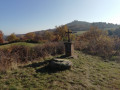
(4) After the last house on the right, just before the ‘village exit’ sign, follow the path branching off to the right. Pass an old cross.
(5) Further on, join the D133 and follow it to the right, keeping to the wider left-hand verge. Ignore the road on the left at the Côte Rouge bus shelter. At the sign for the Saint-Genès metropolitan wetland area (picnic tables), head down into the wetland area through a small gate. At the bottom, turn left onto the boardwalk, walk to the viewing platform on the site (information board) and retrace your steps. Cross the Ruisseau de Saint-Genès via a footbridge and arrive at a Fork in the road marked by signposts.
(6) For a short round trip, head up to the right towards Saint-Genès along a path lined with beautiful pollarded poplars. At the top, explore the renovated old castle, which is home to the Escapad’ association. Head back down the same path to reach the stream again.
_Yellow Disc Markings__
(6) At the signposts, turn right onto the path that runs alongside the Ruisseau de Saint-Genès. Pass through two gates, then cross three small footbridges to get from one bank to the other. You’ll reach the Ruisseau de Saint-Genès signpost.
(7) Turn right towards Saulzet-le-Chaud. Further up, turn left opposite the gate of the INRAe experimental farm and continue to the ‘Quatre Chemins’ crossroads.
(8) Turn left towards the Redon Haut farm.
_Yellow line markings__ in the opposite direction
(9) At the farm entrance, ignore the Yellow Disc markings heading off to the right; carry on straight ahead, even though there are no visible markings (as you’re going in the opposite direction). Don’t worry about seeming to be trespassing. Cross the farm, heading towards Redon Haut as indicated by a sign at the exit.
(10) At a fork in the road, ignore the path on the right, then ignore two descents on the left.
(11) At the first hairpin bend to the left, ignore the path leading off to the right; then, at the next hairpin bend to the right, ignore the path leading off to the left. After a final hairpin bend, rejoin the Artière at the first junction you passed on the way out.
Yellow Disc markings
(1) Turn right and follow the route back in the opposite direction to return to the car park (S/E).
 Visorando Member
 Easy