Bishopston Valley and Pwlldu Bay

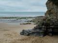
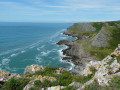
Pwlldu is a pretty little bay on the south coast of the Gower Peninsula, which stretches west of Swansea. This bay is unique in that it is only accessible on foot or by mountain bike, although the two or three dwellings (holiday lettings) are probably accessible by quad bike or a small off-road vehicle capable of negotiating a very stony track and fording a river. Whilst all the tracks and paths taken are officially signposted as footpaths, most of the forest sections are barely passable, such is the extent to which the vegetation has grown since the last local roadmender retired. It is mainly brambles and fallen trees blocking the way that hinder progress. There are indeed ‘Pwlldu’ signposts along the first three kilometres, but these too are sometimes in a dreadful state.
In short, a truly wonderful experience as an introduction to the Gower Peninsula.

Details

103748066
Creation:
Last update:
Last review:
  • Walking
    Activity: Walking
  • ↔
    Distance: 4.86 mi
  • ◔
    Average duration: 2h 30 
  • ▲
    Difficulty: Moderate

  • ⚐
    Back to start: Yes
  • ↗
    Ascent: + 341 ft
  • ↘
    Descent: - 354 ft

  • ▲
    Highest point: 236 ft
  • ▼
    Lowest point: 16 ft

Photos

Description of the walk

(S/E) From the car park, cross the village’s main road and take the small cul-de-sac opposite the Beaufort Arm.

(1) Walk straight down Kittle Green and, on the way out, take the path that runs alongside the few houses, keeping them on your right. The path enters Bishopston Valley (brambles and other obstacles since the last roadmender retired). Carry on following the stream as closely as possible, ignoring any paths that veer away from it. Just before the small bridge, turn right onto the path that leads to a few houses. If you miss the path, don’t worry: just carry on straight ahead. You’ll come to Pwlldu Bay.

(2) Take a short stroll along the beach and head back up towards the little bridge.

(3) Cross the little bridge and take the wonderfully stony path that climbs up and away from the coast. Ignore all the side paths or tracks branching off to the left or right. You’ll come to a clearing on the left-hand side. It’s most likely a football pitch.

(4) Turn left, go round the back of the ‘refreshment kiosk’ and turn right at the next T-junction. You’ll come to a crossroads.

(5) Turn right onto the small road until you reach the first crossroads.

(6) Take the path on the left until you reach the crossroads.

(7) Stay on the path on the right. It climbs up the Bishopston valley.

(8) At the junction, carry straight on.

(9) Turn left at the crossroads and head down towards the stream.

(10) At the T-junction, keep to the left.

(11) Don’t miss the track that crosses the stream and heads back up towards the path you took on the way there.

(1) Take this path to the right. It will take you back to the starting point (S/E)

Waypoints

  1. S/E : mi 0 - alt. 233 ft - Kittle car park
  2. 1 : mi 0.2 - alt. 194 ft - Beaufort Arm
  3. 2 : mi 2.15 - alt. 49 ft - Pwlldu Bay
  4. 3 : mi 2.33 - alt. 59 ft - Small bridge
  5. 4 : mi 3.18 - alt. 210 ft - Sports ground
  6. 5 : mi 3.44 - alt. 194 ft - Crossroads
  7. 6 : mi 3.66 - alt. 177 ft - Junction
  8. 7 : mi 3.82 - alt. 151 ft - Crossroads of paths
  9. 8 : mi 4.26 - alt. 213 ft - Junction
  10. 9 : mi 4.42 - alt. 220 ft - Crossroads
  11. 10 : mi 4.56 - alt. 128 ft - Stream
  12. 11 : mi 4.61 - alt. 144 ft - Stream
  13. S/E : mi 4.86 - alt. 233 ft - Kittle car park

Notes

Although the route isn’t complicated in itself, it’s very difficult to describe. The best thing to do is to load the route and follow your progress using the Visorando app.

Other walks in the area

For more walks, use our search engine .

The GPS track and description are the property of this route's author. Please do not copy them without permission.