Three Cliffs Bay and Pennard Castle circular loop

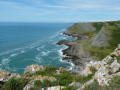
An easy walk on a fine day, offering the chance to admire beautiful scenery with views of the three cliffs. Swimming is possible in Three Cliffs Bay and there’s a lovely viewpoint at Pennard Castle. Be mindful of the tide times.

Details

n°50482009
Creation:
Last update:
Last review:
  • Walking
    Activity: Walking
  • ↔
    Distance: 3.71 mi
  • ◔
    Average duration: 1h 55 
  • ▲
    Difficulty: Easy

  • ⚐
    Back to start: Yes
  • ↗
    Ascent: + 272 ft
  • ↘
    Descent: - 276 ft

  • ▲
    Highest point: 217 ft
  • ▼
    Lowest point: 3 ft

Photos

Description of the walk

Park at the National Trust car park, HW86+PV Southgate.
Large pay-and-display car park. There is a coffee shop nearby.

(S/E) Take the wide path running alongside the houses on the right, then turn left towards the sea to get closer to the cliffs and reach a viewpoint.

(1) Carry on until you rejoin the main path, then follow it for about a hundred metres.

(2) Turn left again to head down towards Three Cliffs Bay, walking as close as possible to the cliffs. Pass the Three Cliffs Corner viewpoint and rejoin the main path once more.

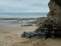
(3) Head down to the beautiful Three Cliffs beach. The descent is a little steep. Then walk along the beach.

(4) Pass under a rock arch at low tide and continue along the beach towards the ruins of Pennard Castle.

(5) Leave the beach on the right and head towards the castle. You’ll come to a fork in the path.

(6) Turn left to reach the castle ruins and enjoy the beautiful view over the bay.

(7) Then retrace your steps.

(6) Carry on straight ahead. At this point, climb up the dune to reach the top of the cliffs.

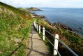
(3) Turn left to walk back from the cliff edge, along a path through the vegetation.

(2) Carry on to the left, past the houses and gardens, to return to the National Trust car park (S/E).

Waypoints

  1. S/E : mi 0 - alt. 217 ft - National Trust car park
  2. 1 : mi 0.34 - alt. 151 ft - Viewpoint
  3. 2 : mi 0.53 - alt. 210 ft - Junction
  4. 3 : mi 1.11 - alt. 105 ft - Junction
  5. 4 : mi 1.4 - alt. 26 ft - Rock arch
  6. 5 : mi 1.62 - alt. 10 ft - Turn right at the fork
  7. 6 : mi 1.99 - alt. 118 ft - Start and finish point
  8. 7 : mi 2.09 - alt. 161 ft - Pennard Castle
  9. S/E : mi 3.71 - alt. 217 ft - National Trust car park

Notes

An easy, very popular walk with several route options to suit your preferences.

Worth a visit

For those who aren’t too cold, there’s the chance to go for a swim.

Reviews and comments

5 / 5
Based on 1 review

Reliability of the description
5 / 5
Ease of following the route
5 / 5
Route interest
5 / 5
User 15208491

Overall rating : 5 / 5

Date of your route : Jul 19, 2026
Reliability of the description : ★★★★★ Very good
Ease of following the route : ★★★★★ Very good
Route interest : ★★★★★ Very good
Very busy route : No

A magnificent walk through a variety of landscapes, from moors to cliffs and beaches… all the way to the ruins of Pennard Castle
The route is a little unclear on the way back, along the golf course, but you can’t get lost

Machine-translated

Other walks in the area

For more walks, use our search engine .

The GPS track and description are the property of this route's author. Please do not copy them without permission.