Country:
 City:


Parking: Zone d’Activités de la Bascule or Rue Lucien Fromagé in Darnétal. Access is available via the Astuce bus network, line TEOR T3, getting off at the École d’Architecture stop in Darnétal.
(S/E) Opposite the theatre, l’Écho du Robec, in the Zone d’Activités de la Bascule, turn left. Follow the cycle path to the first junction and continue left until you reach the traffic lights.
(1) At the pedestrian crossing, cross Boulevard de la Paix and continue straight ahead along Rue Richard Waddington. Pass under the viaduct and turn right immediately, crossing Route de Lyons la Forêt with care, directly opposite the sign for Saint-Léger-du-Bourg-Denis.
(2) Head up the Sente des Trésoriers via the cul-de-sac. At the first Fork in the road, take the left-hand branch, passing in front of the Métropole’s water reservoir. At the end of the path, at the T-junction, turn left onto Rue de Toronto. At the next junction, turn right twice to reach a junction a few metres further on.
(3) Cross Rue des Broches, turn into Impasse des Trésoriers and immediately turn left onto the small path leading up into the woods, the Sentier des Trésoriers. Follow this ascending path, ignoring the paths branching off to the right, until you reach a large open space (junction) at the edge of the woods, marked by a sign for ‘1 km Créa Bonsecours’.
(4) Turn right and follow the path along the edge of the woods, with a reservoir on your left. Ignore the paths branching off to the right until you reach the sign for the fitness trail, 1.8 km away. Walk past the sign; at the fork in the road, turn left and continue along this path until you reach a sign 200 m on your right. Continue along the path to the left and, after the first turn-off on the right, turn immediately left to reach the residential area.
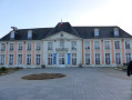
(5) Carry on straight ahead along Rue du Nid du Chien. At the end, take the street on the right and immediately another street on the left, then the path after the metal barriers, Allée de la Plaine. Carry on to the roundabout and take the street on the left until you reach the next roundabout. Turn right onto Rue Jules Ferry. Carry on to the T-junction, take the street on the left and then immediately turn right onto Rue Jules Verne, continuing to the traffic lights. For lovers of beautiful architecture, the town hall is situated about 10 metres to the left.
(6) Cross the Route de Paris at the pedestrian crossing and continue straight ahead onto Rue de la Basilique. Carry on to the roundabout after the building. On your left is the ‘Le Gros Léon’ bell, situated on the lawn, and opposite the roundabout is the Joan of Arc monument. Facing the Joan of Arc monument, take the path on the right, following the GR® sign. Walk down this path, the former route of the funicular railway that linked the Eauplet district to the Notre-Dame Basilica via the hill. At the road, continue straight ahead until you reach the traffic lights.
(7) Turn left, crossing Rue du Général Leclerc at the pedestrian crossing. Walk down to the traffic lights and cross Route de Paris at the pedestrian crossing, then turn left opposite onto Chemin des Noyers. Ignore the first turn-off on the right and take the first left, onto Sente des Tilleuls.
(8) Continue along the path opposite, pass the first wooden gate and carry on to the second gate. Here, there are two options:
-ignore this gate, head up to the right on the GR®, go through the wooden gate and climb the very steep and slippery slope to reach the road.
- ignore the path leading up to the right, go through the gate, follow the path opposite to reach the Côte Sainte-Catherine below the corniche and continue with the route description.
(9) Turn left onto Route de la Corniche until you reach the viewpoint at Côte Sainte-Catherine, with views over Rouen and the surrounding towns. Head down the path dotted with wooden steps that winds down the hill to reach Rue Henri Rivière near the cemetery. Turnright here,then immediately left onto the path leading downhill, then turn onto the wooden staircase on your right. At the bottom, go under the bridge on the left and continue straight on until you reach the traffic lights and the railway line.
(10) Head slightly to the left and cross the road at the pedestrian crossing. Continue by crossing the next pedestrian crossing, and the one after that, which crosses the bus lanes. Turn left onto Rue Martainville, pass the Le Clos Saint-Marc market square on your left, cross Rue Victor Hugo and continue straight on until you reach Place de l’Aître Saint-Maclou on your right.
(11) Turn right to head towards the Aître Saint-Maclou, a former 14th-century cemetery. As you enter the Aître, just on your right, you’ll find the legendary mummified cat, behind a glass pane. Then, retrace your steps, turn right, with the Church of Saint-Maclou on your left, and the Leaning House directly opposite. Cross the small square to the junction.
(12) Cross Rue de la République and continue straight ahead along Rue Saint-Romain. At number 74 on this street stands one of the oldest houses in Old Rouen, dating from the 15th century. At the end of the street, take the road on the left to reach the cathedral forecourt. With your back to the cathedral, head straight ahead along Rue du Gros Horloge. Turn right onto Rue Thouret before the Gros Horloge. At the T-junction, opposite the courtyard of the Palais de Justice, turn left onto Rue aux Juifs until you reach the crossroads.
(13) Cross Rue Jeanne d’Arc and continue straight ahead along Rue Rollon. At the end, at Place du Vieux Marché, take the street on the left and then immediately turn right, walking past the shops on your left. On your right are the ruins of Saint-Sauveur Church and Sainte-Jeanne-d’Arc Church. Turn right at the ruins of Saint-Sauveur Church, then left opposite Sainte-Jeanne-d’Arc Church, and go up the steps directly opposite. At the top, turn right then left until you reach the first turning on the left.
(14) Continue straight ahead and then turn left onto Rue Cauchoise. Follow this street up to the large junction. Cross Place Cauchoise at the pedestrian crossing. Turn onto Rue Saint-Gervais, cross it, then turn right onto Rampe Cauchoise. Then follow Rampe Bouvreuil to the T-junction. Turn left onto Rue Bouquet and take the first right onto Rue Pouchet. At the end, carry on straight ahead, with Rouen station on your left, and continue straight ahead along Rue de la Rochefoucauld to the T-junction.
(15) Turn right onto Rue du Champ des Oiseaux and continue down to the traffic lights. Cross Boulevard de la Marne at the pedestrian crossing and turn right. Then take the first left onto Rue du Donjon. Walk past the Radisson Blu hotel and enter through the Donjon gate, following the path through the small garden.
(16) Continue to the right, cross the small square on the left and turn into Rue Cordier. Go straight on, passing the Chapelle Saint-Louis, now the Théâtre de la Ville de Rouen. Take the first right onto Rue du Petit Porche and walk down to the junction. Cross the road at the first pedestrian crossing to reach Place du Général De Gaulle, opposite Rouen Town Hall. Take the street on the right, pass the Abbey Church of Saint-Ouen and turn left into Rue des Faulx.
(17) Turn left immediately into the Town Hall Gardens. Behind the Abbey Church, turn right and follow the paths to reach the garden exit. Continue left along Rue Saint-Vivien until you reach the traffic lights, then cross the road. Continue straight ahead along Rue Saint-Hilaire. At the roundabout on Place Saint-Hilaire, go straight across and continue straight on along Route de Darnétal. Go past the first set of traffic lights and take the first right onto Rue du Petit Pont.
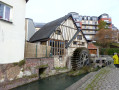
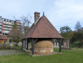
(18) Turn left onto the footpath and cycle path, following the River Robec on your left until you pass under a railway bridge. At the next junction, continue straight ahead along the path past the metal barrier. Follow this path to the Moulin and the Four de la Pannevert.
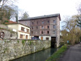
(19) Ignore Rue de la Pannevert, which branches off to the left. Continue along the path straight ahead, passing under the next bridge. Carry on straight ahead, with the River Robec still on your left. First turn right then left, and continue along the road with the river on your right this time. Pass the signposts, the Moulin Saint-Gilles and the Moulin Saint-Paul, and carry on to the T-junction. Turn right onto Rue Lucien Fromagé. At the stop sign, take the road on the right to return to the starting point, Zone de la Bascule. (S/E)


 Visorando Member

 Easy