Visorando Visorando
Visorando Visorando
  •  Tools 
    • Walking route planner
    • Import a GPX file
  • Walks
  • Help centre ↗
  • Visorando Premium
  • Sign up
  • Log in
  1. Visorando
  2. Walks
  3. Rhône-Alpes
  4. Ain
  5. Corveissiat
  6. Balme (ruisseau) - Affluent de l'Ain
Refine your search for walks in Balme (ruisseau) - Affluent de l'Ain
Filters NEW

Filters

Close
Duration
Distance
Difficulty
Ascent NEW
Activities
Route type

Balme (ruisseau) - Affluent de l'Ain walks

fr de

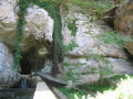
Walking Reculée and Corveissiat Cave

Visorando Member
Reculée et Grotte de Corveissiat
↔1.80 mi ↗+384 ft ↘-381 ft ◔1h 10 ▲Easy
⚑Departure from Matafelon-Granges (Ain)
This valley is one of the most remarkable sites in the Revermont region, with its imposing cliffs offering a magnificent panorama of the Ain Gorges and its cave, whose entrance is 30 metres high. A short route ideal for families.
Download PDF  PDF Download GPX  GPX

Walks near Balme (ruisseau) - Affluent de l'Ain

Walking Grand Corent - Chevanel

Visorando Member
Grand Corent - Chevanel
↔14.11 mi ↗+1,434 ft ↘-1,864 ft ◔7h 45 ▲Difficult
⚑Departure from Grand-Corent (Ain)
Third stage of the Way of St James. A pleasant stage with some elevation gain, shaded sections and stretches on tarmac and dirt tracks.
Download PDF  PDF Download GPX  GPX

Walking Pic d'Oliferne - Grand Corent

Visorando Member
Pic d'Oliferne - Grand Corent
↔15.10 mi ↗+1,201 ft ↘-2,218 ft ◔8 hrs ▲Very difficult
⚑Departure from Vescles (Jura)
Second stage of the Way of St James. A route offering beautiful views of Lake Coiselet and Lake Conflans, taking us through a few small hamlets and across woodland.
Download PDF  PDF Download GPX  GPX
Back to top
  • Contact

Download the app now and go on an adventure!

App storeApp Store
Google playGoogle Play

Checking services status…© 2026 Visorando
 Loading…