Country:
 City:
City:


From Fontenay-le-Vicomte (church), head south-east as you leave the village, following the small road to Chevannes which crosses a plain.
(1) At the Chevannes roundabout, take the Route de Champcueil (south).
(2) Pass through the village of Champcueil towards the hamlet of Louteville (south-east). At Louteville, enter the Grands Avaux forest by following the cobbled path and continue in the same direction (500m) on the D75 until the next junction.
(3) Turn left onto the D948 (north), then after a few metres, take the track on the right towards Nainville-les-Roches (east).
Before entering Nainville, take the path on the right (south).
(4) After 400 m, you’ll join theGR®11, which you should follow for several kilometres through the forest until you reach the next road at Les Vergers du Chalois.
(5) Take the road on the left, pass the restaurant “Le Saut du Postillon”, then after 100 m, take the path on the right (west) and continue along theGR®11. Walk up the hill.
(6) At the top, leave theGR®11, which heads off to the left, and continue straight on along thePR®(west) to the hamlet of La Padôle.
(7) Follow the road to the village of Mondeville.
(8). Walk through the village, turning left after the church and heading towards the campsite. Walk past the campsite entrance and continue along the path that leads into the forest.
(9) At the first crossroads, take the path on the right (north) until it turns sharply to the right. Just after this bend, take the path on the left to stay in the woods, running parallel to the edge of the woodland, which is visible 100 metres to your right.
You’ll come to a junction (this is theGR®11again); follow it by turning right and you’ll soon reach the edge of the woods.
Here, you can either continue along theGR®, which stays along the edge of the woodland and fields, or, just before leaving the woodland, there is a small (single-track) path through the undergrowth – which is more fun – and which also joins theGR® a little further on at the corner of the field on the plain.
(10) Please note: When you reach the corner of this field, continue along theGR® at the edge, but don’t miss the small entrance to the path on the left, 100 metres from the corner of the field.
You’ll enter the forest again and follow this path without straying from the small wire fence (often lying flat or rusty) on the left-hand side of the path. This small fence, which runs for several kilometres, leads you down a long, very pleasant descent to Ballancourt.
(11) On arriving in Ballancourt, you pass under the D191 and find yourself in the town, in a housing estate. From this point, there are several options as you make your way through the town’s narrow streets; the aim is to reach the banks of the River Essonne (west), without crossing it.
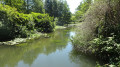
(12) You cycle alongside the Essonne.
(13) Then you reach its confluence with the Juine, with the rivers on your left and keeping the railway line on your right until the last level crossing (Route de Saint Vrain / Ballancourt).
At this final level crossing, take the dead-end road (north) which continues to follow the Essonne until you enter a wood, then, as soon as possible, take a path slightly to the right which passes under the high-voltage power line and crosses a small stream.
Following this path, you’ll reach the former SNCF railway halt at Fontenay.
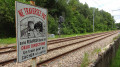
(14) Cross the automatic level crossing and the path takes you back to the village of Fontenay-le-Vicomte (S/E).






 Visorando Member
 Difficult