Sensory walk at Lande Mehagne

The Lande Mehagne: an unusual landscape that resembles a savannah.
The vegetation growing in the Lande is unique. This is due to a specific type of soil known as ‘calaminous’, which contains high levels of zinc. Industrial activities at the former factories in Trooz and Angleur – which have been extracting and processing zinc ore since 1860 – have, over more than a century, resulted in fallout that has permeated the soil, creating a unique biotope.

Details

3141790
Creation:
Last update:
Last review:
  • Walking
    Activity: Walking
  • ↔
    Distance: 2.46 mi
  • ◔
    Average duration: 1h 25 
  • ▲
    Difficulty: Easy

  • ⚐
    Back to start: Yes
  • ↗
    Ascent: + 312 ft
  • ↘
    Descent: - 289 ft

  • ▲
    Highest point: 568 ft
  • ▼
    Lowest point: 269 ft

Description of the walk

This walk is short but offers a sensory experience, with plenty of activities along the route. It is also signposted with a black logo on a white background depicting a bear’s paw.

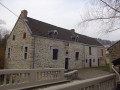
(S/E) You are on Rue des Coquelicots, where the Mehagne Farm is situated; you can see it directly in front of you. Walking past the Embourg Pétanque Club on your right, just next to the farm, you’ll find the start of the walk.

Take the small path on the left and head towards Rue Basse Mehagne. Walk about 40 metres to the left, then turn right between numbers 35 and 37. You’ll arrive at the first attraction: the Insect Hotel. After the activity, carry on straight ahead along the path towards La Petite Traverse, then take the small path directly in front of you and cross Avenue François Bovesse.

(1) As soon as you enter the woods, take the path on your right to reach the charades and riddles activity. Scan the QR code and have a go. Once you’ve solved the puzzles, carry on straight ahead and follow the arrows. After 200 metres, you’ll come to a T-junction where you turn left as indicated by the arrow.
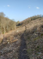
Then follow the arrows to reach the lowest point of the walk. Scan the QR code and listen through the object. Then carry on straight ahead the whole way.

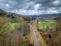
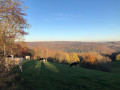
(2) From here, you can enjoy your first view of Chênée and the city of Liège. Carry on climbing a little further and you’ll reach a second viewpoint with an even clearer view. Scan the QR code again and play. You’ve now reached the viewpoint with the clearest view of the city of Liège.
Then carry on straight ahead, following the arrows for about 400 metres, and turn left.

(3) That’s it – you’ve reached the most fun activity on the trail: the Blind Test! Scan the QR code and play with your family. Next, take the next left, where you’ll walk alongside the gardens. Turn left, then right a few dozen metres further on, and after rounding a bend to the right, you’ll reach the penultimate activity.

(4) Scan and play: it’s best to have brought a scarf or something similar. Then turn at a right angle to leave the woods and reach Rue de l’Éperon. Next, cross Avenue François Bovesse and first turn right then left to take the little path that leads further on to Rue des Cerisiers.

Follow the street to the right to reach the final point of interest: this is a spot-the-difference game. Scan the QR code and compare the images. After that, cross the road and continue along the small path in front of you to reach Rue Basse Mehagne.

Carry on straight ahead along Rue Au Passou until you reach the junction with Drève de Mehagne. Turn left, then left again onto Vieux Chemin. At the end, continue along a footpath which will take you to the finish (S/E).


Waypoints

  1. S/E : mi 0 - alt. 538 ft - Rue des Coquelicots
  2. 1 : mi 0.3 - alt. 472 ft - Entrance to the woods
  3. 2 : mi 1.02 - alt. 335 ft - Viewpoint over Chênée
  4. 3 : mi 1.28 - alt. 417 ft - Blind Test
  5. 4 : mi 1.6 - alt. 466 ft - Close your eyes and recognise me
  6. S/E : mi 2.46 - alt. 535 ft - Rue des Coquelicots

Notes

Make sure you bring a smartphone with 4G; this walk includes a few activities that are directly linked to the Chaudfontaine local council website.
In hot weather, do bring a small bottle of water.
A good pair of trainers is all you need.
As for access, free parking is available at the starting point.

(S/E) On your return, if the pétanque club is open, pop in and grab a bite to eat; otherwise, head to the centre of Embourg (a two-minute drive away), where you’ll find an ice-cream parlour, a small tavern and other places to help you recharge.

Feel free to visit the Chaudfontaine local council website or follow this link (https://www.chaudfontaine.be/wp-content/...) where you’ll find a round-up of all the fun family activities on offer.

Worth a visit

Keep an eye out – there are QR codes at various locations offering a few fun activities.

Reviews and comments

4 / 5
Based on 3 reviews

Reliability of the description
4 / 5
Ease of following the route
4 / 5
Route interest
4 / 5
Hellboy2608
Hellboy2608

Overall rating : 5 / 5

Date of your route : Mar 23, 2026
Reliability of the description : ★★★★★ Very good
Ease of following the route : ★★★★★ Very good
Route interest : ★★★★★ Very good
Very busy route : No

Perfect for beginners

Machine-translated

User 17916891

Overall rating : 2.3 / 5

Date of your route : Sep 01, 2025
Reliability of the description : ★★☆☆☆ Disappointing
Ease of following the route : ★★☆☆☆ Disappointing
Route interest : ★★★☆☆ Average
Very busy route : No

I found the start point, but the large arrow on the map obscured the streets I needed to take to begin the route. A more discreet logo would be helpful. Then it was fine until I reached the woods, but once I left the woods, nothing matched up. I instinctively drove back through the village streets to find the start point!

Machine-translated

Valdenoel
Valdenoel

Overall rating : 4.7 / 5

Date of your route : Nov 11, 2023
Reliability of the description : ★★★★★ Very good
Ease of following the route : ★★★★★ Very good
Route interest : ★★★★☆ Good
Very busy route : No

A really lovely walk, despite the mud.
One major downside, though: none of the activities using the QR codes work any more. They lead to a page that can’t be found. What a shame.

Machine-translated

Other walks in the area

For more walks, use our search engine .

The GPS track and description are the property of this route's author. Please do not copy them without permission.