Country:
 City:



From Bagnols-sur-Cèze, head towards Chusclan, then to the car park near the Fontaine du Renard (narrow road, 15 per cent gradient).
(S/E) Continue along the tarmac road, climbing until you reach a sandy track on the right.
(1) Take this track, join a tarmac road, and carry on straight ahead until you reach a Fork in the road.
(2) Turn left and follow the tarmac road uphill to a pass.
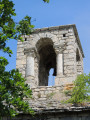
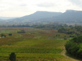
(3) Turn right onto a track, then take a gully-like path on the left which leads to a vineyard. Continue along the path as it climbs, until you reach the Chapel of Sainte-Madeleine.
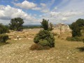
(4) Carry on along the path, passing the ruined fort, and reach the entrance to the castle (free admission).
(5) Walk down the track; at the crossroads, turn right onto the path running beneath the track, and rejoin the track a little further on at another crossroads.
(6) Turn left onto the path above the track; it goes uphill at first, then downhill. Cross the track twice (always take the path opposite: yellow markings). You’ll reach the houses in Vénéjan.
(7) Turn right at the hairpin bend onto the road leading downhill and follow it. It turns into a track which joins a tarmac road.
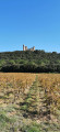
(8) Follow it to the right (lovely view of Jonquier Castle), and you’ll reach a Fork in the road.
(9) Turn right onto the road, then leave it 100 metres further on to take a sandy track on the left, which climbs and then descends back onto the road leading to the car park (S/E).
 Visorando Member
 Difficult


 Easy