Country:

 City:


Coming from Perpignan via the N116, with Lake Vinça on your right, turn left towards the village of Vinça. Follow signs for Valmanya. Signs for Baillestavy will then appear.
Park in the car park at the entrance to La Farga. There is also another car park a few metres further on, on the right, below the road. The village of Baillestavy itself is clearly visible on the right, higher up.
(S/E) Continue along the Carretera de Vinça (D13), heading south towards Valmanya. Stay on the hard shoulder.
Caution: motor traffic.
GR 36 Red and white markings
(1) T-junction. Village centre, town hall, café, village hall. Yellow markings. Turn right before the town hall towards a magnificent stone bridge spanning La Llentilla. Pass close to a fountain. Climb the pretty, steep, stony path leading up to Baillestavy, following theGR® 36 signposting.
GRP Red and yellow markings
(2) Fork in the road. Turn left onto the D13A towards Valmanya. Follow theGRP®, marked in red and yellow. Cross the Còrrec d’en Carbonell via the road bridge. Continue along the road for 350 m.
(3) Fork in the road. Turn right, heading uphill along Rue de Los Camp de la Creu. Leave the D13A. The road deteriorates and becomes a track. Continue due south along this track. Cross a stream. The path now climbs, with the D13 to your left below. Pass the Còrrec de can Comes. Continue towards the road, but do not join it (742 m).
The route marked out on the ground does not correspond to the IGN map.
PR Yellow markings
(4) Fork in the path. Turn right onto a path that climbs again. Leave the GRP® markings.
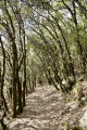
Yellow markings help you find your way through the forest. Pass a few steep sections.
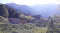
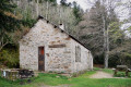
Emerge into a clear area with a fine view of Valmanya. Arrive at the Capella de Sant Vicenç, on your left, built on a small rocky outcrop. Continue along the path.
GR 36 Red and white markings
(5) Fork in the path. Turn left towards Valmanya. Follow the red and white markings ofthe GR®36.
See practical information (³).
You’ll arrive in the beautifully maintained village of Valmanya. There’s a fountain immediately on the left.
(6) Do not continue along Carrer de la Terrera through the village. Do not enter the village.
Turn right, heading uphill, along the wall of the church-cemetery on your right.
Opposite the entrance gate to the church-cemetery, head left up a wide path that is often overgrown with grass.
Follow theGR®36signposts carefully. Head uphill towards the D13D.
(7) Road junction. Take the road uphill for 1.2 km, following the red and white markings.
Caution: motor traffic.
Pass a renovated house (the former Mas Verjau) on your right. Very soon after crossing the stream, look out for a right-hand bend and continue uphill along theGR®36, which cuts across thefirst hairpin bend of the road.
Old, very sparse yellow markings
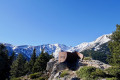
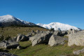
(8) Junction. At the second hairpin bend on the left, leave the road and turn right onto the wide track; there is a gate here. Leave theGR® 36. Please note: you are now in the protected area of the Canigou State Forest. Head up this track, which overlooks the road. Some scattered remnants of yellow markings may help. Continue past two barriers. The track emerges from the forest and makes a wide bend to the left. A magnificent view unfolds before you. In the distance lies the Canigó massif. You will now need to leave the track.
Recent yellow markings
(9) Junction of track and footpaths. Do not take the final bend to the right, but turn right instead, heading steeply uphill into the abandoned pasture. Brand-new yellow markings may be helpful. Climb straight ahead, north-east, in open country. After 300 m of steep ascent, the path turns 90° to the left, due west. Follow the yellow markings and the cairns I have placed. You’ll reach Prat Mitjà at around 1,300 m. Head towards a gap in the fence marked with a yellow sign indicating a left turn. Follow the correct path, which is clearly marked on the ground and signposted.
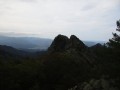
Pass beneath the Roc del Corbàs. Continue through the forest again along a lovely path that remains flat.
Alternative route:GR® 36, red and white markings
(10) Fork in the path. Turn right and then immediately left, taking theGR®36 alternative route, marked with recently repainted red and white markings.
Initially, the route as surveyed on the ground does not correspond to the IGN map.
Descend steadily, due north, through this cool forest. Ford the Còrrec de l’Avetosa.
You’ll reach the old Cortal de l’Orri (1,975 m). There are terraces, walls and building ruins.
The path branching off to the left on the IGN map is no longer visible.
Continue the descent along the forested spur, following the red and white markings.
You’ll reach Cortal de Rasilles (920 m). There’s a signpost and a ruined dwelling.
(11) Junction of three paths marked in red and white. Turn left towards Baillestavy via theGR®36. Descend more gently towards the Còrrec d’en Carbonell.
This area can be confusing for walkers as both theGR®36and theGR®36variant are marked in red and white.
(12) Junction of paths. Turn right onto a small path that descends steeply towards the Còrrec.
Leave the wide path on your left, which is blocked by a designated footbridge.
Cross the Còrrec. Head back up the opposite side along a wide track.
(13) Fork in the tracks. Go round the gate. Turn right onto the track, heading down towards the village of Baillestavy. The track becomes suitable for vehicles. Pass Mas Closa and some beautifully renovated houses.
Continue towards the church. Go round the church on the left. Then turn right onto the road. Return to the route you took on the way there. Head down the pretty, steep, stony path leading down to Baillestavy.
(1) Turn left onto the Carretera de Vinça (D13). Head for the car park (S/E).

 Visorando Member
 Moderate