Country:
 City:
City:


Parking is available at the Parc des 2 Rivières; enter via the D 94 before the bridge. There are few spaces, particularly in the afternoon. The car park closes at 9 pm in the summer.
(S/E) Head towards the outdoor sports facilities and walk along the Yerres on your left. Continue to the end of the park, past the Ferris wheel on the Yerres.
(1) Turn left to see the confluence of the Yerres and the Réveillon at the end of the terrace. Turn back.
(1) Take the footbridge over the Réveillon. Head towards Rue Raymond Poincarré and follow it to the left until you reach the traffic lights (you are now on thePR®62, marked in yellow). Then turn right to cross the road and take Rue du Clos des Abbesses (follow the white signs: Promenade du Réveillon).
(2) Turn left onto Rue du Réveillon. At a barrier, the street turns right and crosses the Réveillon. Leave the street immediately and follow a path to a footbridge. Take the footbridge to cross the Réveillon again.
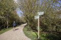
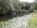
(3) As you come off the footbridge, turn right and walk alongside the river on your right-hand side. Stay in the woodland, either alongside the Réveillon or a short distance away, and ignore all paths branching off to the left. You will pass under a high-voltage power line several times. You will emerge onto Rue de Cercay; follow it to the right for a few dozen metres to cross the Réveillon at the pedestrian crossing.
(4) Turn left to cross the Réveillon again, then turn right to walk alongside it on your right-hand side. You’ll come out onto the D 253; follow it to the right for a few dozen metres and cross it at the pedestrian crossing.
(5) Turn left to cross the Réveillon, then turn right to walk alongside it on your right-hand side (small shaded square with a commemorative stele). Continue along the river through the meadow, then walk alongside a sports ground on your left. You’ll come out onto Rue du Réveillon; follow it to the right for a few dozen metres to cross the Réveillon at the pedestrian crossing.
(6) Turn left to cross the Réveillon, then right to continue along the river, keeping it on your right.
(7) At the junction, carry on straight ahead along the Réveillon (keeping to the right).
(8) When you reach the entrance to a housing estate, at a small square, turn right to follow the river. Pass under the bridge of an old railway line.
(9) Carry on straight ahead and pass under a railway bridge. Follow the river, pass under the N 19 bridge and reach a golf course. Carry on straight ahead and pass between the driving range (on the left) and the river (on the right). As you approach the houses, turn right into the meadow and walk alongside a vineyard on your left. Further on, you’ll reach a junction in the middle of a meadow.
(10) Carry on straight ahead, cross the Route de Brie and take the path to the right of the houses. Ignore thefirst path on the left between the houses.
(11) Take thesecond path on the left between the houses (leaving the river). Pass through a metal barrier and continue straight on along Rue des Vendangeurs. At the roundabout, take thefirst right. Then take thesecond right, onto Rue des Fouleurs.
(12) At the next junction, turn right. Immediately ignore a street on the left and carry on straight ahead until you reach Rue de la Mairie in Santeny.
(13) Turn right then left onto Rue de la Fontaine. At the next junction, continue along Grande Rue until you reach a bakery.
(14) Then take the passageway under the building on the right. At the end of the car park, turn right and walk alongside the Réveillon on your left. After about fifty metres, take a footbridge to cross the river (there’s a lovely park on the other side of the ditch).
(15) Turn left and follow the river upstream.
(16) Cross Avenue du Général Leclerc and continue along the path opposite. After a small pond, carry on with a field on your left and houses on your right. This path ends at a road.
(17) Turn left and head down the road, which ends at a car park. Turn right at the car park and you’ll immediately reach the bank of a pond (picnic tables).
(18) Walk round the three ponds in either direction (the route on the map follows an anti-clockwise direction).
(18) Return to the car park, turn left and head back up the road.
(17) Turn right onto the path. Follow the outward route in the opposite direction until you reach Avenue du Maréchal Leclerc.
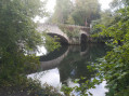
(16) Follow the avenue to the right and cross the Réveillon via a bridge flanked by a wall. Turn left at the junction.
(14) Follow the Grande Rue, then the Rue de la Fontaine. Follow the Rue de la Mairie to the right for a few metres.
(13) Turn left onto Rue du Réveillon.
(12) At the three-way junction you passed on the way there, veer right, keeping the long wall on your right. Follow Rue de la Fontaine Froide in this way until you reach the square (PR®, yellow markings).
(19) Then turn sharply left onto Route de Brie. Immediately afterwards, at the street lamp, head down a tree-lined path on the right.
(10) At the junction in the middle of the meadow, turn right. Further on, walk alongside the vineyard on your right, go under the N19 bridge and cross the golf course as on the way out (do not cross the Réveillon). Go under the railway bridge.
(9) As you emerge from the underpass, turn right onto a cycle path which climbs and joins another cycle path.
(20) Follow it to the left at an acute angle (you are on the embankment of a former railway line).
(21) At the first junction, take the path leading down to the right. Ride past an educational orchard on your right. The path joins the Réveillon: take the footbridge to cross it.
(7) Turn left as you come off the footbridge.
(6) Cross Rue du Réveillon at the pedestrian crossing and continue straight ahead (car park) along theGRP® (red and yellow markings). Walk alongside the river on your right.
(5) Cross the D 253 at the pedestrian crossing and continue straight on. Follow the Réveillon, keeping it on your right.
(4) Cross Rue de Cercay, follow it to the right to cross the Réveillon, then turn left and walk alongside the river on your left. Follow the outbound route in the opposite direction.
(3) Take the footbridge to cross the Réveillon, then turn right. Follow Rue du Réveillon.
(2) Turn right onto Rue du Clos des Abesses. Cross Rue Poincarré and follow it to the left. At the start of a left-hand bend, leave the street and turn right onto a path to cross the Réveillon one last time.
(1) Turn left as you come off the footbridge to quickly reach the car park (S/E).

 Visorando Member
 Moderate

 Easy
Easy 

 Local authority