Country:

 City:
City:



In Saint-Jean-Saverne, follow the signs for “Chapelle Saint-Michel” and head into the forest until you reach the car park by the roadside. It is also possible to start the walk from the Langenthal Cross, where there is also a car park.
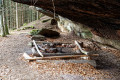
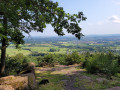
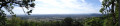
(S/E) From the car park, take the track that climbs up past the barrier to reach the Club Vosgien chalet area and the Chapelle Saint-Michel. Beautiful panoramic views over the countryside, Saverne and the Château du Haut-Barr.
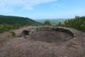
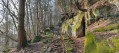
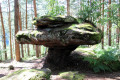
(1) After visiting the Rond des Sorcières behind the chapel, take the steps leading to the Grotte des Fées beneath the Rond des Sorcières, then continue down the path following the blue-white-blue Blue Rectangle markings until you reach a road.
(2) Head slightly to the right and turn immediately left onto the unmarked path for about 100 metres, which leads onto the Sentier Joseph Walter, marked with a Red Saltire. Continue to the footbridge.
(3) Cross the footbridge and follow the wide path to the right until you reach the junction.
(4) Ignore the ‘Red Saltire’ signpost to the left and continue down the slope to the clearing, then turn left until you reach the next junction.
(5) Turn right twice to reach the Schnackeplatz just above the eastern entrance to the TGV tunnel; with a bit of luck, there’ll be a train heading into the tunnel. Return to the junction.
(5) Head to the right and walk for about 800 m.
(6) Leave the road and turn left onto the forest path marked with a Red Ring. Ignore the paths branching off to the left and right and carry on to the next junction.
(7) Turn left and begin the climb towards the castle, following the ‘Yellow Ring’ markings. Almost all the ascent takes place here.
(8) At thefirst landing, slightly to the left, continue the climb, pass the next landing and reach the Rocher Daubenschlag.
(9) Head to the left and walk along the right-hand side of the rock; this is where you’ll find the entrance to the castle, as well as a rock resembling a gorilla’s head. After your visit, continue to the left, following the Yellow Ring markings, passing the Hühnerfelsen and arriving near the quarries.
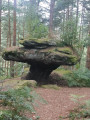
(10) Turn right towards the quarries (dating from the 12th century) and the Opferteller site (Offering Plateau). Continue following the Red Disc markings and rejoin the Yellow Ring path to the right.
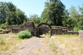
(11) Take the Blue Ring path on the left, pass the Kanzelfels and continue to the right. Follow this path, keeping to the right-hand side, until you reach the gate of the oppidum.
(12) Head left onto the Chemin de la Heidenstadt, GR®531 Blue Rectangle, until you reach the Langenthal Cross junction.
(13) Continue straight ahead along the tarmac road for about 800 m until you reach the end of the bend.
(14) Take the path to the left (unmarked) and you’ll come to a forest track.
(15) Follow it to the right for about 400 m.
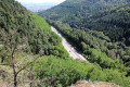
(16) Head left to reach the Rocher des Dames, which overlooks the A4 motorway at the Col de Saverne.
(17) Retrace your steps back to the junction.
(16) Turn right, heading in the opposite direction to the outward journey, onto the forest track marked ‘Red Ring’, and return to a junction you passed earlier.
(15) Turn right, following the route in the opposite direction to your outward journey, and head for the Club Vosgien shelter and the Mont Saint-Michel car park (S/E).

 Visorando Member