Around the Grands Communaux de Trept

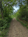
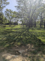
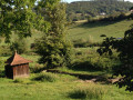
A pleasant route around the Grands Communaux de Trept, a typical landscape where limestone slabs outcrop and the Pierre de Dieu and the Pierre du Diable stand tall. Almost entirely shaded and presenting no difficulty.

Details

74350862
Creation:
Last update:
Last review:
  • Walking
    Activity: Walking
  • ↔
    Distance: 4.23 mi
  • ◔
    Average duration: 2h 20 
  • ▲
    Difficulty: Easy

  • ⚐
    Back to start: Yes
  • ↗
    Ascent: + 456 ft
  • ↘
    Descent: - 456 ft

  • ▲
    Highest point: 1,306 ft
  • ▼
    Lowest point: 1,047 ft

Photos

Description of the walk

In Trept, take Rue des Grandes Roches. After the last houses, follow the path on the left leading to the car park, where there is a shaded picnic area with tables. This route is based on a Secirely trail. It is marked in red, but some signposts are missing. Recommended direction: clockwise. 

(S/E) Head back towards the village and turn right onto Rue des Grandes Roches until you reach the junction after the first few houses. 

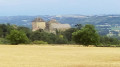
(1) Turn right onto Chemin du Château d’eau. You’ll reach one of the old slate quarries, now abandoned, and continue on to Impasse de Bange, near the Route de Crémieu (D517): fromhere you can see much of the hills surrounding the town of Bourgoin-Jallieu.

(2) Turn right, then carry on straight ahead to follow the dirt track, which runs more or less parallel to the D517 and leads into a wood. On emerging from the woods, you’ll reach a junction with a view of the Saint-Hilaire Gare roundabout. This name has lost its original meaning, as the Eastern Railway Line (Lyon–Montalieu) has not carried passengers for many years and the old station is therefore disused.

(3) Continue to the right and enter the woodland again. Keep going in the same direction, ignoring the adjacent paths, until you reach a fork situated about a hundred metres from the edge of the woodland and the road leading to Le Bourg. 

(4) Turn right onto the path that climbs up to the plateau: ignore the signposting at this point. You’ll reach a crossroads at the edge of the woodland, facing the Gagne limestone quarries. 

(5) Carry straight on through heathland, skirting the quarries on your left below. You’ll reach the Pierre du Diable: the Pierre de Dieu stands on your left, about a hundred metres away. 

(6) Continue straight on to return to the car park (S/E). 

Waypoints

  1. S/E : mi 0 - alt. 1,076 ft - Car park
  2. 1 : mi 0.22 - alt. 1,060 ft - Water Tower Path
  3. 2 : mi 0.89 - alt. 1,086 ft - Impasse de Bange, on the right
  4. 3 : mi 1.93 - alt. 1,047 ft - Crossroads
  5. 4 : mi 3.11 - alt. 1,115 ft - Turn right at the fork
  6. 5 : mi 3.58 - alt. 1,273 ft - Woodland edge, quarries
  7. 6 : mi 4.03 - alt. 1,270 ft - Devil’s Rock
  8. S/E : mi 4.23 - alt. 1,076 ft - Car park

Notes

Picnic tables near the car park.

Worth a visit

Discover a typical landscape where limestone slabs outcrop and the ‘Pierre du Bon Dieu’ and ‘Pierre du Diable’ stand tall, like strange sentinels, remnants of the Ice Age. Berry-bearing shrubs and low-growing flora, adapted to a thin layer of arid soil, thrive here. In spring, walkers come across lizards, grasshoppers and butterflies, and can spot the first lily of the valley, grasses, orchids, ferns, euphorbias and, of course, the red pasque flower – the emblem of this Sensitive Natural Area – a rare and protected plant, a wild anemone of a beautiful dark garnet colour.


Biodiversity through community action
It is a genuine collective effort centred on these communal lands that is enabling biodiversity to be restored! By designating 100 ha to the west of the village as a Sensitive Natural Area (ENS), local councillors have involved hunters (construction of hare warrens, maintenance of footpaths), naturalists from the ADPE and Lo Parvi (scientific monitoring, educational activities), a farmer (grazing, shrub clearance), quarry workers – who live near the site – and, of course, walkers.

Reviews and comments

4.3 / 5
Based on 2 reviews

Reliability of the description
4.5 / 5
Ease of following the route
4 / 5
Route interest
4.5 / 5
Waitukubuli
Waitukubuli

Overall rating : 4.7 / 5

Date of your route : Jun 13, 2025
Reliability of the description : ★★★★★ Very good
Ease of following the route : ★★★★★ Very good
Route interest : ★★★★☆ Good
Very busy route : No

A beautiful hike, mostly shaded with trails through woods and stone. Not very steep and not too long, accessible to many people.

Machine-translated

User 13328667

Overall rating : 4 / 5

Date of your route : May 21, 2025
Reliability of the description : ★★★★☆ Good
Ease of following the route : ★★★☆☆ Average
Route interest : ★★★★★ Very good
Very busy route : No

Hello,
Thank you for this discovery. Shady paths to explore again in the height of summer.
As is often the case, the place names mentioned in the description and on the map aren’t actually found along the route. We used Waze to find out the names. A few more signposts would be welcome.
On the other hand, the red markings are clearly visible and we even discovered some lovely painted ‘pansy stones’, which we naturally left in place, sheltered amongst the rocks.
Thank you for your help.
Kind regards.

Machine-translated

Other walks in the area

For more walks, use our search engine .

The GPS track and description are the property of this route's author. Please do not copy them without permission.