Country:

 City:


Park in the car park at Montagnieu Town Hall on the D17E.
The route starts on Chemin de Feydel at the far end of the car park, opposite the town hall.
(S/E) Set off to the left onto the small road (Chemin de Feydel). At thefirst junction, turn right, then immediately left. You’ll reach the Route de Virieu.
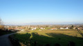
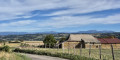
Walk about thirty metres to the right and cross the road with care. Take Chemin de Busserond opposite, following it whilst ignoring a path on the left, then two on the right. You’ll come to a wider path (Chemin du Latoud). Follow it to the right for a few metres and turn left. Walk through farmland, with views of Mont Blanc. After a 90° right-hand bend, you’ll reach a junction (signposted ‘Le Molard des Mottes’).
(2) Turn right and carry on straight ahead, passing two paths on your left. You’ll reach the Grand Fermin crossroads (two paths and a road) just after a bend in the road.
(3) Cross the road and carry on straight ahead along the path opposite. At the junction of the paths, carry on straight ahead. You’ll reach the Route de Virieu. Cross the road carefully and follow the path opposite. Join the Route de Tribouillon and follow it to the right. Carry on to the entrance to the village and proceed to the crossroads marked by a cross.
(4) Turn right (cross on your left) and carry on straight ahead along Impasse de Tribouillon. After a short descent and a short climb to cross the Molles stream, you’ll reach a crossroads.
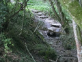
(5) Turn left onto a small tarmac track. At the left-hand bend, turn right and follow the grassy path which descends gently, with a slight camber at the start. The descent becomes steeper, then the climb is even steeper. You’ll arrive in Feydel.
(6) Turn right onto the Feydel path and continue straight on to the town hall (S/E).

 Visorando Member



 Moderate