Around Larnas

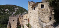
Larnas is situated on the eastern edge of the Saint-Remèze plateau, at an altitude of 300 m. The village is crossed by the River Nègue and is overlooked by the Dent de Rez (719 m).

Details

18386770
Creation:
Last update:
Last review:
  • Walking
    Activity: Walking
  • ↔
    Distance: 7.39 mi
  • ◔
    Average duration: 4h 00 
  • ▲
    Difficulty: Moderate

  • ⚐
    Back to start: Yes
  • ↗
    Ascent: + 669 ft
  • ↘
    Descent: - 666 ft

  • ▲
    Highest point: 1,168 ft
  • ▼
    Lowest point: 719 ft

Photos

Description of the walk

Park in the car park behind the town hall and the Larnas tourist office.

(S/E) From the car park, head towards the road, turn left and walk past the town hall and the tourist office, following thePR® signposts (white and yellow). Take the Route d’Ellieux, walk past the church and head uphill to the start of the Chemin de l’Oratoire, beneath the power line.

(1) Turn right onto the Chemin de l’Oratoire and follow thePR® signposts. When you reach a Fork in the road, continue to the left, still following thePR® signposts, until you come to another Fork in the road.

(2) Turn left towards Viviers (9.3 km), following thePR® signposts. The path descends along the bottom of the valley on the right-hand side and joins a road after crossing the Ruisseau d’Ellieux.

(3) Turn left onto the tarmac road, still following thePR® signposts. Walk past a farm and continue straight on. Pass under the power lines and reach the start of a cul-de-sac on the left.

(4) Continue straight on along the path as it enters the woodland, still following thePR® signposts.
At the end of the path, join a track beneath the power line and take it to the left until you reach a fork.

(5) Turn left onto the track towards Saint-Thomé and Larnas, still following thePR® markings. Stay on this track until you reach the junction with a wayside cross.

(6) Follow the tarmac road to the left for about 100 m, then take the path leading uphill to the right (MTB track 2). At the lavender field, carry on straight ahead, ignoring the paths to the right and left. Continue straight on, following the MTB markings.

(7) Turn right onto the path leading uphill, following thePR® signposting (you can also go straight on and rejoin the route further on). Join the tarmac road and turn left. Pass in front of the field of lavender and oak trees. At the fork in the road, turn right onto the track (Chemin des Buissières). Continue straight on along the main track, ignoring the turn-offs to the right.

(8) Turn left into the lane lined with dry-stone walls. Carry straight on along this path until you reach the junction with the D262. Cross the road (take care).

(9) Head towards Bas Rocher, 0.4 km to Larnas. Follow the path on the left, following thePR® signposts. Continue to the Bas Rocher signpost. Turn left towards Larnas.

(10) Underneath the power lines, take the path on the left towards Larnas (0.7 km). Remember to close the gate for the grazing animals. Join the tarmac road heading northwards. When you reach the crossroads, turn left onto Rue du Village. Opposite the town hall and the tourist office, turn left then right to reach the car park (S/E).


Waypoints

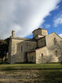
  1. S/E : mi 0 - alt. 1,004 ft - Town Hall car park. Towards the - Église Saint-Pierre (Larnas)
  2. 1 : mi 0.41 - alt. 1,102 ft - Chemin de l’Oratoire
  3. 2 : mi 1.13 - alt. 932 ft - Sainte-Beaume Wood. Path towards the - Grotte de la Sainte-Beaume (Saint-Montan)
  4. 3 : mi 1.45 - alt. 719 ft - Hunting lodge
  5. 4 : mi 2.22 - alt. 873 ft - Postbox 392. Dead end
  6. 5 : mi 2.96 - alt. 1,132 ft - Gandaubert signpost
  7. 6 : mi 4.24 - alt. 1,079 ft - Calvary. Overlooking the - Nègue (rivière) - Affluent de l'Escoutay
  8. 7 : mi 4.7 - alt. 1,112 ft - Path leading uphill to the right
  9. 8 : mi 5.46 - alt. 1,102 ft - Path. Dry-stone walls
  10. 9 : mi 6.34 - alt. 1,010 ft - D262. Near the - Fontaine des Buis
  11. 10 : mi 6.96 - alt. 1,109 ft - Signpost: La Peyrière
  12. S/E : mi 7.39 - alt. 1,004 ft - Town Hall car park

Notes

Make sure you take plenty of water with you.
Walking poles and walking shoes are recommended.

Worth a visit

Saint-Pierre Church (Larnas).
The village of Saint-Montan, a few kilometres away (south-east).

Always be cautious and plan ahead when you're outdoors. Visorando and the author of this route cannot be held responsible for any accidents occurring on this route.

The GR® and PR® markings are the intellectual property of the Fédération Française de Randonnée Pédestre.

Reviews and comments

4.6 / 5
Based on 3 reviews

Reliability of the description
4.7 / 5
Ease of following the route
5 / 5
Route interest
4 / 5
venterol50
venterol50

Overall rating : 5 / 5

Date of your route : Jun 15, 2026
Reliability of the description : ★★★★★ Very good
Ease of following the route : ★★★★★ Very good
Route interest : ★★★★★ Very good
Very busy route : Yes

We went for a walk in lovely sunshine and a gentle breeze – just right!
And in June, we got to enjoy the lavender fields – they’re beautiful and smell lovely!

Machine-translated

GjRobert
GjRobert

Overall rating : 4.3 / 5

Date of your route : Jan 14, 2025
Reliability of the description : ★★★★★ Very good
Ease of following the route : ★★★★★ Very good
Route interest : ★★★☆☆ Average
Very busy route : No

More of a challenge, a provocation to stand up to the wind…
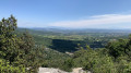
A good walk nonetheless, with lovely views, plenty of woodland and some rather gruelling DFCI tracks. Especially with a wind strong enough to knock the wind out of a bull. (Who, no doubt, being more astute than us, stayed sheltered that day!) A power line we crossed four times (a double high-voltage power line) whistled unpleasantly in our ears because of the wind all along the way. But then again, these minor annoyances mean we’ll have to reschedule this hike, which, without the 60 km of wind, must be thoroughly enjoyable.
So, one to do again – and for those with strong legs…
Thank you.

Machine-translated

yrené
yrené

Overall rating : 4.3 / 5

Date of your route : Feb 20, 2024
Reliability of the description : ★★★★☆ Good
Ease of following the route : ★★★★★ Very good
Route interest : ★★★★☆ Good
Very busy route : No

A good route that isn’t too difficult

Machine-translated

Other walks in the area

For more walks, use our search engine .

The GPS track and description are the property of this route's author. Please do not copy them without permission.