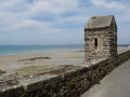
Around the Bosq Valley from Anctoville-sur-Boscq

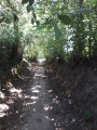
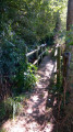
A lovely walk along the sunken, shaded paths around Le Bosq.

Details

n°40586772
Creation:
Last update:
Last review:
  • Walking
    Activity: Walking
  • ↔
    Distance: 5.14 mi
  • ◔
    Average duration: 2h 30 
  • ▲
    Difficulty: Easy

  • ⚐
    Back to start: Yes
  • ↗
    Ascent: + 167 ft
  • ↘
    Descent: - 177 ft

  • ▲
    Highest point: 217 ft
  • ▼
    Lowest point: 82 ft

Photos

Description of the walk

Start at the town hall square in Anctoville-sur-Boscq.

(S/E) Head towards the church and turn right.

(1) After the bend, take the path on the right, Chemin des Grandes Landes, and follow it to the end.

(2) Turn right and carry on. Go under the railway bridge and follow the track down to the Route du Vieux Val. Cross the road and carry on straight ahead until you reach a road on the right.

(3) Follow this road all the way along. It then turns into a track, which you should follow to the crossroads (Les Essaix).

(4) Turn left and follow the small road uphill to the crossroads.

(5) Cross the road and carry on along the road opposite. After the farm buildings, take the track on the right, cross a small road and carry on to the farm, then arrive at the Croix d’Any crossroads (marked by a wayside cross).

(6) Turn right and follow the D314 until you reach a house.

(7) Take the track on the left and follow it to the road at the end of the track.

(8) Turn right onto this road and carry on to the Moulin du Boscq.
Turn left at the old mill, cross the bridge over the Boscq and continue for about 100 metres.

(9) Turn right onto Chemin de la Duponterie and carry on until you reach a crossroads.

(10) Take the path on the right, Chemin des Croutes, to the next junction.

(11) Carry on along the path branching off to the left and follow it up to the next crossroads: (a sign reads “Chemin du Manoir”.

(12) Turn right onto this path and follow it up to the entrance to the manor house, then turn right to return to the starting point (S/E).

Waypoints

  1. S/E : mi 0 - alt. 164 ft - Town Hall Square, Anctoville-sur-Boscq
  2. 1 : mi 0.12 - alt. 180 ft - Chemin des Grandes Landes
  3. 2 : mi 0.47 - alt. 213 ft - Junction
  4. 3 : mi 1.34 - alt. 102 ft - Turn right
  5. 4 : mi 1.82 - alt. 105 ft - Crossroads
  6. 5 : mi 1.99 - alt. 141 ft - Crossroads
  7. 6 : mi 3.03 - alt. 194 ft - Calvary
  8. 7 : mi 3.57 - alt. 167 ft - House
  9. 8 : mi 3.83 - alt. 121 ft - Road junction
  10. 9 : mi 4.05 - alt. 95 ft - Path on the right
  11. 10 : mi 4.31 - alt. 115 ft - Crossroads
  12. 11 : mi 4.68 - alt. 98 ft - Crossroads
  13. 12 : mi 4.85 - alt. 128 ft - Crossroads
  14. S/E : mi 5.14 - alt. 164 ft - Town Hall Square, Anctoville-sur-Boscq

Notes

Start at the Town Hall square. (Toilets in the courtyard).

For a short walk, go from point (4) to point (11).

Worth a visit

Nearby:
Granville: the old town and ramparts, the harbour.
Donville: Dior garden and museum.

Reviews and comments

4.7 / 5
Based on 1 review

Reliability of the description
5 / 5
Ease of following the route
5 / 5
Route interest
4 / 5
brice.dorval.duteil
brice.dorval.duteil

Overall rating : 4.7 / 5

Date of your route : Aug 02, 2024
Reliability of the description : ★★★★★ Very good
Ease of following the route : ★★★★★ Very good
Route interest : ★★★★☆ Good
Very busy route : No

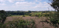
A lovely countryside walk through the bocage

Machine-translated

Other walks in the area

For more walks, use our search engine .

The GPS track and description are the property of this route's author. Please do not copy them without permission.