Around Chassiers

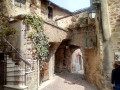
A very straightforward and simple route around Chassiers, with some lovely views of the village and the surrounding area.

Details

54028813
Creation:
Last update:
Last review:
  • Walking
    Activity: Walking
  • ↔
    Distance: 4.52 mi
  • ◔
    Average duration: 2h 40 
  • ▲
    Difficulty: Easy

  • ⚐
    Back to start: Yes
  • ↗
    Ascent: + 689 ft
  • ↘
    Descent: - 692 ft

  • ▲
    Highest point: 1,627 ft
  • ▼
    Lowest point: 902 ft

Description of the walk

Start from the small car park next to Chassier church, Ruelle Adrienne Bressac.

(S/E) Take the path uphill towards the school, following the yellow and whitePR® markings.

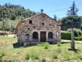
(1) At the crossroads, turn right towards the Chapelle Saint-Joseph. At the three-way junction that follows, leave the château-town hall on your right and continue to the left. Then head straight on, leaving the village behind, until you reach a fork at the edge of the woods with the Chapelle Saint-Joseph.

(2) Keep to the right towards Les Combes and continue uphill until you reach a three-way junction with a path branching off to the right.

(3) Leave the road and take the path running alongside it to the right. Continue uphill and enjoy the successive views to the left and right until you reach a road (Impasse des Combes).

(4) Turn right. There’s a lovely view of Taurier to the west and, a little further on, of the Chassiers valley. Pass through the hamlet and head into the forest. At the four-way junction, turn right and reach thesecond three-way junction, still following the yellow and white markings.

(5) Leave the yellow and whitePR® markings to take the path down to the right and reach the edge of the woodland.

(6) The unmarked section is now over. Carry on to the left, then walk alongside the vineyards on your right and continue to the left, following the yellow and white markings.

(7) When you reach the road, turn right and continue down the slope. At the next junction, turn right again and follow the road until you reach the start of aGR®-marked path leading uphill to the right.

(8) This path is difficult to walk on, so carry on along the road for a few dozen metres and take the sunken path that descends to the left, just after thefirst houses. At the bottom, when you reach the road, turn left and then immediately right onto the small road that climbs gently, with a field on your right. Cross a woodland and reach the edge.

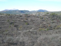
(9) As you emerge from the woodland, you’ll be met with a beautiful, unobstructed view. Turn right and walk alongside the vineyard. After the small house, take the forest track that leads downhill.

(10) Once you’ve completed the descent through the woods and reached the road, carry on straight ahead and quickly turn right onto the sunken track that leads downhill.

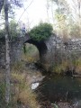
(11) At the lowest point of the walk, on the small bridge spanning the river, begin the climb back up towards Chassiers and carry on straight ahead, following the signposts. Reach the village and head for the church (S/E).


Waypoints

  1. S/E : mi 0 - alt. 1,148 ft - Car park - Église Saint-Hilaire (Chassiers)
  2. 1 : mi 0.03 - alt. 1,168 ft - Option to head towards the Ligne valley
  3. 2 : mi 0.63 - alt. 1,348 ft - Chapelle Saint-Joseph (Chassiers)
  4. 3 : mi 0.87 - alt. 1,421 ft - Junction on the path
  5. 4 : mi 1.06 - alt. 1,549 ft - Les Combes
  6. 5 : mi 1.61 - alt. 1,581 ft - End of signposting
  7. 6 : mi 1.97 - alt. 1,355 ft - The signposting resumes
  8. 7 : mi 2.2 - alt. 1,280 ft - Return via the road
  9. 8 : mi 2.74 - alt. 1,112 ft - Marked path to be avoided
  10. 9 : mi 3.38 - alt. 1,056 ft - Viewpoint
  11. 10 : mi 3.79 - alt. 984 ft - Entrance to the sunken path
  12. 11 : mi 3.97 - alt. 902 ft - Small bridge
  13. S/E : mi 4.52 - alt. 1,148 ft - Car park - Église Saint-Hilaire (Chassiers)

Notes

The car park at Chassiers is very small, but it shouldn’t be too difficult to find a space if you drive a little further away.

You can extend the walk by starting on theGR® trail which follows the Ligne (river). To do this, as soon as you set off, carry on straight ahead as you leave Chassier instead of turning right.

You can also park near (1).

Worth a visit

Please note that the bar in Chassiers is open from Thursday to Sunday in the late afternoon.

Always be cautious and plan ahead when you're outdoors. Visorando and the author of this route cannot be held responsible for any accidents occurring on this route.

The GR® and PR® markings are the intellectual property of the Fédération Française de Randonnée Pédestre.

Reviews and comments

3.7 / 5
Based on 4 reviews

Reliability of the description
3.8 / 5
Ease of following the route
3.5 / 5
Route interest
3.8 / 5
goldorak74
goldorak74

Overall rating : 4.3 / 5

Date of your route : Oct 11, 2025
Reliability of the description : ★★★★★ Very good
Ease of following the route : ★★★★☆ Good
Route interest : ★★★★☆ Good
Very busy route : No

A pleasant little walk above Chassiers. Alternating between forest and more open areas.
The trail is well marked.

Machine-translated

denisvallee
denisvallee

Overall rating : 3.3 / 5

Date of your route : Jun 05, 2025
Reliability of the description : ★★★☆☆ Average
Ease of following the route : ★★★☆☆ Average
Route interest : ★★★★☆ Good
Very busy route : No

Nice, but the route is not easy to follow (logging in the forest has destroyed the signs, there are no signs at times, etc.).
It's better to visit the beautiful village first and then extend the hike by starting on the white-yellow signposting that leads to Les Fourniols (start at the school car park) and climb up to the now non-existent ruins of the ruined chapel of Saint Joseph before taking the path leading to the combes.

Machine-translated

zaviou
zaviou

Overall rating : 4 / 5

Date of your route : May 19, 2025
Reliability of the description : ★★★★☆ Good
Ease of following the route : ★★★★☆ Good
Route interest : ★★★★☆ Good
Very busy route : No

A lovely walk this spring. Very picturesque spots, with a magnificent stream leading to a wash house. The scents of this season were enchanting
The route alternates with drier scenery higher up. We finished in the village, which had a very medieval feel to it – it was a lovely surprise.

Machine-translated

mdre
mdre

Overall rating : 3 / 5

Date of your route : Jul 15, 2024
Reliability of the description : ★★★☆☆ Average
Ease of following the route : ★★★☆☆ Average
Route interest : ★★★☆☆ Average
Very busy route : No

A short walk that’s rather poorly described; you’ll need to follow the trail

Machine-translated

Other walks in the area

For more walks, use our search engine .

The GPS track and description are the property of this route's author. Please do not copy them without permission.