Around Bera

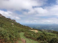
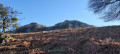
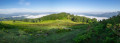
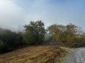
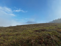
A ridge route above the town of Bera, taking you from the Col de Lizuniaga, on the French-Spanish border, to Bera.

The Haute Route des Pyrénées is not yet very high at this point.

Details

n°93113378
Creation:
Last update:
Last review:
–
  • Walking
    Activity: Walking
  • ↔
    Distance: 4.54 mi
  • ◔
    Average duration: 2h 50 
  • ▲
    Difficulty: Easy

  • ⚐
    Back to start: No
  • ↗
    Ascent: + 810 ft
  • ↘
    Descent: - 1,401 ft

  • ▲
    Highest point: 1,276 ft
  • ▼
    Lowest point: 138 ft

Photos

Description of the walk

The starting point is at the Col de Lizuniaga, on the road from Sare to Bera.

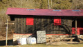
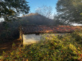
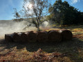
(S) Cross the road carefully heading south-west to walk alongside a row of pidgeon hunting huts.

(1) At the top of the row of pidgeon hunting huts, turn right to stay on the Haute Route des Pyrénées (HRP).

(2) Continue to the left, heading south on the HRP, which winds its way up the hillside.

(3) Carry on along the HRP, which turns right to reach the Col Idoia (Idoiko Lepoa in Basque).

(4) Take the path opposite that climbs up the ridge. Follow the ridge to the Col de Meaka (Meakako Lepoa in Basque).

(5) Continue along the ridge on the HRP to the summit of Larrate (Larrate Gaina in Basque).

(6) Turn right to descend north-west, still on the HRP, until you reach a road.

(7) Take the path on the left as you leave the tarmac road.

(8) Head straight ahead northwards to reach the car park (E)

Waypoints

  1. S : mi 0 - alt. 741 ft - Lizuniaga Pass
  2. 1 : mi 0.86 - alt. 1,020 ft - Haute Route des Pyrénées
  3. 2 : mi 1.17 - alt. 1,017 ft - Leave the HRP
  4. 3 : mi 1.43 - alt. 1,040 ft - Return to the HRP
  5. 4 : mi 1.86 - alt. 902 ft - Col - Idoiko Lepoa
  6. 5 : mi 2.68 - alt. 1,093 ft - Col - Meakako Lepoa
  7. 6 : mi 3.02 - alt. 1,276 ft - Summit - Larrate Gaina
  8. 7 : mi 3.57 - alt. 679 ft - Path on the left
  9. 8 : mi 3.9 - alt. 390 ft - Route
  10. E : mi 4.54 - alt. 138 ft - Car park at the end of the walk

Notes

This walk is not circular, so you will need to arrange a return journey by leaving a car at the finish, which is close to the start by road.

The presence of pidgeon hunting huts indicates you should avoid visiting in October and November.

Other walks in the area

For more walks, use our search engine .

The GPS track and description are the property of this route's author. Please do not copy them without permission.