


 Country:
 City:


Start: The route starts at the car park at the foot of the Pfaffenstein
(S/E) A straight path leads from here southwards uphill to the foot of the rock. From there, the route climbs via the ‘Nadelöhr’ (Eye of the Needle) along a strenuous path.
Note: If you prefer an easier route, you can also opt for the gentler ascent to the right. However, the many stairs and steps of the ‘Nadelöhr’ are better suited to the ascent than the descent.
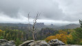
(1) Once at the top, after a short break, turn left at the junction, where a breathtaking view of the Gohrisch and the Papststein awaits. Back on the main path, carry on until you reach a junction on the right leading to the ‘Opferkessel’, a cauldron-shaped depression thought to have been formed during the last Ice Age. Here, another wonderful panorama unfolds.
(2) Back on the footpath, carry on to the right until you reach the inn on the Pfaffenstein with its viewing tower. There, you can take a leisurely break and enjoy the inn’s delicious food and drink.
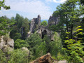
(3) Thanks to clear signposting towards the south, the path to the Barbarine is easy to find from this cosy resting spot. After numerous steps and a dark crevice, the view opens up towards the ‘Steinerne Jungfrau’.
(4) Now walk back towards the inn and then, at the first junction, turn left down the gorge path. Following the Malerweg, you’ll reach a junction at the edge of the forest.
(5) Here, turn right and head north back to the starting point. (S/E)
 Visorando Member
 Moderate

 Tourism professional

