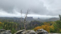
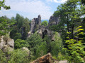
Up to the Großer Zschirnstein

From the car park in Kleingießhübel, the path soon leads out of the village into the forest and onto the quiet Alte Tetschener Straße. Along the way, peaceful sections alternate with unspoilt stretches until the Zschirnsteinweg finally leads up to the summit. At the top, a beautiful view and a small mountain hut await.

Details

n°110393117
Creation:
Last update:
–
Last review:
–
  • Walking
    Activity: Walking
  • ↔
    Distance: 5.79 mi
  • ◔
    Average duration: 3h 30 
  • ▲
    Difficulty: Easy

  • ⚐
    Back to start: Yes
  • ↗
    Ascent: + 958 ft
  • ↘
    Descent: - 958 ft

  • ▲
    Highest point: 1,818 ft
  • ▼
    Lowest point: 886 ft

Description of the walk

Start: Kleingießhübel car park

(S/E) From the car park in Kleingießhübel, we head left along the tarmac meadow path – which climbs steeply at first – out of the village and soon reach the woodland.

(1) We follow the meadow path straight ahead. The gradient eases off until, after 1.5 km, the track becomes steeper again as it approaches a large junction.

(2) Here, we continue straight on along the Alte Tetschener Straße, which now climbs gently, until, after a further 1.2 km, we reach the next major junction at a rest area called Kalkbude.

(3) On the Zschirnsteinweg, which branches off to the right here, the going gets increasingly worse as you go along. The 500-metre stretch that follows is washed out, apart from the coarse, loose gravel. Even though the terrain levels out again afterwards, there are still a number of short, steep sections with rocky slabs to negotiate on the way to the viewpoint. The summit offers a lovely view and a small mountain hut.

(4) We take the same route back. (S/E)

Waypoints

  1. S/E : mi 0 - alt. 886 ft - Kleingießhübel
  2. 1 : mi 0.12 - alt. 978 ft - Woodland, straight ahead
  3. 2 : mi 1.07 - alt. 1,296 ft - Carry on straight ahead at the junction
  4. 3 : mi 1.8 - alt. 1,368 ft - Kalkbude rest area, turn right
  5. 4 : mi 2.9 - alt. 1,762 ft - Zschirnstein
  6. S/E : mi 5.79 - alt. 886 ft - Kleingießhübel

Notes

Author: Saxon Switzerland Tourist Board

Other walks in the area

For more walks, use our search engine .

The GPS track and description are the property of this route's author. Please do not copy them without permission.