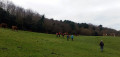
At the foot of Jaizkibel from Notre-Dame de Guadalupe

A round-trip route on the slopes of Jaizkibel, following the Way of St James, known locally as the “Camino del Norte”. The turning point for this route has been chosen to make for a walk of around two hours.

Details

n°9698016
Creation:
Last update:
Last review:
  • Walking
    Activity: Walking
  • ↔
    Distance: 4.21 mi
  • ◔
    Average duration: 2h 15 
  • ▲
    Difficulty: Easy

  • ⚐
    Back to start: Yes
  • ↗
    Ascent: + 377 ft
  • ↘
    Descent: - 367 ft

  • ▲
    Highest point: 883 ft
  • ▼
    Lowest point: 646 ft

Photos

Description of the walk

Head towards Hondarribia Airport. Pass the airport and turn left towards “Guadalupe”, which is on the climb up Jaizkibel. Just after the chapel, turn right and park in the large car park

(S/E) Leave the car park and head towards the T-junction. Cross the road, take the path opposite until you reach the first hairpin bend on the left.

(1) Ignore the path branching off to the right and take the path on the left that runs level with the road.

(2) Ignore the path going uphill to the right and continue straight ahead.

(3) Turn back and return via the same route to the car park (S/E).

Waypoints

  1. S/E : mi 0 - alt. 646 ft - Notre-Dame de Guadalupe car park
  2. 1 : mi 0.28 - alt. 705 ft - Hairpin bend to the left
  3. 2 : mi 1.48 - alt. 830 ft - Y-junction
  4. 3 : mi 2.07 - alt. 850 ft - Turn-back point
  5. S/E : mi 4.21 - alt. 646 ft - Notre-Dame de Guadalupe car park

Notes

There is a water point at the car park.

Reviews and comments

4.7 / 5
Based on 1 review

Reliability of the description
5 / 5
Ease of following the route
5 / 5
Route interest
4 / 5
maitej
maitej

Overall rating : 4.7 / 5

Date of your route : Aug 22, 2022
Reliability of the description : ★★★★★ Very good
Ease of following the route : ★★★★★ Very good
Route interest : ★★★★☆ Good
Very busy route : Yes

An easy walk with some lovely views

Machine-translated

Other walks in the area

For more walks, use our search engine .

The GPS track and description are the property of this route's author. Please do not copy them without permission.