Alpe Guimello and Alpe di Muggio

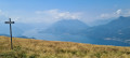
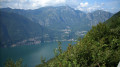
The path partly follows the Anello del Monte Muggio. It offers magnificent views of Lake Como, stretching from north to south along the arm ending at Como, as well as of Lake Lugano. Varied terrain: meadows, woodland and rocky sections. The route passes over the summit of Monte Muggio at 1,799 m.

Details

59628044
Creation:
Last update:
Last review:
  • Walking
    Activity: Walking
  • ↔
    Distance: 6.13 mi
  • ◔
    Average duration: 4h 20 
  • ▲
    Difficulty: Moderate

  • ⚐
    Back to start: Yes
  • ↗
    Ascent: + 1,729 ft
  • ↘
    Descent: - 1,719 ft

  • ▲
    Highest point: 5,840 ft
  • ▼
    Lowest point: 4,596 ft

Photos

Description of the walk

Park in the Alpe Giumello car park.

(S/E) Turn right onto the Anello del Monte Muggio road. Continue to the Alpe Chiaro junction.

(1) Turn right between the houses. Climb over the mountain pasture fence and continue to the edge of the forest. Follow the edge of the forest to the left, then enter it; further on, you’ll come to a crossroads by a stream.

(2) Take the path that climbs to the left. Follow this path until you reach the edge of another woodland at a four-way junction shaped like an X.

(3) A return trip to the summit is possible by turning left. Turn right, follow the edge of this woodland and then reach Monte Croce di Muggio (alt. 1799 m).

(4) Begin the descent opposite, heading south-east along the edge of the woodland, until you reach a multi-way junction.

(5) Turn left onto the Anello del Monte Muggio, enter the woods and descend, crossing several streams before reaching a church, the Chiesetta al Santo Ulderico.

(6) Head back up the left-hand path marked with yellow dots. Walk through the forest until you emerge at Alpe Dolca.

(7) Cross the clearing and pass through Alpe Dolco. Enter the woods again and emerge further on at Pra Boscino.

(8) Turn left and follow an easy climb to reach the Alpe Chiaro viewpoint, where there is a giant bench.

(9) Turn left at a 90° angle to return to the original junction at Alpe Chiaro.

(1) Turn right and follow the route you took on the way there in the opposite direction to return to the Alpe Giumello car park (S/E).

Waypoints

  1. S/E : mi 0 - alt. 5,059 ft - Alpe Giumello car park
  2. 1 : mi 0.46 - alt. 5,046 ft - Alpe Chiaro. Junction of the circular loop
  3. 2 : mi 0.7 - alt. 5,302 ft - Crossroads by the stream
  4. 3 : mi 1.14 - alt. 5,669 ft - X-shaped junction
  5. 4 : mi 1.46 - alt. 5,830 ft - Monte Croce di Muggio
  6. 5 : mi 2.07 - alt. 5,128 ft - Edge of the forest
  7. 6 : mi 3.33 - alt. 4,596 ft - Chiesetta al Santo Ulderico
  8. 7 : mi 4 - alt. 4,951 ft - Alpe Dolca
  9. 8 : mi 4.79 - alt. 4,944 ft - Pra Boscino
  10. 9 : mi 5.34 - alt. 4,961 ft - Alpe Chiaro viewpoint
  11. S/E : mi 6.13 - alt. 5,066 ft - Alpe Giumello car park

Notes

The path partly follows the Anello del Monte Muggio.
Please note: some rocky sections are fitted with chains, but they are not difficult.
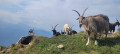
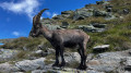
There are plenty of cows in the fields on the southern slope, as well as goats roaming freely at the summit.
(S/E) There are numerous restaurants, small chalets and a ski lift in winter.
(1) A water source is available at Alpe Chiaro.

Worth a visit

(4) Monte Croce dei Muggi: there is a hut here, and there may also be a few goats.
(6) Chiesetta al Santo Ulderico: a small church situated at 1,390 m.
(9) Alpe Chiaro viewpoint: go and see the large bench and enjoy the breathtaking view.

Reviews and comments

4.7 / 5
Based on 2 reviews

Reliability of the description
5 / 5
Ease of following the route
4.5 / 5
Route interest
4.5 / 5
Hugo38500
Hugo38500

Overall rating : 4.7 / 5

Date of your route : Aug 21, 2025
Reliability of the description : ★★★★★ Very good
Ease of following the route : ★★★★★ Very good
Route interest : ★★★★☆ Good
Very busy route : Yes

A beautiful, easy loop.
Beautiful views of Lake Como and the surrounding peaks.
Not crowded for August, chamois on the way back... and a nice bar/restaurant at the car park!

Machine-translated

ThierryG
ThierryG

Overall rating : 4.7 / 5

Date of your route : Sep 17, 2024
Reliability of the description : ★★★★★ Very good
Ease of following the route : ★★★★☆ Good
Route interest : ★★★★★ Very good
Very busy route : No

A walk with no technical difficulties, but interesting for the chance to explore the ‘Alps’ and enjoy panoramic views of the lakes. The turn-off between the houses at the start isn’t easy to spot.
Thank you for this lovely route

Machine-translated

Other walks in the area

For more walks, use our search engine .

The GPS track and description are the property of this route's author. Please do not copy them without permission.