


 Country:

 City:
City:


Park at Mas d’en Reig, in the stony car park located on the bend.
YellowPR® markings for routes nos. 11 and 12
(S/E) Cross the road towards the signpost and follow the sign for “Chapelle Notre-Dame de la Salette”. About fifty metres further on, at two ‘no entry’ signs, leave the road and turn right onto an uphill concrete track. You’ll briefly rejoin the tarmac before turning right onto a wide, very steep stony track. At a left-hand bend, leave this track for a narrower path starting on the right, marked by two large cairns – which are very useful as the signposting is poor here. You’ll soon reach the chapel and the orientation table, which is in need of repair.
(1) Resume the route, leaving the chapel on your left, pass a first wayside shrine and reach the flat, open area of the Coll d’Ullastre, where a second wayside shrine stands. Ignore the track branching off to the right and head straight on towards a small, rather unattractive building which marks the resumption of the signposted path. You’ll come out onto a tarmac road; follow it, keeping in the same direction.
(2) Keep to the right to follow the path which climbs up the ridge through a landscape of vineyards, where information boards featuring QR codes allow you to learn more about the different grape varieties.
(3) Continue along the ridge, ignoring a track branching off to the right. The climb continues with a few steep sections before joining the Route des Crêtes at a hairpin bend.
(4) Carry on straight ahead, slightly uphill, to reach the Coll dels Gascons: thePR® markings now follow the road, unlike the route shown on the IGN map.
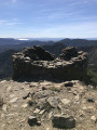
(5) Leave the road and take the narrow, well-marked path opposite and slightly to the left, which climbs steeply and very quickly reaches a junction marked by a signpost. Turn right, following the sign for “Tour Madeloc”, and follow the path, which climbs at times quite steeply, to reach Batterie 500.
(6) A military coastal defence structure built in 1886. Return to the Route des Crêtes and follow it, turning right. Continue until you reach the start of the first left-hand bend.
No signposting
(7) Be very careful to spot, on the right, the start of a path that is barely visible as it is very little used; it descends straight down the slope to rejoin the Route des Crêtes further down. Head right until you reach the bend where there is a small DFCI sign pointing towards La Galline.
(8) Ignore this track. Opposite, rejoin the path, which is just as hard to spot as at the start; it runs alongside the track several times before rejoining it at the Batterie de la Galline.
YellowPR® markings
(9) Turn right, negotiate several hairpin bends, then rejoin the tarmac road before reaching the hamlet of La Guineille. Navigate a hairpin bend to the left, with an ochre-coloured rendered house on your right, and continue for about twenty metres.
No markings
(10) Leave the road and head down a flight of steps to the right, leading to a concrete path which then gives way to a narrow track. Continue until you reach the road, which you’ll come to at an unusual signpost indicating the Tour Madeloc via a route called “Retour aux sources”, illustrated with a red-painted praying mantis. Follow the road to the right until you reach a sharp right-hand bend where there are several signs for the Véloroute de la Côte Vermeille.
(11) Turn left, leaving the tarmac, and you’ll immediately come to a junction with a road sign pointing towards Banyuls-sur-Mer. Head left, take a hairpin bend to the right and you’ll find yourself amidst the vineyards. Ignore the path on the left which heads straight towards the village of Cosprons; continue along the edge of the vineyard until the end, cross the causeway over the Rec de Cosprons, then head straight up to the D86a.
(1) Turn right and walk alongside the road, preferably using the right-hand verge to make the most of the gravel surface. You’ll reach a junction with a signposted path marked on both sides by a sign reading ‘Respect de la vigne’ (Respect the vineyards), urging walkers not to stray from the path.
(13) Head down to the right, then turn left once at the bottom to pass under the railway bridge.
No signposting
Continue on to reach the car park at the Paulilles site. Cross this lovely, tree-lined car park and follow the access road to the large roundabout on the D914. Turn left to walk alongside the D914, using the path protected by wooden safety barriers. Continue to the pedestrian crossing.
(14) Cross with extreme caution and head towards Bernardi Beach. Do not go all the way to the car park; instead, cut across past the seasonal restaurant to join the coastal path.
YellowPR® signposting
Turn right. Climb up to cross the small rocky headland where the remains of rather unattractive buildings stand, then descend a few very high and awkward log steps before crossing the metal footbridge over the Còrrec d’Oliva de Rama and reaching Anse de Paulilles. Walk along the beautiful beach on the boardwalk, cross a large, well-maintained area and then head straight on to leave the site.
(15) Turn left to walk alongside a concrete fence, pass the little cottages at Plage del Forat and continue along the partly tarmac-surfaced track until you reach the hairpin bend to the left (signpost).
(16) Take the path starting on the right, which soon runs along the coast at a higher level. At the junction, turn left and continue for about sixty metres.
(17) Take care not to miss the turn-off to the left marked by two yellow markers on the rocks on the ground: it is tempting to carry on straight ahead along the wide path. You’ll come to another junction.
(18) Turn left once more, follow the coast to reach the first Elmes beach, then the D914.
(19) Turn left, staying on the pavement. Walk past the second Les Elmes beach and head back up to the roundabout.
No signposting
Turn right towards the station, following Rue Georges Clémenceau. Navigate the left-hand bend, leaving Rue Waldeck Rousseau on your left, and continue to the next junction.
(20) Cross Rue Richelieu to take the steps opposite, continue along Rue du Maréchal Foch, then turn left onto Rue Saint-Pierre. Carry on straight ahead to reach Avenue de la République. Cross the road to reach the lovely beachfront promenade, lined with numerous cafés and ice-cream parlours. Continue to the roundabout.
(21) Turn right onto Avenue du Général de Gaulle and carry on until you reach the railway bridge. Go under it and turn right onto Avenue Guy Balpompe Male for a few metres.
YellowPR® signposts
(22) Cross at the pedestrian crossing to follow Rue Amiral Vilarem, pass the gendarmerie, then take the stairs on the left as indicated by the signposting. Walk straight up, past the tennis courts, and head for the car park (S/E).


 Visorando Member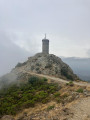
 Difficult


 Very difficult
