Country:
 City:


Park in the Musée Ampère car park, at the entrance to Poleymieux when approaching from Saint-Didier-au-Mont-d’Or. An electric vehicle charging point is available.
By bus, take line 84 (Vaise–Neuville): alight at the ‘Maison Ampère’ car park stop.
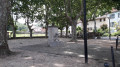
(S/E) Head to the Ampère Museum, a must-see: a QR code on the façade tells the story of the house where the Ampère family once lived. Why not take the opportunity to visit this world-renowned museum? Then head down towards the village in the direction of the town hall, following the Route d’Ampère: 200 metres on the right, you’ll find a stone building, the Maison de la Dîme (QR code and description opposite). Continue for about thirty metres until you reach the statue of André Marie Ampère on the left: there’s a QR code at the foot of the statue. Carry on to the primary school.
(1) Turn left onto Chemin du Cruy. After about 150 metres, as you come out of the bend, take the steps on the right (Marches du Cruy). Return to Chemin du Cruy and follow it to the right to reach Saint-Christophe Church.
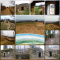
(2) Leave the main road and turn left onto the small flight of steps on Chemin de Planchamp. At the end of the path, by the statue of the Virgin and Child, head down to the right towards the Centre de Secours car park. Walk through the car park, past the building, then turn left onto Chemin des Ollages to reach the 21st-century drystone shelter: a project by the Polmepat Association, with a QR code detailing its history.
(3) Take the path uphill again to pass through a small picturesque neighbourhood and emerge onto Chemin de la Péronière. 50 metres on, look out for La Péronière with its porch: a QR code provides information about the site. Continue for a further 50 metres to reach the former Orsi restaurant, formerly known as Peytel: there is a QR code on the façade. Reach the three-way junction, take the left-hand track, then turn right onto Chemin de la Croix Rampau to pass in front of the Risler Tower.
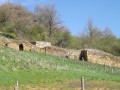
(4) Carry on straight ahead along Chemin de la Croix Rampau until you reach a drystone shelter: the ‘caborne des Grandes Oreilles’ with a QR code.
(5) Turn right onto the Chemin des Places to reach the Moulin d’Ampère: QR code. You can enjoy a breathtaking view, and perhaps a picnic spot, at the Croix Rampau by following the path to the left after the mill.
(6) Head back towards the Caborne des Grandes Oreilles.
(5) Turn right onto the Chemin de Rampau, signposted as a dead end. At the first junction, turn left onto the Chemin de la Cher, towards Le Rebat, whilst the Chemin des Carrières continues straight ahead. Pass the dead-end on the left, then take the small dirt track on the right to reach the Ermitage Saint-Antoine (QR Code) and, a little further on, the rouissoir (QR Code).
(7) Return to the Tour Risler.
(4) Turn right to follow the Chemin Pierre Marion, which winds up like a flight of steps. On this path, on your left, you’ll find information on the history of the 12th-century building: QR code. Walk round the building, passing the Tour Carrée (former church) on your right. Then turn left and follow the Route de l’Ancienne Église. Continue along the Montée des Chavannes.
(8) Turn right onto the Chemin de la Maby for about 300 m, then turn left at the three-way junction to follow the Chemin du Bouchat, which rejoins the Montée des Chavannes further on. Continue to the right.
(9) Opposite No. 279, turn left onto the Chemin du Martinet and return to the rear of the Ampère Museum and the car park (S/E).

 Visorando Member
 Moderate