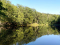
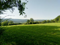
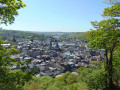
Exploring the Spa ski run

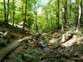
From Spa station, take the narrow streets to leave the town. You’ll walk alongside the Mambaye woods, following the Rau du Vieux Spa, to reach the very top of the ski run, where there’s a remarkable viewpoint. You’ll pass the Auberge de la Géronstère, where you can taste the sulphurous water from its spring. You’ll head back down along a stream towards the Mambaye estate and then return to Spa railway station, where you can enjoy a drink at the brasserie opposite the station.

Details

n°2111664
Creation:
Last update:
Last review:
  • Walking
    Activity: Walking
  • ↔
    Distance: 7.59 mi
  • ◔
    Average duration: 4h 30 
  • ▲
    Difficulty: Moderate

  • ⚐
    Back to start: Yes
  • ↗
    Ascent: + 1,194 ft
  • ↘
    Descent: - 1,175 ft

  • ▲
    Highest point: 1,765 ft
  • ▼
    Lowest point: 823 ft

Photos

Description of the walk

(S/E) From Spa railway station, take the street running alongside the railway line. Cross the N686.

(1) Take the steps onto the Chemin du Freueux. Continue to Avenue du Professeur Henijean.

(2) Turn left, then left again onto Chemin Bahychamps.

(3) At the fork, keep right onto the same path. Turn right towards Promenade de Walque.

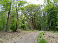
(4) First turn left then right to pass under the arbour. If you miss this point, don’t worry – the path rejoins the top of the arbour and you can pick it up again on the way back.

(5) Head down the path on the left at the ‘dead end’ sign.

(6) Carry on straight ahead.

(7) There’s a small viewpoint overlooking the Manbaye woods; at the wooden cross, take the small path on the left. Then continue along the stream.

(8) At the fork in the path by the rock, go straight on. Cross Avenue André Guillaume. Cross two ski runs. At the third one, turn left.

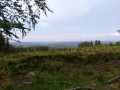
(9) At the top of the ski run, you can admire the view stretching across the whole of the northern Spa region as far as the Dutch border. Turn left, then right at the next junction. Cross Avenue André Guillaume again, then carry on straight ahead.

(10) At the red and white barrier on your left, just before the Auberge de la Géronstère, turn left onto a barely marked path.
Those wishing to see the source of the Géronstère should walk straight on for about thirty metres and go down the steps.

(11) At the bench on the left, take care as the path is barely marked; a little further on, it joins another, more visible path which you should follow to the right.

(12) Cross the small square on the Mambaye estate. Cross the Chemin de Mambaye and the Ruisseau du Vieux Spa.

(6) Follow the route back in the opposite direction to the way you came until you reach the junction with Chemin Bahychamps.

(3) Continue straight on along Rue de Barisart. Take care.

(13) Turn left at the red house, taking a small path and then some steps which will lead you back onto the path you took on the way there. Follow it in the opposite direction.

(2) Continue along Avenue du Professeur Henijean and Avenue Clémentine. Turn left after crossing the railway line via Rue vers la Chapelle and head towards the railway station (S/E).

Waypoints

  1. S/E : mi 0 - alt. 823 ft - Gare ferroviaire et arrêt de bus
  2. 1 : mi 0.31 - alt. 860 ft - Stairs on the path to Le Freueux
  3. 2 : mi 0.49 - alt. 912 ft - Junction used for both the outward and return journeys
  4. 3 : mi 0.81 - alt. 915 ft - Junction common to both the outward and return journeys
  5. 4 : mi 1.13 - alt. 1,050 ft - Junction shared by the outbound and return routes. Charmille
  6. 5 : mi 1.4 - alt. 1,135 ft - Take the path on the left (signposted ‘dead end’)
  7. 6 : mi 1.6 - alt. 1,063 ft - Junction for both outward and return journeys
  8. 7 : mi 1.84 - alt. 1,191 ft - Take the path to the left of the wooden cross.
  9. 8 : mi 2.53 - alt. 1,266 ft - Straight on to the rock
  10. 9 : mi 3.96 - alt. 1,765 ft - Ski slope – Remarkable viewpoint
  11. 10 : mi 4.81 - alt. 1,467 ft - Turn left after the metal barrier
  12. 11 : mi 5.44 - alt. 1,129 ft - To the left of the bench
  13. 12 : mi 5.76 - alt. 1,060 ft - Carry on straight ahead to the Domaine de Mambay
  14. 13 : mi 6.94 - alt. 883 ft - Turn left after the red house
  15. S/E : mi 7.59 - alt. 823 ft - Gare ferroviaire et arrêt de bus

Notes

(S/E) Take bus route 44 to Spa station, or drive to the car park opposite the station.
On this square, there is a small brasserie and a chip shop.

(10) You’ll pass the Auberge de la Géronstère, where you can have a drink or an ice cream.

Worth a visit

(9) Viewpoint above the ski run; if you have binoculars, you can see as far as the Dutch border.
You can also take a break on the chalet’s terrace, which is always open and has benches and tables.

(10) Sulphurous spring at La Géronstère

Reviews and comments

3.7 / 5
Based on 3 reviews

Reliability of the description
2.7 / 5
Ease of following the route
3.3 / 5
Route interest
5 / 5
Fazmataz
Fazmataz

Overall rating : 4.7 / 5

Date of your route : Feb 15, 2025
Reliability of the description : ★★★★☆ Good
Ease of following the route : ★★★★★ Very good
Route interest : ★★★★★ Very good
Very busy route : No

A lovely walk, with a thin layer of snow on the higher ground to boot.
We used the GPX file, so we can’t comment on the quality of the route description.

Machine-translated

Erpeno
Erpeno

Overall rating : 3.7 / 5

Date of your route : Aug 29, 2023
Reliability of the description : ★★★☆☆ Average
Ease of following the route : ★★★☆☆ Average
Route interest : ★★★★★ Very good
Very busy route : No

A superb walk. However, the route description is rather poor – certainly inadequate, and at times even leaving you unsure which way to go.

Machine-translated

ombrageux
ombrageux

Hello,
1) Given that you can’t follow the track on one side, it seems logical to follow the road that runs alongside the track.
2) Even if it changes name, it’s the same path, so we might as well follow it.
5) It can’t be a no-entry sign, as there’s only one exit and two houses on this path.
10) I’ve made the change; it’s possible that the barrier is less visible now than it was when I took the trouble to map this walk.

As for the vocabulary, given that it’s passed the moderators’ criteria, I assume they’re happy with it, and that’s all that matters to me.

Kind regards

Machine-translated

Roland Schenk
Roland Schenk

Overall rating : 2.7 / 5

Date of your route : Aug 12, 2022
Reliability of the description : ★☆☆☆☆ Very disappointing
Ease of following the route : ★★☆☆☆ Disappointing
Route interest : ★★★★★ Very good
Very busy route : No

Hello sir, I’m not usually one to criticise, but your itinerary is written as if for someone who knows the area.
Regarding the first point: at the station, whether you turn left or right, Chemin de Freueux isn’t easy to find (even locals don’t know where it is).
Secondly, at the fork in the road, follow the same path – as it happens, it changes name – so please give the name of the street instead.
At point 5, ‘Voie sans issue’ is actually a no-entry road.
At point 10, at the red barrier – ‘the forest is full of them’ – on a barely marked path; you tell me yourself, how far away is it? I’ve never found it.
Please do use simple and precise language.
For example, ‘at the rock, go straight on’ – the rock is just a large stone.
In the end, it took me longer to decipher your description than it did to walk the route.
A lovely walk, somewhat spoiled by all this.
Kind regards, Roland

Machine-translated

Other walks in the area

For more walks, use our search engine .

The GPS track and description are the property of this route's author. Please do not copy them without permission.