


No description
Gérardmer - Honneck-Sotré

This walk is part of a multi-day hike: Boucle de Gérardmer - Mini-trek 2jours
Details
Creation:
Last update:
-
 Activity: Walking
 -
 Distance: 12.06 mi
 -
 Average duration: 6h 35
 -
 Difficulty: Moderate
 -
-
 Back to start: No
 -
 Ascent: + 1,220 ft
 -
 Descent: - 2,782 ft
 -
-
 Highest point: 4,101 ft
 -
 Lowest point: 2,257 ft
-
 Country:
France
Country:
France
-
 Area: Vosges mountains
 -
 City:
La Bresse (88250)
City:
La Bresse (88250) -
 Start: N 48.035823° / E 6.945088°
 -
 End: N 48.083206° / E 6.9087°
 -
 IGN map(s): Ref. 3618OT, 3618OTR
 -


 Hour-by-hour weather
Description of the walk
Waypoints
- S : mi 0 - alt. 3,829 ft
- E : mi 12.06 - alt. 2,257 ft
Other walks in the area
From the Cabane des Champis to Lac de Blanchemer
 Visorando Member
  8.77 mi
+1,627 ft
-2,201 ft
5h 25
Moderate
Departure from La Bresse (Vosges)
8.77 mi
+1,627 ft
-2,201 ft
5h 25
Moderate
Departure from La Bresse (Vosges)
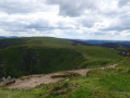
Starting from Les Champis, the route passes through the Marécage Rouge Feigne, the Col de Thiaville (alt. 1,112 m), the Hohneck (alt. 1,363 m) and the Col du Wormspel (alt. 1,277 m) before descending towards Lac de Blanchemer.
Tour around Lac de Lispach via Abri des Champis
Visorando Member 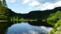 6.60 mi
+1,204 ft
-1,224 ft
4h 05
Moderate
Departure from La Bresse (Vosges)
6.60 mi
+1,204 ft
-1,224 ft
4h 05
Moderate
Departure from La Bresse (Vosges)
A circuit through the forest to reach a fine viewpoint above the Abri des Champis overlooking the Vologne valley (Moselotte valley) and the Bresse and Hohneck massifs. It's a very pleasant way to start off, along Lac de Lispach, to admire this ancient glacial valley. The trails are perfectly signposted for walking, mountain biking and snowshoeing in winter. In summer, the ridge is a flower-filled meadow.
Blanchemer Lake
Visorando Member 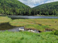 4.36 mi
+1,106 ft
-1,106 ft
3h 00
4.36 mi
+1,106 ft
-1,106 ft
3h 00
 Easy
Departure from La Bresse (Vosges)
Easy
Departure from La Bresse (Vosges)
Discover a charming little lake of glacial origin, dammed in 1959 to produce electricity. A route that combines beautiful scenery with learning about the power of water.
Tour of Lake Lispach
Visorando Member 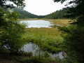 1.19 mi
+33 ft
-36 ft
0h 35
Easy
Departure from La Bresse (Vosges)
1.19 mi
+33 ft
-36 ft
0h 35
Easy
Departure from La Bresse (Vosges)
Walk around this mountain lake located at the foot of the ski slopes of a family resort. The floating bog, which covers part of the water's surface, offers magnificent views in a unique setting.
Three Vosges lakes from Lispach
Visorando Member 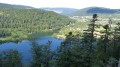 9.15 mi
+1,982 ft
-1,988 ft
5h 55
9.15 mi
+1,982 ft
-1,988 ft
5h 55
 Difficult
Departure from La Bresse (Vosges)
Difficult
Departure from La Bresse (Vosges)
In the Vosges forest, discover three lakes with very different surroundings, peat bogs and forest sections that can be quite technical at times.
⚠️ 27/05/2026: The Diehlaine trail between (9) and (S/E) is currently closed for safety works.If this trail reopens, please let us know in the comments section for this hike.
La Ténine via Lac de Lispach
Visorando Member 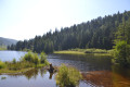 2.68 mi
+171 ft
-151 ft
1h 25
Easy
Departure from La Bresse (Vosges)
2.68 mi
+171 ft
-151 ft
1h 25
Easy
Departure from La Bresse (Vosges)
The route is a circular one that starts from the south car park of Lac de Lispach. It continues via Chemin de Mariron to join the educational trail that runs alongside the D34. Follow the D34 for about 100 m to reach Chemin de Ehlinger, then take the Collet de la Mine trail, which will take you to Lake Lispach. The walk around the lake with its educational panels is very pleasant.
The magic of Lake Lispach
Visorando Member 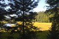 2.86 mi
+387 ft
-387 ft
1h 40
Easy
Departure from La Bresse (Vosges)
2.86 mi
+387 ft
-387 ft
1h 40
Easy
Departure from La Bresse (Vosges)
A magical little walk in the forest around the magnificent little Lac de Lispach, combined with a breathtaking view of Lac de Longemer and a short visit to the entrance of an old 16th-century copper mine.
Lac de Lispach and Rouge Feigne
Visorando Member 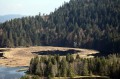 5.94 mi
+1,230 ft
-1,243 ft
3h 50
Difficult
Departure from La Bresse (Vosges)
5.94 mi
+1,230 ft
-1,243 ft
3h 50
Difficult
Departure from La Bresse (Vosges)
Starting from Lake Lispach, this hike will take you through a variety of landscapes. From the peat bogs bordering Lake Lispach, you’ll see the Vosges forest and even some stubble fields at Rouge Feigne at an altitude of over 1,100 metres. The return journey along the mountainside will convince you that the Vosges are not just mountains for cows... Please note: some sections are tricky, particularly for those prone to vertigo or in wet or icy conditions.
⚠️ 27/05/2026: The Diehlaine trail between (4) and (2) is currently closed for safety works.If this trail reopens, please do let us know in the comments section for this hike.
For more walks, use our search engine .
The GPS track and description are the property of this route's author. Please do not copy them without permission.

