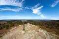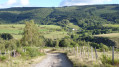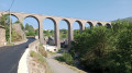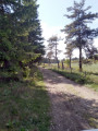
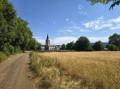
On the Causse de Montbel, between Montbel and Larzalier

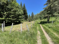
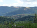
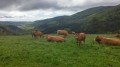
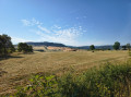
A walk through the fields of the Montbel plain, passing through the hamlet of Larzalier, the highest point on the railway line linking Mende to La Bastide and the famous Cévennes line.
Hiking on the Causse has the advantage of minimal elevation changes in this mountainous region.

Details

n°62274353
Creation:
Last update:
Last review:
  • Walking
    Activity: Walking
  • ↔
    Distance: 8.42 mi
  • ◔
    Average duration: 4h 15 
  • ▲
    Difficulty: Moderate

  • ⚐
    Back to start: Yes
  • ↗
    Ascent: + 417 ft
  • ↘
    Descent: - 423 ft

  • ▲
    Highest point: 4,055 ft
  • ▼
    Lowest point: 3,675 ft

Photos

Description of the walk

On the D6, there is a car park near Montbel Church.

(S) From Montbel church, head south along the path that runs alongside the cemetery on your left, towards the plain. Cross the first junction; then, about 300 metres further on, a path joins from the left, leading to another junction.

(1) Leave the return path on your left, take the path on the right and continue due west towards Chaufret. Stay on the edge of the woodland until you reach a junction with a wide track; cross it and continue to the next crossroads.

(2) Take the path on the left, which climbs slightly, and carry on until you reach the tarmac road.

(3) Cross the road and take the path opposite, which leads down towards the hamlet of La Prade. Walk through the hamlet and continue downhill to the railway line.

(4) Cross the level crossing (without barriers) and continue along the path. Cross a second level crossing and continue southwards across the Larzalier plain, ignoring the turnings to the left and right, towards the D27.

(5) Just before reaching the road, take the path on the left to reach the hamlet of Larzalier. It crosses the railway line again, then joins a path coming from the right (elevation 1135).

(6) Continue to the left, heading due north. Keep going in this direction until you reach a path branching off at a 90° angle to the right.

(7) Take this path, which climbs up to Larzalier, approaching the snow gallery. Cross the hamlet, keeping to the left. Follow the gallery (on your left) as far as the level crossing (with barriers).

(8) Cross the railway line and take the path on the right which moves away from the railway line and crosses the Montbel plain again, heading north-east, reaching a junction (elevation 1206) after a short stretch through woodland.

(9) Turn left, heading due north. Keep heading in this direction until you reach the junction you passed on the way there.

(1) Follow the path you took on the way there in the opposite direction to return to Montbel church and the car park (S/E).

Waypoints

  1. S/E : mi 0 - alt. 4,016 ft - Montbel Church – Car park
  2. 1 : mi 0.69 - alt. 3,950 ft - Junction marking the start of the circular route.
  3. 2 : mi 2.18 - alt. 3,950 ft - Crossroads
  4. 3 : mi 2.78 - alt. 4,042 ft - Crossing with a road
  5. 4 : mi 3.26 - alt. 3,835 ft - Level crossing
  6. 5 : mi 4.39 - alt. 3,698 ft - Junction just before the RD 27
  7. 6 : mi 4.86 - alt. 3,720 ft - Crossroads (elevation 1135)
  8. 7 : mi 5.28 - alt. 3,743 ft - Crossroads
  9. 8 : mi 6.06 - alt. 3,973 ft - Level crossing
  10. 9 : mi 7.16 - alt. 3,960 ft - Crossroads
  11. S/E : mi 8.42 - alt. 4,016 ft - Car park

Notes

A walk on flat ground with very little change in altitude, but with very little shade along the route. Make sure you bring protection from the sun and the heat in the height of summer.

Worth a visit

The railway line, known as the ‘Translozérienne’, connects the prefecture of Mende to La Bastide, where it joins the Cévennes line. It is the highest non-electrified railway line in France, and Larzalier is the line’s highest point, at an altitude of over 1,200 metres.

The great Larzalier tunnel, over 500 metres long, is an imposing structure designed to protect the line from snowdrifts, which were once common in winter and prevented trains from running.

The village of Allenc and its 11th-century church with its imposing bell tower.

Reviews and comments

5 / 5
Based on 1 review

Reliability of the description
5 / 5
Ease of following the route
5 / 5
Route interest
5 / 5
Ybxl
Ybxl
• Edited:

Overall rating : 5 / 5

Date of your route : Jul 10, 2026
Reliability of the description : ★★★★★ Very good
Ease of following the route : ★★★★★ Very good
Route interest : ★★★★★ Very good
Very busy route : No

A lovely, interesting walk offering a different perspective on the mountainous Cévennes. Some interesting terrain, in a more agricultural area. Starting from the church or the town hall. Lovely views over the plains. Half in the shade, half in the open. Altitude: 1,200 metres. I really enjoyed this walk. I was equipped with a Garmin Rando GPS, which meant I didn’t have to read the route description and avoided getting lost.

Machine-translated

Other walks in the area

For more walks, use our search engine .

The GPS track and description are the property of this route's author. Please do not copy them without permission.