


James Hamilton Heritage Park
For more info visit https://gillianswalks.com/2016/01/12/walk7/
Details
Creation:
Last update:
-
 Activity: Walking
 -
 Distance: 0.78 mi
 -
 Average duration: 0h 20
 -
 Difficulty: Easy
 -
-
 Back to start: Yes
 -
 Ascent: + 10 ft
 -
 Descent: - 10 ft
 -
-
 Highest point: 538 ft
 -
 Lowest point: 522 ft
-
 Country:
United Kingdom
Country:
United Kingdom
-
 City:
South Lanarkshire
City:
South Lanarkshire -
 Start/End: N 55.77733° / W 4.185938°
 -


 Hour-by-hour weather


Waypoints
- S/E : mi 0 - alt. 528 ft
- S/E : mi 0.78 - alt. 528 ft
Other walks in the area
Cleughearn Forestry, Whitelee Windfarm
 Tourism professional
 2.89 mi
+121 ft
-102 ft
1h 25
Easy
2.89 mi
+121 ft
-102 ft
1h 25
Easy
 Departure from South Lanarkshire
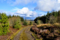
A pleasant walk around one of the quieter areas of forestry within the UK’s largest onshore windfarm. Starting at the parking area just off Ardochrig Road (near Strathaven), you soon find yourself on a mossy track through the trees. In this area it is possible to spot jay, bullfinch, merlin, peregrine, roe deer, and occasionally goldeneye ducks on the ponds.
Greggs, Parade, Drygate circuit
 Visorando Member2.38 mi
+79 ft
-85 ft
1h 10
Easy
Departure from Glasgow
Visorando Member2.38 mi
+79 ft
-85 ft
1h 10
Easy
Departure from Glasgow
An easy urban circuit around Dennistoun starting from Greggs on Duke Street. Along Alexandra Parade to the Royal then down towards Drygate. Back on to Duke street past the brewery to complete the circuit.
Lochgoin Circuit, Whitelee Windfarm
 7.87 mi
+276 ft
-276 ft
3h 50
Easy
Departure from East Renfrewshire
7.87 mi
+276 ft
-276 ft
3h 50
Easy
Departure from East Renfrewshire
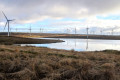
An easy 7 mile circuit around Whitelee Windfarm’s Lochgoin Reservoir. The route is way-marked meaning that navigation is simple and underfoot is a mixture of loose stones and grass. Look out for Dunwan Dam and take a detour to Blackwood Hill Viewpoint, from which on a clear day you will be able to see as far as the Isle of Arran and Ben Lomond.
Duncarnock Fort (The Craigie) from Neilston
 4.84 mi
+305 ft
-315 ft
2h 30
Easy
Departure from East Renfrewshire
4.84 mi
+305 ft
-315 ft
2h 30
Easy
Departure from East Renfrewshire
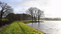
Duncarnock Fort (known locally as The Craigie) is a craggy hill (204 m / 669 ft) which stands invitingly on the banks of Glanderston Dam. Pausing on the summit of what was formerly an iron age fort, take a moment to wonder about it’s history and all that may have happened here many years ago! On a clear day, just as Mary Queen of Scots is rumoured to have done, you will enjoy panoramic views over greater Glasgow extending to the Campsies in the north.
River Clyde walkway from Cardies Bridge
 9.73 mi
+738 ft
-732 ft
5h 05
9.73 mi
+738 ft
-732 ft
5h 05
 Moderate
Departure from South Lanarkshire
Moderate
Departure from South Lanarkshire
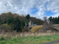
Walk part of River Clyde walkway from Cardies Bridge.
Loudoun Hill Circular
 1.93 mi
+335 ft
-341 ft
1h 10
1.93 mi
+335 ft
-341 ft
1h 10
 Difficult
Departure from East Ayrshire
Difficult
Departure from East Ayrshire
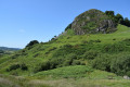
At just 361m elevation, the volcanic plug of Loudoun Hill near Darvel, is where Robert the Bruce had his first major military victory. Despite being small, it’s steep slopes certainly pack a punch and on a clear day the views from the top make it a must-do in the area. A favourite with children and adults alike!
Dismantled Railway, Darvel
 6.80 mi
+499 ft
-486 ft
3h 35
Easy
Departure from East Ayrshire
6.80 mi
+499 ft
-486 ft
3h 35
Easy
Departure from East Ayrshire
A linear walk from the village of Darvel along a fantastic disused railway track to the Spirit of Scotland Monument beneath Loudoun Hill.
Kelvin Walkway: Milngavie to Partick
 10.58 mi
+10 ft
-151 ft
4h 50
Moderate
Departure from East Dunbartonshire
10.58 mi
+10 ft
-151 ft
4h 50
Moderate
Departure from East Dunbartonshire
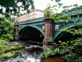
This 10 mile route along the River Kelvin feels surprisingly rural when walked from North to South, with the hustle and bustle of the city becoming more apparent the further along you go. Rather poorly way-marked for the first half, signage is then very easy to follow for the remainder of the route down to the Riverside Museum, where the Kelvin meets the Clyde.
For more walks, use our search engine .
The GPS track and description are the property of this route's author. Please do not copy them without permission.

