


Kilmarnock to Dundonald
For more info visit https://gillianswalks.com/2023/01/31/walk-221-kilmarnock-to-dundonald-6-5-miles/
Details
Creation:
Last update:
-
 Activity: Walking
-
 Distance: 6.38 mi
-
 Duration calculated by the app: 2h 39
-
 Difficulty: Easy
-
-
 Back to start: No
-
 Ascent: + 131 ft
-
 Descent: - 102 ft
-
-
 Highest point: 197 ft
-
 Lowest point: 85 ft
-
 Country:
United Kingdom
-
 City:
East Ayrshire
-
 Start: N 55.585643° / W 4.505701°
-
 End: N 55.577604° / W 4.595848°
-


 Hour-by-hour weather


Waypoints
- S : mi 0 - alt. 105 ft
- E : mi 6.38 - alt. 131 ft
Other walks in the area
Caprington Castle via Earlston, Kilmarnock
 Tourism professional
 3.67 mi
+56 ft
-56 ft
1h 45
Easy
Departure from East Ayrshire
This is a really pleasant walk on the outskirts of Kilmarnock. After crossing Caprington Golf Course past the historical ruin of Blacksyke Tower you will follow a former railway track bed across a field to reach the small hamlet of Earlston. The next stop is Caprington Castle and surrounding woodlands finishing with a wander through the residential part of Caprington.
Kilmarnock to Gatehead Circular
 5.30 mi
+115 ft
-115 ft
2h 30
Easy
Departure from East Ayrshire
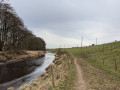
A peaceful walk following the River Irvine between Kilmarnock and Gatehead, returning via the beautiful Caprington Woods and castle.
Coodham Estate from Kilmarnock
 6.34 mi
+305 ft
-299 ft
3h 10
Easy
Departure from East Ayrshire
This route first crosses Caprington Golf Course and then makes use of paved roads and paths to reach the 95 acre Coodham Estate just outside Symington. Take time to explore the Estate’s many interesting features and paths including the lake, mansion, shrine and graveyard, before starting the walk back to Kilmarnock via the high road past Stafflar Farm.
Kay Park, Kilmarnock
 Association / Club / Walk leader0.65 mi
+30 ft
-30 ft
0h 20
Easy
Departure from East Ayrshire
This is an amenity park walk on tarmac surfaces with some gentle gradients.
Kay Park with Kilmarnock Water section
0.98 mi
+36 ft
-33 ft
0h 30
Easy
Departure from East Ayrshire
This is an amenity park walk on tarmac surfaces with some steeper gradients.
Knockentiber Circular
 2.53 mi
+36 ft
-36 ft
1h 10
Easy
Departure from North Ayshire
A pleasant short walk along quiet country roads and the cycle path, starting in the village of Knockentiber.
Knockentiber / Springside 7km Loop
 4.38 mi
+125 ft
-128 ft
2h 05
Easy
Departure from North Ayshire
A great walk between the Ayrshire villages of Knockentiber and Springside. The outward route follows the NCN73 Kilmarnock-Irvine cycle track into Springside and returns via the quiet Knockentiber Road. Lovely views from the highest points, including down into Crosshouse and over to the Isle of Arran.
Knockentiber / Springside 9km Loop
 5.69 mi
+95 ft
-98 ft
2h 40
Easy
Departure from North Ayshire
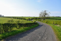
Starting in the village of Knockentiber, this route uses a small section of the NCN73 cycle track before heading out into open countryside, following quiet country roads onto the Overtoun Rd leading to Springside. The return is via the Knockentiber. Road - a single track road offering fine views down to Crosshouse and back towards the Isle of Arran on a clear day.
For more walks, use our search engine .
The GPS track and description are the property of this route's author. Please do not copy them without permission.

