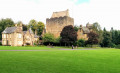
Caprington Castle via Earlston, Kilmarnock

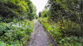
This is a really pleasant walk on the outskirts of Kilmarnock. After crossing Caprington Golf Course past the historical ruin of Blacksyke Tower you will follow a former railway track bed across a field to reach the small hamlet of Earlston. The next stop is Caprington Castle and surrounding woodlands finishing with a wander through the residential part of Caprington.

Details

n°23463147
Creation:
Last update:
Last review:
  • Walking
    Activity: Walking
  • ↔
    Distance: 3.67 mi
  • ◔
    Average duration: 1h 45 
  • ▲
    Difficulty: Easy

  • ⚐
    Back to start: Yes
  • ↗
    Ascent: + 56 ft
  • ↘
    Descent: - 56 ft

  • ▲
    Highest point: 128 ft
  • ▼
    Lowest point: 62 ft

Photos

Description of the walk

(S/E) Leave Caprington Golf Club car park towards the main entrance and turn right (South West) onto B7038/Ayr Road.

(1) Just before reaching Dewaldens Garden Centre look out for a lane on the right leading on to Caprington Golf Course. Go down the lane (North West).

Cross the golf course using the grassy footpath straight ahead, picking up a track between two hedgerows.

(2) Along this track you will pass the remains of Blacksyke Tower. Continue ahead (West) for another 200m to reach a fence with a stile leading onto a field.

(3) Cross the stile and follow the row of hedges on your right-hand side across the field, emerging onto a minor road.

Turn right (North West) to walk through the small hamlet of Earlston.

800m along the road you will reach a crossroads. Turn right (East) to walk towards a gated entrance into Caprington Woods.

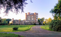
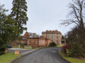
After going through the gate continue straight ahead (East) along a tree-lined driveway. Caprington Castle will soon come into view.

(4) In front of the castle you will be at another crossroads where you turn right (South East) to cross Todrigs Burn and follow road/track through the trees.

Stay on this road for 1km. There will be a field on your left-hand side and at the end of the field the road bends to the left before arriving at a bridge over the River Irvine.

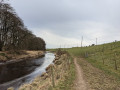
(5) You are not going to cross the bridge; instead look for a (often very muddy) path heading off to the right (East) alongside the river. Follow this, with the river on your left-hand side.

After 500m the path turns right to run parallel to the A71 along a pleasant pathway, emerging onto the corner of Maxholm Road/Fleming Street another 500m along.

Turn right (South) to walk along Maxholm Road.

(6) At the end of the street cross over Stonyhill Avenue then turn right (West). Almost immediately turn left (South) onto a lane which leads to Scargie Road.

At the end of Scargie Road cross over Cunningham Drive and pick up a lane at the other side which leads to Inchgotrick Road.

Turn right (South West) and walk to the end of Inchgotrick Road.

Turn right (North West) to a lane which leads to Caprington Golf Club car park (S/E)

Waypoints

  1. S/E : mi 0 - alt. 118 ft - Caprington Golf Club, Kilmarnock (KA1 4UW)
  2. 1 : mi 0.24 - alt. 112 ft - Lane next to Garden Centre
  3. 2 : mi 0.46 - alt. 118 ft - Remains of Blacksyke Tower.
  4. 3 : mi 0.62 - alt. 118 ft - Stile
  5. 4 : mi 1.78 - alt. 82 ft - Caprington Castle and Todrigs Burn
  6. 5 : mi 2.35 - alt. 72 ft - Bridge and footpath on right
  7. 6 : mi 3.21 - alt. 92 ft - Lane between Stonyhill Avenue and Scargie Road
  8. S/E : mi 3.67 - alt. 118 ft - Caprington Golf Club, Kilmarnock (KA1 4UW)

Notes

For more information, a walk review and option for extending the walk, visit Gillian's Walks

Transport
PLEASE AVOID USING THE CAR PARK AT CAPRINGTON GOLF CLUB IF IT IS BUSY. There is plenty of on-street parking available in nearby Caprington residential area, a short walk from the start of the route. It is also easily accessible by public transport with bus stops on the Ayr Road.

Terrain
This route involves some muddy trails and field edge “paths” as well as a stile and two kissing gates. There is also some pavement walking in a residential area. It is overall a fairly level walk. There can sometimes be livestock in the field.

Worth a visit

  • Dewaldens Garden Centre & Cafe
  • Sprockets Cycles
  • Caprington Golf Club - private golf club
  • Blacksyke Tower - a ruin on the golf course which used to be an engine house linked to the coal mining industry
  • Earlston - small hamlet just outside Kilmarnock. Todrigs Farm is close by, birthplace of Johnnie Walker. Also has links to the famous Eglinton Hunt with the kennels being located at the farm.
  • Caprington Castle & Estate - castle still occupied by the Cunninghame family. Lovely woodland walks on the Estate.
  • River Irvine
  • The Espresso Kart & Coffee Bar - near by

Reviews and comments

3 / 5
Based on 1 review

Reliability of the description
4 / 5
Ease of following the route
2 / 5
Route interest
3 / 5
User 13383747

You are correct it was that one . Sorry for posting the comment under the wrong walk. This would have been a better option for the walking group I had in mind.
Thanks

Gillian's Walks
Gillian's Walks

Hi Kenny,
Thanks for emailing me your route map, which shows me that we were talking about two different walks, hence my confusion about the wee bridge and the cows. I think the walk you did a version of was this one, Caprington and Gatehead - https://www.visorando.com/en/walk-kilmar....
I will continue our conversation via email since this thread is in relation to a different route in the area.
Thanks again for your feedback and also for your kind comments about Gillian's Walks :-)
Gillian

User 13383747

The very basic and dangerous footbridge is next to a pipe. The closed off crossing is at FB on the OS map just north of the river near the remains of an old railway enbankment which is on the OS map.
On the western most part of the walk immediately after crossing the road bridge there are rough steps down to the river, that section VERY overgrown.
PS Gillians Walks is excellent.
I will email you the route that I took.

Gillian's Walks
Gillian's Walks

Thank you for the feedback on this route, and sorry to hear that parts of it are overgrown at this point in late summer. It is indeed the case that there is sometimes cattle in the field beyond the metal stile (I presume that is where you mean, although you mention being near the river so perhaps you were in another field too at some point?), but I'm glad you were able to find an alternative route which you felt was safer. I'm afraid I cannot remember a very small footbridge anywhere on the route - whereabouts was that?

Thanks
Gillian

User 13383747

Overall rating : 3 / 5

Date of your route : Aug 31, 2026
Reliability of the description : ★★★★☆ Good
Ease of following the route : ★★☆☆☆ Disappointing
Route interest : ★★★☆☆ Average
Very busy route : No

I do not recommend this route!
Part of the way is over grown and not passable. The very small footbridge is permenantly blocked off because it is dangerous.
I managed to avoid both by taking detours which were not great but OK if you don't mind rough ground and are a reasonably fit hill walker not a Sunday stroller. The biggest problem for me was 3 bulls in the field near the river, so another slightly long detour was needed.
This was about a five mile walk, I would suggest a short 2 mile walk staying in the estate passing the castle.

Other walks in the area

For more walks, use our search engine .

The GPS track and description are the property of this route's author. Please do not copy them without permission.