


Ardrossan High Road
For more info visit https://gillianswalks.com/2023/03/20/ardrossan-high-road/
Details
Creation:
Last update:
-
 Activity: Walking
-
 Distance: 5.15 mi
-
 Average duration: 2h 40
-
 Difficulty: Easy
-
-
 Back to start: Yes
-
 Ascent: + 308 ft
-
 Descent: - 308 ft
-
-
 Highest point: 322 ft
-
 Lowest point: 3 ft
-
 Country:
United Kingdom
-
 City:
North Ayshire
-
 Start/End: N 55.668918° / W 4.84401°
-


 Hour-by-hour weather


Waypoints
- S/E : mi 0 - alt. 13 ft
- S/E : mi 5.15 - alt. 13 ft
Other walks in the area
Ardrossan to Portencross
 Tourism professional
 6.43 mi
+23 ft
-20 ft
3h 00
Easy
 Departure from North Ayshire
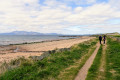
Plenty of beach-walking on this one, with options to use earth footpaths instead should you wish. With Portencross being the closest point on the mainland to the Isle of Arran, you have the potential for some incredible views across the Firth of Clyde.
Portencross to Largs
 7.01 mi
+49 ft
-56 ft
3h 15
Easy
Departure from North Ayshire
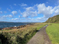
Portencross is arguably one of the best places from which to view the Isle of Arran! The Isle of Cumbrae quickly takes it’s place as you progress towards Largs via the industrial grounds of Hunterston and the pretty town of Fairlie. Much of this walk is along cycle tracks, pavements and minor roads.
Ardeer Quarry (Aka Ardeer Rec)
 Association / Club / Walk leader0.53 mi
+13 ft
-13 ft
0h 15
Easy
Departure from North Ayshire
Amenity park land with a mixture of grassland, woodland, wildflower meadows and a pond.
Lynn Glen Pulse Raiser
1.18 mi
+105 ft
-105 ft
0h 40
Easy
Departure from North Ayshire
One from my Pulse Raiser series of walks, this is a woodland river side walk with undulating terrain and steep steps.
Lynn Glen Circular, Dalry
 1.16 mi
+108 ft
-108 ft
0h 40
Easy
Departure from North Ayshire
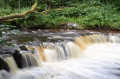
This short circular walk around the Caaf Water is packed with unexpected ‘fairy’ surprises hidden within a tranquil wooded glen. The gorge is designated as a Site of Special Scientific Interest because of the unique and interesting rocks it contains. Perfect for families and for anyone who likes waterfalls!
McGavin Park
0.50 mi
+30 ft
-26 ft
0h 15
Easy
Departure from North Ayshire
A short circular amenity park walk on tarmac paths with one small, shallow gradient.
Dalry Community Park - Easy route
0.38 mi
+13 ft
-10 ft
0h 10
Easy
Departure from North Ayshire
A short, flat tarmac circuit in amenity park land. Ideal for those new to fitness or recovering from illness or injury.
Fairlie Glens and Waterfalls Circular
 4.76 mi
+607 ft
-614 ft
2h 45
 Moderate
Departure from North Ayshire
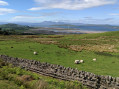
On a clear day the views from this route are simply outstanding: the islands of Cumbrae & Arran and the pink sandy beaches at Fairlie and Hunterston. A variety of woodland paths, tracks and grassy hillsides lead you gently uphill past the remains of Fairlie Castle and along the base of Black Hill. The return section follows the Fairlie Moor Road and then the Ayrshire Coastal Path. There is the opportunity to visit some hidden waterfalls along the route.
For more walks, use our search engine .
The GPS track and description are the property of this route's author. Please do not copy them without permission.

