


ThC

 Visorando Member
 Premium user
 - Location: Remoulins (30210)
- Gender: man
Sign up:
Published route(s)
 Pretty villages and beautiful countryside between Uzès and Nîmes
 13.19 mi
 +801 ft
 -830 ft
 6h 45
6h 45
 Difficult
 Departure from Euzet (Gard)
This is a simple hike with little elevation gain, just over 20 km, so it's a bit challenging but still accessible to many. Above all, it's a very pleasant hike. Starting from Euzet-les-Bains, this route takes you through Saint-Hippolyte-de-Caton, Saint-Étienne-d'Olm, Saint-Cézaire-de-Gauzignan, Saint-Maurice-de-Cazevieille and Saint-Jean-de-Ceyrargues. Between each village, you will pass through pleasant countryside with fields and woods.
Nasbinals loop offering different landscapes of the Aubrac region
16.31 mi
+1,234 ft
-1,237 ft
8h 35
 Very difficult
Departure from Nasbinals (Lozère)
Very difficult
Departure from Nasbinals (Lozère)
This hike follows the Way of St James to the village of Aubrac, crossing fields and offering superb views of the surrounding area. Depending on the season, you may encounter numerous cows, flowers everywhere, or even snow and fog. In any case, this trail has something magical about it.After Aubrac, the route leaves the GR®65 to join the GR®6 and then the GR®670, passing through woodland, meadows with or without cows, and an old Roman road.
Lussan loop at the Portail des Concluses
14.40 mi
+1,355 ft
-1,345 ft
7h 50
Difficult
Departure from Lussan (Gard)
This hike starts from the car park below the village of Lussan, which I visited on the way back. It crosses fields and forest, heathland, to reach the Portail des Concluses, which this year at the end of May still had water, so it was superb. We climb back up from the Portail des Concluses on the other side, a good climb that is a little strenuous but nothing insurmountable. After walking through the heath, we pass through hamlets and villages interspersed with passages through the surrounding countryside to return to the village of Lussan.
Between the Cèze and Auzon rivers from Saint-Jean-de-Valériscle
 14.44 mi
+2,966 ft
-2,969 ft
9h 15
Very difficult
Departure from Saint-Jean-de-Valériscle (Gard)
14.44 mi
+2,966 ft
-2,969 ft
9h 15
Very difficult
Departure from Saint-Jean-de-Valériscle (Gard)
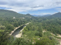
This is a challenging hike that allows you to discover different aspects of the southern Cévennes countryside, passing through forests and superb panoramas, as well as villages and hamlets. The climb from Robiac to the Chapelle Lacham is challenging, with some steep sections, but the scenery is well worth the effort. The descent from the chapel to Saint-Florent-sur-Auzonnet is also challenging, due to the large unstable rocks typical of the Cévennes over much of the descent.
Loop south of Mont Lozère via Vialas
14.69 mi
+3,281 ft
-3,291 ft
9h 35
Very difficult
Departure from Saint-Maurice-de-Ventalon (Lozère)
This beautiful loop allows you to discover the variety of landscapes in the south of Mont Lozère, including forests, pastures and granite hamlets on the plateau. There are superb views throughout the route. Some may find this hike challenging due to its length and elevation gain, but it offers magnificent views.
Loop in the south of the Cévennes, from the Col de Portes to the banks of the Luech
 15.78 mi
+2,756 ft
-2,776 ft
9h 40
Difficult
Departure from Portes (Gard) (Gard)
15.78 mi
+2,756 ft
-2,776 ft
9h 40
Difficult
Departure from Portes (Gard) (Gard)
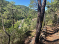
This challenging loop starts at Col de Portes and descends to Peyremale via the beautiful medieval village of Le Puech. After Peyremale and Saint-Herm, the route climbs back up to higher ground, offering superb views of the meandering Luech river below, which you eventually reach and follow along the beautiful hamlet of Chareneuve, which seems cut off from the world.Follow the Luech to Martinet Neuf after Chambon. Take a path that climbs steeply to Dieusses. Towards the end of the climb, you can clearly see the Château de Portes on the other side of the Luech, which you will have to reach. You are now about halfway there.Descend towards Chamborigaud, with beautiful views of the viaduct, which the path passes under. After the Chamborigaud bridge, take the GR®700, which climbs up to the Col de Portes. This is the thousand-year-old Régordane path. Although it stays close to the road, which you cross in a few places, this road, which starts off as a road but later becomes a path, is very pleasant.
Large circular loop around the Luech
 17.42 mi
+3,474 ft
-3,488 ft
11h 00
Very difficult
Departure from Chamborigaud (Gard)
17.42 mi
+3,474 ft
-3,488 ft
11h 00
Very difficult
Departure from Chamborigaud (Gard)
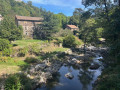
This is a challenging circular route with an elevation gain of over 1,000 metres, starting from Chamborigaud and climbing up to the Route des Crêtes, with superb views of the surrounding mountains, including the ruins of the old castle of Verfeuil, from the south of Mont Lozère to Mont Ventoux. There are various places between the points (7) and (15) that also offer beautiful views. From Vialas to Chamborigaud, you will come across numerous streams that flow into the Luech, which you will follow, with a superb spot that is ideal for a break or a swim, even if there are still 6 km to go to reach the starting point, with a steep hill to leave the Luech. But overall, it is a very beautiful route for lovers of good, challenging hikes.
A circular route through the heath to the Cèze river and then through the fields
 19.58 mi
+1,798 ft
-1,804 ft
10h 35
Very difficult
Departure from Saint-Jean-de-Maruéjols-et-Avéjan (Gard)
19.58 mi
+1,798 ft
-1,804 ft
10h 35
Very difficult
Departure from Saint-Jean-de-Maruéjols-et-Avéjan (Gard)
This circular loop starts in Saint-Jean-de-Maruéjols and heads into the heath via Avéjan, Cabiac, then Serre du Barri and the Ermitage Saint-Ferréol on the banks of the Cèze. It then climbs back up towards Barjac, passing through several charming hamlets. After Barjac, you walk through fields on the plain, along the border of the nearby Ardèche region, through meadows and farmhouses, before returning to the starting point. This circular route is nothing exceptional, but it allows you to discover the heath and the plain with its agricultural activity. Its appeal lies in combining a challenging hike with very clear and easy-to-follow signage, except for the short passages indicated in the description where you move from one signpost to another.
Circular loop around Eygalières with views of the Alpilles
 19.77 mi
+2,530 ft
-2,543 ft
11h 20
Very difficult
Departure from Eygalières (Bouches-du-Rhône)
19.77 mi
+2,530 ft
-2,543 ft
11h 20
Very difficult
Departure from Eygalières (Bouches-du-Rhône)
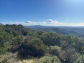
This is a long hike of over 30 km, starting from the beautiful village of Eygalières and leading to the ridges and the Plateau de la Caume, offering views on both sides of Mont Ventoux, the Luberon and the Crau plain. Then take the Chemin de Baume Brignolle via a DFCI track surrounded by nature and tranquillity to reach the watchtower above Aureille, with superb views of the Alpilles and the path you have just walked, the Crau plain and the sea in the distance. A little further on, you can see the Opies tower, before returning to Eygalières via Gros Calan. The advantage of this hike, apart from the fact that it offers a very broad view of the Alpilles, is that despite its distance, there are very few roads to walk along. The route mainly follows paths or DFCI tracks surrounded by nature.
Circular loop from Lasalle, via Colognac and Soudorgues
 18.80 mi
+3,645 ft
-3,652 ft
11h 50
Very difficult
Departure from Lasalle (Gard)
18.80 mi
+3,645 ft
-3,652 ft
11h 50
Very difficult
Departure from Lasalle (Gard)
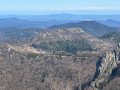
A circular loop following only GR® trails. We start on the GR®63 to reach Colognac. Then we take the GR®6 and 67 to the Col de l’Asclier, with superb views all along this gradual climb, before taking the GR®61 and then the GR®63 again to Lasalle. Camp Barrat (13) is a perfect spot for a picnic; situated at an altitude of 920 m, it offers views stretching from the sea to the Monts de Lozère. The 270° view from the summit of the Col du Fageas is superb too. However, it is a demanding route, with a significant elevation gain, even if it is gradual and without any particular difficulty. The steep descents are even more challenging, with numerous stones requiring constant attention, particularly after the Col du Fageas on the way to the Col de l’Asclier, though this section can be avoided. Another demanding descent follows the Col de la Mortière.
A long, varied hike between Mont Ventoux and the Luberon
 20.58 mi
+3,189 ft
-3,186 ft
12h 15
Very difficult
Departure from Méthamis (Vaucluse)
20.58 mi
+3,189 ft
-3,186 ft
12h 15
Very difficult
Departure from Méthamis (Vaucluse)
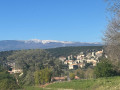
A hike starting from the village of Méthamis, following several GRP® routes, including the Mont Ventoux Massif trail, then the Grande Combe de Lioux, the GRP® de la Pierre en Vaucluse to the beautiful village of Murs, then the GRP® des Monts de Vaucluse and the GR®91. It offers numerous views of the Ventoux, the Luberon and the Carpentras plain to the Dentelles de Montmirail, and even as far as the Lozère mountains in the distance towards the end of the route.You’ll walk through a variety of landscapes, starting with gorges over riverbed pebbles, then through woodland, a track with views, a few stretches of road (though very quiet), a forest track descending into valleys, and stony paths...
This route is physically demanding, not only because of its length and elevation gain, but also due to two technical sections: between (18) and (19), descending to the Gorges de Vaumale, and then between (30) and (31), stony descents that require great care.