


Pierrealibert

 Visorando Member
 Premium user
Sign up:
Published route(s)
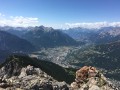
 Serre des Aigles via the Croix de Toulouse
 7.69 mi
 +4,019 ft
 -4,019 ft
 7h 00
7h 00
 Difficult
 Departure from Briançon (Hautes-Alpes)
A beautiful hike starting from the centre of Briançon, offering magnificent views of the town, the valley and the famous glaciers of the Écrins massif.
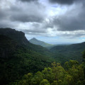
Rivière Noire
 6.63 mi
+2,083 ft
-2,096 ft
4h 50
6.63 mi
+2,083 ft
-2,096 ft
4h 50
 Moderate
Departure from Mauritius
Moderate
Departure from Mauritius
This hike is located in the northern part of Rivière Noire National Park and offers several views of the park’s various valleys.
You will also have the chance to spot numerous Mauritian black flying foxes (huge bats) in the final section of the hike.
Piton de la Petite Rivière Noire
 3.89 mi
+699 ft
-702 ft
2h 25
Moderate
Departure from Mauritius
3.89 mi
+699 ft
-702 ft
2h 25
Moderate
Departure from Mauritius
This is an easy hike that takes you to the highest point on the island at 828 metres.
If you follow the ridge, the path is lined with trees all the way. You'll have to wait until you reach the summit to enjoy a splendid 360° view. Everything is worth the effort.
You may encounter a few monkeys along the way.