


nordavind

 Visorando Member
 Premium user
 Sign up:
Published route(s)
 Col and Cime d'Anelle
 5.96 mi
 +2,277 ft
 -2,251 ft
 4h 45
4h 45
 Moderate
 Departure from Saint-Étienne-de-Tinée (Alpes-Maritimes)
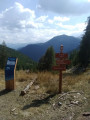
This morning route is an alternative to the Bois d'Anelle loop, passing via the Cime d'Anelle. The first section climbs through the Ublan countryside, then crosses the woods in the shade of the fir trees.
Tour of Mont Férant
 8.38 mi
+2,598 ft
-2,556 ft
6h 05
Moderate
Departure from Saint-Étienne-de-Tinée (Alpes-Maritimes)
8.38 mi
+2,598 ft
-2,556 ft
6h 05
Moderate
Departure from Saint-Étienne-de-Tinée (Alpes-Maritimes)
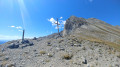
This walk is accessible to most people thanks to the very even gradient along the route. The trail is entirely located within the Mercantour National Park and takes us through the little-visited mountain pastures around the hamlet of Roya.