


LIONEL13118

 Visorando Member
- Location: Istres (13800)
- Gender: man
Sign up:
Published route(s)
 The hills above Les Mas
 6.31 mi
 +666 ft
 -666 ft
 3h 30
3h 30
 Moderate
 Departure from Aureille (Bouches-du-Rhône)
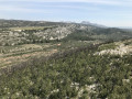
A circular route that mainly follows wide, easy paths, offering views of the unforgettable landscapes of the Alpilles. From the top of the hills, there is a sweeping 360° panorama over the Crau plain, the Étang de Berre, and the surrounding hills. The actual elevation gain is 240 m according to my altimeter.
La Tour des Opies without climbing and via the shortest route
 3.41 mi
+1,171 ft
-1,171 ft
2h 35
Moderate
Departure from Eyguières (Bouches-du-Rhône)
3.41 mi
+1,171 ft
-1,171 ft
2h 35
Moderate
Departure from Eyguières (Bouches-du-Rhône)
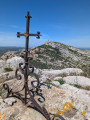
Hike to the Tour des Opies, the highest point of the Alpilles at 498 m, a round trip, taking the shortest route via the gentle path—the only one where you won’t need to use your hands. This walk offers a 360° panorama and a breathtaking view. On the way down, you can make a round trip to the Croix des Opies, situated in another valley, directly opposite the Tower, which offers a different panorama.