


le gaillard

 Visorando Member
Sign up:
Published route(s)
 The Corniches du Méjean and Corniches du Tarn from Rozier
 10.66 mi
 +2,618 ft
 -2,598 ft
 7h 10
7h 10
 Difficult
 Departure from Le Rozier (Lozère)
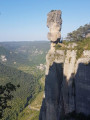
A beautiful, challenging circular hike with breathtaking views. The view from the Cinglegros rock is fantastic, but access is reserved for those who do not suffer from vertigo.
Circular from Le Pouldu to Saint-Michel via Saint-Maurice
 11.44 mi
+840 ft
-837 ft
6h 00
11.44 mi
+840 ft
-837 ft
6h 00
 Moderate
Departure from Guidel (Morbihan)
Moderate
Departure from Guidel (Morbihan)
The River Laïta winds its way from Quimperlé to Le Pouldu. Its banks are steep and it is bordered by a state-owned forest which is home to the ruins of Saint-Maurice Abbey. The coastal path (GR®®34) allows you to reach the abbey site from the mouth of the river via either bank. The extension towards the chapel and the Saint-Michel fountain takes you through a wilder area. The walk can be done as a circular route during the high season by using the Pouldu ferry.