


La plouhatine de randonnée

 Association / Club / Walk leader
- Mairie de Plouha
22580 Plouha - Tel:0681503253
- Website: https://www.laplouhatinerando.fr/
Sign up:
Published route(s)
 Sunken paths and cliffs in Plouha
 3.21 mi
 +436 ft
 -430 ft
 1h 50
1h 50
 Easy
Easy
 Departure from Plouha (Côtes-d'Armor)
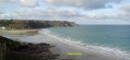
This route was used for the first edition of the 24h du Sport de Plouha. Starting from the superb Plage du Palus, it runs alongside Le Corzic and climbs gently up an old sunken path to Pointe de Plouha. From there, the view is magnificent. You then descend back to Palus via theGR®34.
Keregal and the Corzic Valley
 3.15 mi
+266 ft
-246 ft
1h 40
3.15 mi
+266 ft
-246 ft
1h 40
 Moderate
Departure from Plouha (Côtes-d'Armor)
Moderate
Departure from Plouha (Côtes-d'Armor)
This route was used for the second edition of the Plouha 24-hour sports event. Starting from the superb Palus beach, it leads to Keregal Chapel and ends along the small coastal river of Plouhatin, the Corzic, which takes us back to the sea. The route is mainly through woodland.