Visorando Visorando
Visorando Visorando
  •  Tools 
    • Walking route planner
    • Import a GPX file
  • Walks
  • Help ↗
  • Visorando Premium
  • Sign up
  • Log in
Loading…
  1. Visorando
  2. jose-molina@laposte.net

jose-molina@laposte.net

jose-molina@laposte.net
Visorando Member
Premium user
  • Gender: man

Sign up: 29 May 2017

Published routes 3

Published route(s)

  • List
  • Map

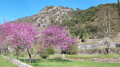
Walking Saint-Marcel de Fontfouillouse via Monteils
Saint-Marcel de Fontfouillouse par Monteils
↔9.60 mi ↗+2,178 ft ↘-2,172 ft ◔6h 20 ▲Moderate
⚑Departure from Les Plantiers (Gard)
A lovely hike from Les Plantiers to the Saint-Marcel church in Fontfouillouse, passing through the hamlet of Monteils, the Col de l'Espinas and Faveyrolle.

Download PDF  PDF Download GPX  GPX

Walking Col du Véry via the ridges of Mont de Vorès

Col du Véry par les crêtes du Mont de Vorès
↔9.29 mi ↗+1,440 ft ↘-1,457 ft ◔5h 30 ▲Moderate
⚑Departure from Hauteluce (Savoie)
Hike in the Beaufortain, magnificent view of the Hauteluce valley, the Outray mountain and Mont Blanc. Moderator's note Accessibility in summer: see the notice dated 21/07/2022
Download PDF  PDF Download GPX  GPX

Walking Trail from Mialet to discover the hamlets of the Camisards

Sentier de Mialet à la découverte de hameaux camisards
↔9.84 mi ↗+1,946 ft ↘-1,959 ft ◔6h 15 ▲Moderate
⚑Departure from Mialet (Gard) (Gard)
In the heart of the Cévennes, a circuit along paved slanting streets and forest tracks, discovering the farmhouses and hamlets of the Camisards.
Download PDF  PDF Download GPX  GPX
Back to top
  • Contact
  • Walking community

Download the app now and go on an adventure!

App storeApp Store
Google playGoogle Play

Checking services status…© 2026 Visorando
 Loading…