


Grabouillon

 Visorando Member
- Location: Cuers (83390)
- Gender: man
Sign up:
Published route(s)
 Rougiers, Castrum Saint-Jean
 10.58 mi
 +1,745 ft
 -1,736 ft
 6h 25
6h 25
 Moderate
 Departure from Rougiers (Var)
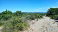
This hike takes you to the ruins of Castrum Saint-Jean, 600 metres above sea level, on the spur of the hill overlooking the present-day village of Rougiers. Don't forget to visit the Guillandière spring in the communal woods, east of Saint-Jean hill.
The Hermitage of Saint-Jean du Puy from Kirbon
 7.74 mi
+1,371 ft
-1,365 ft
4h 45
Moderate
Departure from Trets (Bouches-du-Rhône)
7.74 mi
+1,371 ft
-1,365 ft
4h 45
Moderate
Departure from Trets (Bouches-du-Rhône)
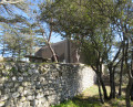
This hike leads to the Hermitage of Saint-Jean du Puy, an observatory overlooking the Arc Valley and facing the Sainte-Victoire Mountain. On the other side, to the south, is the village of Saint-Zacharie and the Sainte-Baume mountain range.
The site, which has become a favourite spot for hikers, consists of a refuge, a chapel, a shelter with gardens and a watchtower that serves as an observatory overlooking the valley.