


EF30

 Visorando Member
 Premium user
 - Gender: man
Sign up:
Published route(s)
 Route in Gardonnenque in Saint-Mamert-du-Gard
 7.43 mi
 +266 ft
 -266 ft
 3h 40
3h 40
 Moderate
 Departure from Saint-Mamert-du-Gard (Gard)
This walk allows you to discover part of the Gardonnenque region located north-west of Nîmes.
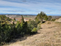
Between vineyards and heath, you will pass through four villages: Saint-Mamert, Parignargues, Gajan and Fons. On the hilltops, on a clear day, at the Saint-Mamert mill, you can enjoy a 180° panorama from Pic Saint-Loup to Mont Bouquet, via Mont Aigual and Mont Lozère. In the foreground is the Bois des Leins massif.
Circular route starting from L'Esperou in the Aigoual Massif
 12.40 mi
+1,119 ft
-1,096 ft
6h 40
Moderate
Departure from Dourbies (Gard)
12.40 mi
+1,119 ft
-1,096 ft
6h 40
Moderate
Departure from Dourbies (Gard)
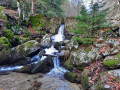
A hike in the heart of the Cévennes in the Mont Aigoual massif, where a variety of landscapes awaits you, depending on the slope—whether facing the Atlantic or the Mediterranean. You will pass through deciduous and coniferous forests and peat bogs, with the highlight, in fine weather, being a view stretching all the way to the sea as you cross the bridge over the Cascades d’Orgon.
The hike follows sections of thePR® trail marked in yellow andthe GR® trail in red and white. You will also be well guided by the signposts marking this circular route.