


blairo68

 Association / Club / Walk leader
Sign up:
Published route(s)
 From Bonhomme to Lac Blanc towards Tête des Faux and Étang du Devin

 9.35 mi
 +2,536 ft
 -2,526 ft
 6h 30
6h 30
 Difficult
 Departure from Le Bonhomme (Haut-Rhin)
A circular hike starting from Le Bonhomme. It takes us through the forest to Lac Blanc.
The return journey crosses a small section of the battlefields of theFirst World War. There are numerous military structures, as well as a national necropolis and a German military cemetery.
An important place of remembrance in the history of the Alsace region.
Tour of four Alsatian lakes
 10.19 mi
+2,438 ft
-2,434 ft
6h 50
Difficult
Departure from Orbey (Haut-Rhin)
10.19 mi
+2,438 ft
-2,434 ft
6h 50
Difficult
Departure from Orbey (Haut-Rhin)
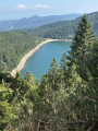
An exceptional hike offering panoramic views of successive lakes. There are a few challenging climbs, but it's well worth the effort. Best done in good weather to fully enjoy the views available to hikers.
 Moderate