


Chloé.1998

 Visorando Member
- Gender: woman
Sign up:
Published route(s)
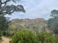
 Rocher de Roquebrune - Les Trois Croix
 3.28 mi
 +1,260 ft
 -1,257 ft
 2h 35
2h 35
 Very difficult
 Departure from Le Muy (Var)
A challenging hike, but rewarded with a magnificent 360° panorama at Les Trois Croix. View of the fairy chimneys on the way back.
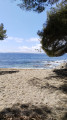
Coastal path at Les Issambres
 5.25 mi
+102 ft
-98 ft
2h 30
5.25 mi
+102 ft
-98 ft
2h 30
 Easy
Departure from Roquebrune-sur-Argens (Var)
Easy
Departure from Roquebrune-sur-Argens (Var)
An easy walk, though uneven in places, along the Issambres coastal path. Views of the Bay of Saint-Tropez for the first few kilometres, followed by views of the Estérel Massif and the Bay of Saint-Raphaël.
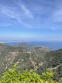
A circular walk to the Pic de l’Ours and Dent de l’Ours from the Col de l’Évêque
 5.58 mi
+1,093 ft
-1,109 ft
3h 30
5.58 mi
+1,093 ft
-1,109 ft
3h 30
 Moderate
Departure from Saint-Raphaël (Var) (Var)
Moderate
Departure from Saint-Raphaël (Var) (Var)
A lovely walk in the Esterel Massif, well signposted and without any significant difficulty. Discover the reddish rocks typical of this massif. Enjoy the magnificent panoramic views of the Mediterranean Sea. Make sure you wear good walking shoes. Best done in fine weather to make the most of the magnificent scenery.