Country:
 City:
City:


Take the first exit at the Créac’h Gwen roundabout to enter the leisure park car park.
If this car park is full, park at the next one near the indoor tennis centre.
Access by bus: lines B and C1, Créac’h Gwen stop.
Yellow markings
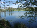
(S/E) From the car park, head towards the lake, which serves as a water sports centre for beginner kayaking lessons, and walk round it anti-clockwise. Cross a footbridge and head towards the banks of the Odet.
(1) At the rowing club’s premises, a signpost indicates the detour to take at high tide (see practical information). Continue along Kérogan Bay via “Plage des Gueux” (view of Corniguel harbour on the opposite bank). Pass to the right of the Aquarive swimming pool and reach a road.
Yellow and blue markings
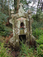
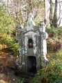
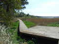
(2) Continue straight on along the paved path, past the day-care centre, until you reach the reed bed. Turn right onto the boardwalk which takes you round the reed bed and leads out opposite a monumental fountain (Fontaine Sainte-Anne or de Keribin), erected following a tragic event. Walk back up to the road.
(3) Head up into the woods opposite, following a clearly marked and signposted path. Ignore the paths branching off to the right and left and continue until you reach a fork.
Blue markings
(4) Let the yellow-marked route branch off to the left and continue climbing through the woods, following the blue markings.
Yellow and blue markings
At the next fork, rejoin the yellow-marked route, continue out of the woods, cross a large meadow and come out onto a small road.
Yellow markings
Turn right onto this small road, leaving the blue markings which branch off to the left, and carry on straight ahead until you come to the CFA building and civil engineering centre.
(5) Go round it on the right, first along the road and then along a path, until you reach a street; on your right is the IFRIA (training centre for the agri-food sector). Head left towards the large Moulin des Landes roundabout ( heavy traffic – make sure to use the pedestrian crossings to go round it on the right, past a business park with several shops), then head down to the lower roundabout, which provides access to the Castorama store.
(6) As you leave the roundabout, take the track on the right and follow it down past the buildings of the DIY superstore. Continue along the small road leading to the village of Kervoalic, where the road becomes a farm track.
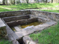
(7) This track can be muddy in winter due to deep ruts. Continue between the fields along a track that narrows and runs alongside horse pastures. When you reach the first houses in the Bourdonnel neighbourhood, you’ll come to a lovely spot with a pond, a wash house and a fountain – all very well maintained. It’s the perfect place for a peaceful break.
Walk past the houses on your left, go through a gate and you’ll reach a fork in the path.
(8) Turn right, leaving the old signposted path straight ahead, and go up a slope to enter a wooded area. ThePR® route shown on IGN maps is no longer accurate. Follow this visible track on OSM, which winds through the woods, overlooking the site of the former waste disposal centre, then heads towards the fire station (tower and mast, clearly visible).
(9) Turn left and continue to follow the track which zigzags through the woods, passes near a wash house awaiting restoration, and joins the roundabout on Avenue de Kéradennec, which you can hear on your right.
No signposting
Follow the yellow markings across the roundabout and turn left to follow this avenue along a suitable route (thePR® route on IGN maps is no longer up to date). You’ll reach another roundabout.
(10) Opposite, take a path to reach the underpass at the Toul Sable roundabout and rejoin the yellow markings.
Yellow markings
Walk down Avenue de la Plage de Gueux along the path that runs alongside the perimeter wall of the health and environmental testing laboratory and then the Pierre-Jakez Hélias University Campus.
(11) At the roundabout near the Aquarive Swimming Pool, turn left, walk alongside the École de Management Bretagne Atlantique and, at the end, turn right to reach the Kerogan peat bog (barrier).
::9: Enter and walk round in an anti-clockwise direction (large information board at the entrance), continuing along the boardwalk. At the end of the boardwalk, carry on straight ahead (bench) and turn left to reach the exit, ignoring a yellow signpost directing you to turn right.
Return to the roundabout by the swimming pool, go round it on the left and continue towards the car park near the Quimper Tennis Club, passing close to the France Bleu Breizh Izel radio station premises, go round the skatepark and arrive at the car park (S/E).



 Visorando Member
 Moderate