Venta Negra from the Col de Lizuniaga

A walk amidst ferns, the sound of a stream and birdsong, leading to the discovery of a little house.

Details

30642717
Creation:
Last update:
Last review:
  • Walking
    Activity: Walking
  • ↔
    Distance: 2.59 mi
  • ◔
    Average duration: 1h 45 
  • ▲
    Difficulty: Easy

  • ⚐
    Back to start: Yes
  • ↗
    Ascent: + 659 ft
  • ↘
    Descent: - 643 ft

  • ▲
    Highest point: 1,135 ft
  • ▼
    Lowest point: 466 ft

Photos

Description of the walk

Starting point: Col du Lizuniaga. To get there, see the ‘Practical Information’ section below.

(S/E) From the car park, walk past a restaurant and take the wide path on the left. At the bend leading off to the left, leave this track and take the path on the right until you reach the RD406.

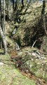
(1) At the road, cross the stream and take the path on the left which follows the watercourse. You’ll soon feel as though you’re in a different world, hearing nothing but the murmur of the stream and birdsong. This rarely used path can be overgrown with brambles. Continue to the junction with a wide track.

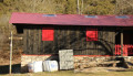
(2) Turn left and you’ll reach the Venta Negra, a small black house with red shutters in the middle of a vast flat area, which has been closed for many years. The R32 boundary marker is located here.

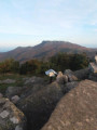
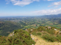
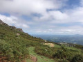
(3) With your back to the venta, take the wide path (PR®-NA16). Look back from time to time to enjoy a superb view of La Rhune. Continuing along the path, you’ll pass near boundary markers 34 and 35, walk alongside a whole row of pidgeon hunting huts and enjoy a superb view of the mountains. You’ll reach the hamlet of Plazidobaita.

(4) Follow the path leading off to the left, heading towards the restaurant and then the car park (S/E).


Waypoints

  1. S/E : mi 0 - alt. 712 ft - Lizuniaga Pass
  2. 1 : mi 0.77 - alt. 466 ft - Route
  3. 2 : mi 1.46 - alt. 928 ft - Main track, on the left
  4. 3 : mi 1.58 - alt. 1,033 ft - Venta Negra
  5. 4 : mi 2.37 - alt. 748 ft - Plazidobaita, on the left
  6. S/E : mi 2.59 - alt. 719 ft - Roadside car park

Notes

Access to the start

From Ciboure, head towards Ascain, drive through the town centre and climb up to the Col de Saint-Ignace.
Head down towards Sare.
At the roundabout in Sare, take the D406 – that is, turn right towards Vera and the Col de Lizuniaga.
At the pass, park in the restaurant car park or, better still, to avoid inconveniencing customers, drive down 50 metres and park on the left-hand side of the road: please note, there are few spaces.

For your information: the journey by car is approximately 21 km.

Avoid this route at all costs during the wood pigeon hunting season.

Worth a visit

Be aware of the hunting posts between (3) and (4).

Always be cautious and plan ahead when you're outdoors. Visorando and the author of this route cannot be held responsible for any accidents occurring on this route.

The GR® and PR® markings are the intellectual property of the Fédération Française de Randonnée Pédestre.

Reviews and comments

5 / 5
Based on 2 reviews

Reliability of the description
5 / 5
Ease of following the route
5 / 5
Route interest
5 / 5
Jijidé
Jijidé

Overall rating : 5 / 5

Date of your route : Sep 02, 2024
Reliability of the description : ★★★★★ Very good
Ease of following the route : ★★★★★ Very good
Route interest : ★★★★★ Very good
Very busy route : No

Hello
You mention a path that is blocked between points 1 and 2: we found it to be well maintained and clear all the way along.
However, it is between the start and point 1, in the central section on the French side, that the path is hard to make out amidst ferns two metres high; you can make out its outline on the ground, but it is clearly not in use… every era has its own problems!
Otherwise, as always, thank you for your descriptions.
Kind regards

Machine-translated

Hervé Bignon
Hervé Bignon

Overall rating : 5 / 5

Date of your route : Apr 21, 2024
Reliability of the description : ★★★★★ Very good
Ease of following the route : ★★★★★ Very good
Route interest : ★★★★★ Very good
Very busy route : No

A quick warm-up before lunch at the start/finish point.

I can confirm that the uphill section after the control point (1) is indeed overgrown with brambles.

But the route through the forest is lovely, and it feels as though you’re alone in the world.

Thank you.

Machine-translated

Other walks in the area

For more walks, use our search engine .

The GPS track and description are the property of this route's author. Please do not copy them without permission.