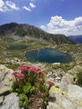
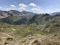
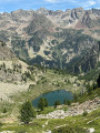
Tour of the lakes starting from the Sant'Anna di Vinadio Sanctuary

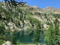
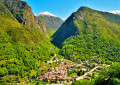
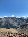
Superb hike starting from the Santa Anna di Vinadio Sanctuary in Italy. This 4-hour Lakes circuit can be done clockwise or anti-clockwise.
Be sure to read the warnings about snow and equipment to bring with you in the practical information section.

Details

2368989
Creation:
Last update:
Last review:
  • Walking
    Activity: Walking
  • ↔
    Distance: 6.22 mi
  • ◔
    Average duration: 4h 35 
  • ▲
    Difficulty: Moderate

  • ⚐
    Back to start: Yes
  • ↗
    Ascent: + 1,959 ft
  • ↘
    Descent: - 1,991 ft

  • ▲
    Highest point: 8,087 ft
  • ▼
    Lowest point: 6,617 ft
  • ⚐ Country: Italy
  • ⚐
    Area: Alps
  • ⚐ City: Vinadio 
  • ⚑
    Start/End: N 44.231938° / E 7.105377°
  • ❏
    IGN map(s): Ref. 3640ET
  • Hour-by-hour weather

Photos

Description of the walk

Parking is available at the sanctuary. See the Practical Information section for details on how to get to the start of the hike.

(S/E) Descend towards the sanctuary, take the road uphill towards the Rocher de l'Apparition. Follow the paved path suitable for 4x4s. Shortly afterwards, you will reach the IT 342 signpost.

(1) Continue left towards "Giro dei Laghi / Colle di S. Anna". Follow the path suitable for 4x4 vehicles. At the first lake, "Lago di Colle de S. Anna 2156 m", leave the path that branches off to the left and head towards "Giro dei Laghi". Continue to follow the path until you reach the Col de Sainte-Anne.

(2) Continue straight ahead, following the track towards "Giro dei Laghi".
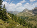
Continue towards Col du Lausfer (signposted FR 78). Along the way, there is a magnificent passage between two rocks, then a wooden footbridge on the mountainside.
Be careful here: this is a tricky passage for those who are afraid of heights.
Continue climbing towards the Col du Lausfer via a stony passage that may be snow-covered in June. Reach the pass at signpost 65a.

(3) Descend straight down to the Lacs Variclès below. The path branches off to the right to stay above the lake.

(4) After passing thesecond lake (Lac Variclès), descend to Lac Lausfer Supérieur.
Follow the lake on the left and begin the climb up the Col du Saboulé, reaching it at the boundary marker and marker FR 64.

(5) Take the path downhill to the right to pass in front of the building. Follow it, then take the path with caution:
This path on the mountainside is very snowy in June. See note in the Practical Information section. Reach the Paso Tesina pass.

(6) Turn right and follow the path downhill. Walk along Lago di Santa-Anna before reaching the junction with signpost IT 342.

(1) Turn left towards the Rocher de l'Apparition and head to the car park at the sanctuary (S/E).


Waypoints

  1. S/E : mi 0 - alt. 6,657 ft - Sanctuary car park
  2. 1 : mi 0.58 - alt. 6,906 ft - IT marker 342
  3. 2 : mi 1.5 - alt. 7,526 ft - Col de Sainte Anne Beacon FR 78
  4. 3 : mi 2.64 - alt. 7,946 ft - Beacon 65a - Col du Lausfer
  5. 4 : mi 2.93 - alt. 7,746 ft - Lac du Lausfer Supérieur
  6. 5 : mi 3.53 - alt. 8,041 ft - Col du Saboulé - Beacon FR 64
  7. 6 : mi 4.22 - alt. 7,831 ft - IT Paso Tesina
  8. S/E : mi 6.22 - alt. 6,624 ft - Sanctuary car park

Notes

Hiking is possible from June to September.
If you leave at 10 a.m. at the latest (after enjoying a delicious cappuccino and a treat at the Snack du Sanctuaire), you can stop for lunch at Lake Lausfer Supérieur.
Please note: if you do the opening hike (mid-June, see the calendar on the website) until the first week of July, there are some snowy sections on the mountainside.
Be sure to bring a small shovel, trousers with gaiters and possibly crampons (if it is icy) as there are small crevasses, and do not hike alone.
(Between 5 and 6) This is the most difficult section because the path is not visible and if you find yourself between two rocks, you can sink up to your thighs and have great difficulty getting out (from personal experience). A shovel and assistance are essential.
Bring good walking shoes because there are many rocky sections.
To get to the sanctuary from France, go to Isola 2000, then take the Col de la Lombarde towards Italy. After a few kilometres, turn left towards the sanctuary.

Worth a visit

(2) Note that at the Col de Sainte Anne, you can see the road climbing towards Isola 2000 on the French side. The descending path leads down to Isola Village.
(3) Col du Lausfer: you can climb up to the Cime du Lausfer (2,547 m). Please note that this climb is difficult as it is very steep (take care at the summit). It takes about 20 minutes.
(4) Lac du Lausfer: This is the ideal place to stop for lunch. This peaceful, sheltered lake is sheltered from the wind.
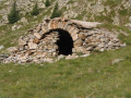
(Between 5 and 6) Pass in front of the building where ibexes shelter at night.
When you arrive, you will enjoy quenching your thirst at the same snack bar, then visit this magnificent, unusual church (sloping floor, ex-votos).
Visit the sanctuary. It is a magnificent place of silence and contemplation.
The Sanctuary is open from mid-June to mid-September. It is a place of pilgrimage much loved by Italians.

Reviews and comments

4.9 / 5
Based on 27 reviews

Reliability of the description
4.9 / 5
Ease of following the route
4.9 / 5
Route interest
5 / 5
User 9537736

Overall rating : 5 / 5

Date of your route : Jul 24, 2026
Reliability of the description : ★★★★★ Very good
Ease of following the route : ★★★★★ Very good
Route interest : ★★★★★ Very good
Very busy route : Yes

A very pleasant walk with no real difficulty; the signposting and route description are accurate

Machine-translated

gg13500
gg13500

Overall rating : 5 / 5

Date of your route : Jul 14, 2026
Reliability of the description : ★★★★★ Very good
Ease of following the route : ★★★★★ Very good
Route interest : ★★★★★ Very good
Very busy route : No

Thanks for sharing.
A superb hike. Good walking boots are essential.
Well worth doing if you’re in the area.
The only tricky bit is when you’re coming from France via Isola, once you’ve crossed the Italian border. The road is narrow and it’s difficult for vehicles to pass each other. Otherwise, no problems at all – it’s spot on.

Machine-translated

Rene 06
Rene 06

Overall rating : 4.3 / 5

Date of your route : Jun 30, 2026
Reliability of the description : ★★★★☆ Good
Ease of following the route : ★★★★☆ Good
Route interest : ★★★★★ Very good
Very busy route : Yes

Best avoided before the end of June unless you’re carrying crampons and an ice axe – there’s a risk of snowfields on the northern section of the route•

The route can be taken via the right or the left; the signposts indicate the same estimated time: 3½ hours of very scenic views.

After the hike, do pop in to see the little church – it’s well worth a visit.

Machine-translated

User 13153815

Overall rating : 4.3 / 5

Date of your route : Jun 24, 2026
Reliability of the description : ★★★★☆ Good
Ease of following the route : ★★★★☆ Good
Route interest : ★★★★★ Very good
Very busy route : Yes

A lovely walk

Machine-translated

Soso30320
Soso30320

Overall rating : 5 / 5

Date of your route : Sep 20, 2025
Reliability of the description : ★★★★★ Very good
Ease of following the route : ★★★★★ Very good
Route interest : ★★★★★ Very good
Very busy route : Yes

A very beautiful, easy hike. The scenery is magnificent! I highly recommend it!

Machine-translated

V4_pat
V4_pat

Overall rating : 4.7 / 5

Date of your route : Jul 04, 2025
Reliability of the description : ★★★★★ Very good
Ease of following the route : ★★★★☆ Good
Route interest : ★★★★★ Very good
Very busy route : Yes

A very beautiful and accessible hike with diverse landscapes, flora and fauna. We stopped for a snack at the lower Variclès lakes (less crowded), then climbed to the summit of Lausfer. The return trip along the balcony trail was magnificent. Thank you for sharing this experience with us.

Machine-translated

Pierre-Louis74
Pierre-Louis74

Overall rating : 5 / 5

Date of your route : Jul 01, 2025
Reliability of the description : ★★★★★ Very good
Ease of following the route : ★★★★★ Very good
Route interest : ★★★★★ Very good
Very busy route : Yes

A magnificent, very accessible hike.

Machine-translated

af_512
af_512

Overall rating : 5 / 5

Date of your route : Oct 01, 2024
Reliability of the description : ★★★★★ Very good
Ease of following the route : ★★★★★ Very good
Route interest : ★★★★★ Very good
Very busy route : No

Very good hike, well-marked trail, perfect for my first solo hike.

Machine-translated

Bouquetin740
Bouquetin740

Overall rating : 5 / 5

Date of your route : Sep 16, 2024
Reliability of the description : ★★★★★ Very good
Ease of following the route : ★★★★★ Very good
Route interest : ★★★★★ Very good
Very busy route : No

A magnificent loop around the sanctuary. Walking is not easy on the stones that make up the old military road, but there are many paths that allow you to avoid them in part. A very mineral atmosphere and magnificent lakes to contemplate. It's a shame that the circuit is so short, but there are plenty of others in the region.

Machine-translated

Brigitte2674
Brigitte2674

Overall rating : 5 / 5

Date of your route : Sep 12, 2024
Reliability of the description : ★★★★★ Very good
Ease of following the route : ★★★★★ Very good
Route interest : ★★★★★ Very good
Very busy route : No

Beautiful route

Machine-translated

bebeghislaine
bebeghislaine

Overall rating : 5 / 5

Date of your route : Sep 01, 2024
Reliability of the description : ★★★★★ Very good
Ease of following the route : ★★★★★ Very good
Route interest : ★★★★★ Very good
Very busy route : Yes

A superb hike, but best avoided on Sundays as it gets very crowded.

Machine-translated

Violette C2.
Violette C2.

Overall rating : 4.7 / 5

Date of your route : Aug 24, 2024
Reliability of the description : ★★★★★ Very good
Ease of following the route : ★★★★☆ Good
Route interest : ★★★★★ Very good
Very busy route : Yes

This is a very beautiful hike that can be considered high mountain hiking

Machine-translated

Sophie 04
Sophie 04

Overall rating : 5 / 5

Date of your route : Oct 03, 2023
Reliability of the description : ★★★★★ Very good
Ease of following the route : ★★★★★ Very good
Route interest : ★★★★★ Very good
Very busy route : No

A superb hike that takes you past a multitude of lakes. We encountered a few people on the hike. Best to do in October for the colours and tranquillity.

Machine-translated

jocanyoning
jocanyoning

Overall rating : 5 / 5

Date of your route : Sep 07, 2023
Reliability of the description : ★★★★★ Very good
Ease of following the route : ★★★★★ Very good
Route interest : ★★★★★ Very good
Very busy route : No

A magnificent hike in perfect weather! The "tour of the lakes" lives up to its name!
The only downside: dogs are allowed to run free on the Italian side, so goodbye marmots and chamois!

Machine-translated

LAURENTGRI
LAURENTGRI

Overall rating : 5 / 5

Date of your route : Sep 10, 2023
Reliability of the description : ★★★★★ Very good
Ease of following the route : ★★★★★ Very good
Route interest : ★★★★★ Very good
Very busy route : Yes

Superb hike, with the opportunity to swim in the lakes! Very easy! Done on a Sunday, so very crowded!

Machine-translated

Other walks in the area

For more walks, use our search engine .

The GPS track and description are the property of this route's author. Please do not copy them without permission.