Chalet des Auges, starting from Thônes Morette

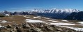
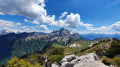
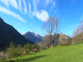
A round trip to the Chalets des Auges from the Morette National Necropolis (just before Thônes when coming from Annecy), offering breathtaking panoramic views of the Aravis and Mont Blanc in the background, whilst tackling a challenging route.

Details

47955
Creation:
Last update:
Last review:
  • Walking
    Activity: Walking
  • ↔
    Distance: 13.71 mi
  • ◔
    Duration according to the author: 6 hrs 
  • ▲
    Difficulty: Very difficult

  • ⚐
    Back to start: Yes
  • ↗
    Ascent: + 4,180 ft
  • ↘
    Descent: - 4,180 ft

  • ▲
    Highest point: 5,896 ft
  • ▼
    Lowest point: 1,916 ft

Photos

Description of the walk

Coming from Annecy, pass the Morette Necropolis on your right, continue along the D909 for about a hundred metres, then turn left at the junction.
Park at the start of the Route des Cascades in the car park opposite the Auberge de Morette, just below the RD909.

(S/E) Follow the start of the Cascades route, then join the forest track (GR®96).

(1) Head up towards Notre-Dame des Neiges, passing by the chalets at La Rosière.

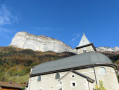
(2) Continue along theGR® and, after a gentle climb, reach the crossroads by the Notre-Dame des Neiges chapel.

(3) Leave theGR®96and turn left onto theGRP® of the Massif de Tournette-Aravis, marked in yellow and red. You’ll reach a crossroads of paths on the edge of the Bois des Lanches.

(4) Keep to the right on theGRP® and head through the mountain pasture to reach the Pas du Loup.

(5) Cross the pass, continue into the Montagne des Auges and descend slightly to the Chalets des Auges.

(6) Follow the same route back in the opposite direction to return to the car park opposite the Auberge de Morette (S/E).

Waypoints

  1. S/E : mi 0 - alt. 1,916 ft - Car park opposite the Auberge de Morette
  2. 1 : mi 0.46 - alt. 2,500 ft - Forest track (GR96)
  3. 2 : mi 2 - alt. 3,947 ft - Chalets de la Rosière
  4. 3 : mi 3.55 - alt. 4,734 ft - Crossroads at the - Notre-Dame des Neiges
  5. 4 : mi 5.33 - alt. 5,285 ft - Edge of the woodland
  6. 5 : mi 6.09 - alt. 5,787 ft - Pas du Loup
  7. 6 : mi 6.86 - alt. 5,774 ft - Chalets des Auges
  8. S/E : mi 13.71 - alt. 1,916 ft - Car park opposite the Auberge de Morette

Worth a visit

(6) Enjoy the 360° view

Always be cautious and plan ahead when you're outdoors. Visorando and the author of this route cannot be held responsible for any accidents occurring on this route.

The GR® and PR® markings are the intellectual property of the Fédération Française de Randonnée Pédestre.

Reviews and comments

5 / 5
Based on 2 reviews

Reliability of the description
5 / 5
Ease of following the route
5 / 5
Route interest
5 / 5
Ludo1009
Ludo1009

Overall rating : 5 / 5

Date of your route : Jul 14, 2025
Reliability of the description : ★★★★★ Very good
Ease of following the route : ★★★★★ Very good
Route interest : ★★★★★ Very good
Very busy route : No

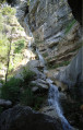
For me, it was a steep climb up to the Notre-Dame-des-Neiges plateau, then the final stretch to reach the pass, but what a reward from the summit. A magnificent view. As I set off early, the sun wasn’t too strong. I had to stop about 200 metres from the chalet because there were herding dogs, but that didn’t bother me. I popped over to the Glières plateau on the way down. The forest track on the descent is slippery because of all the loose stones, but the little stream running alongside it is lovely. Thank you for this lovely walk.

Machine-translated

Vince999
Vince999

Overall rating : 5 / 5

Date of your route : Aug 19, 2020
Reliability of the description : ★★★★★ Very good
Ease of following the route : ★★★★★ Very good
Route interest : ★★★★★ Very good
Very busy route : Yes

This route is very well signposted and very well maintained.
I really enjoyed this walk because of the magnificent view of the Aravis range and, beyond that, Mont Blanc.
I completed the circular loop in 6 hours, including a lunch break.
Highly recommended.

Machine-translated

Other walks in the area

For more walks, use our search engine .

The GPS track and description are the property of this route's author. Please do not copy them without permission.