Country:

 City:
City:


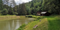
Access via the Thann valley and the D1066. In Ranspach, take Rue du Général de Gaulle, pass the town hall and continue straight on until you reach an old factory: 50 metres after this, turn right onto the street (Route du Chaillot): the car park is immediately on the left, overlooking the private Miss pond.
(S/E) Walk down Rue du Général de Gaulle to the old factory and turn right, towards the ‘Sentier Botanique’: marked with a Red Triangle.
(1) At the junction, follow the flat path slightly to the left, marked with both the Red Triangle and Green Ring signs. This is a very pleasant path, with numerous information boards identifying the trees and shrubs. Ignore the two junctions leading to Ranspach on the left and continue straight on, following the Green Ring of the Dengelberg Route.
(2) At the crossroads, where you will need to return, carry on straight ahead towards Wesserling station, following the four-way signposting. Ignore the first wooden footbridge leading off to the left and, just after that, pass an old spring.
(3) Cross a green footbridge on the left (marked with a Red Rectangle crossed out in White) towards Le Treh. A few dozen metres further on, turn left towards Malakoff Rock for a short, slightly rocky climb.
(4) Malakoff Rock overlooks Wesserling station: superb views and a bench. The path continues downhill and rejoins the route marked with a Red Rectangle crossed out in a White Rectangle.
(5) Follow these markings to the right, heading downhill, and cross the footbridge again.
(3) Continue to the right until you reach the crossroads you passed on the way up.
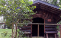
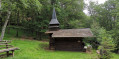
(2) Take the path climbing to the left, marked with a Green Ring, for the Dengelberg route. This wide path, which narrows to a trail, winds its way up in several hairpin bends and passes numerous junctions: be sure to follow the Green Ring markings at every junction. Reach the Dengelberg plateau (alt. 610 m) and its beautiful chapel, built in 1996.
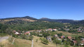
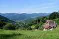
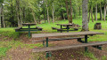
(6) Magnificent panoramic views over the lower and upper Thur valleys. The spot is well equipped for picnics, with tables provided. Continue along the Green Ring route for the descent, passing to the right of the chapel, and rejoin the start of the Botanical Trail.
(1) Turn left downhill to reach the old factory and Rue du Général de Gaulle. Head back up to the left until you reach the Miss car park (S/E).

 Tourist office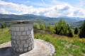
 Moderate
 Visorando Member
 Difficult